What Nobody Tells You Before You Drive the Moab Rim Trail
Here's what the trip-planning sites conveniently omit about the Moab Rim Trail: the climb begins immediately at the trailhead with a slickrock pitch steep enough that first-time visitors regularly back down before reaching the second obstacle, the technical ledges and the notorious Z-Turn section pack more committed driving into 6.5 miles than most trails deliver across twice the distance, and the views from the rim above the Colorado River justify every minute of the climb for travelers who actually make it to the top.
The Moab Rim Trail isn't a beginner slickrock route with a couple of scenic stops. It's one of the most technically demanding short trails in the immediate Moab area, climbing roughly 940 vertical feet from the Colorado River corridor to the rim of the plateau above town in less than three miles of one-way distance. The terrain is genuine technical slickrock with committed ledge sections, the exposure on portions of the climb is real, and the trail rewards proper vehicles and attentive driving with one of the best high-overlook payoffs available anywhere in the Moab trail network.
Thousands of drivers attempt the Moab Rim Trail each year. The ones who get the most out of it, and avoid the recoveries that periodically close the trail while wreckers are brought in, are the ones who arrive understanding what the climb actually demands and what the route at the rim actually delivers.
Moab Rim Trail at a Glance
The basics:
Total distance: 6.5 miles round-trip as an out-and-back from the Kane Creek Boulevard trailhead
Elevation gain: Approximately 940 feet from the Colorado River trailhead to the rim above
Trail rating: Difficult, rated 4 out of 5 or 7 to 8 out of 10 on most difficulty scales
High point: Approximately 5,000 feet at the rim overlook
Typical season: Year-round when conditions are dry; closes effectively whenever rain or snow makes the slickrock dangerous
Drive time: 3 to 5 hours round-trip depending on driver pace and time spent at the rim
Vehicle requirement: High-clearance 4WD with 4LO low-range capability, 33 inch tires minimum (35 inch strongly recommended), skid plate protection, and lockers for the most demanding sections
What it covers:
The Moab Rim Trail climbs the sandstone face above the Colorado River corridor on the west side of Moab, ascending from the river to the broad rim of the Behind the Rocks plateau. The trail follows a route originally established for utility access and now functioning as one of the area's signature technical recreation trails. The drive features immediate steep slickrock climbing, multiple committed ledge sections, the famously demanding Z-Turn, and a payoff at the rim that delivers panoramic views across Moab Valley, the Colorado River corridor, and the La Sal Mountains. The trail also connects to the Hidden Valley hiking trail network, providing access for travelers who want to combine vehicle driving with foot-based exploration of the upper terrain.
Designated status:
The Moab Rim Trail operates on Bureau of Land Management land with multi-use designation. The trailhead is accessible without permits or fees. The trail is shared with mountain bikers and hikers, with shared-use etiquette expected. Trail conditions are managed and signed by the BLM Moab Field Office, with closures during severe weather posted at the trailhead and on the BLM website.
The Initial Climb: The Trail's Defining Feature
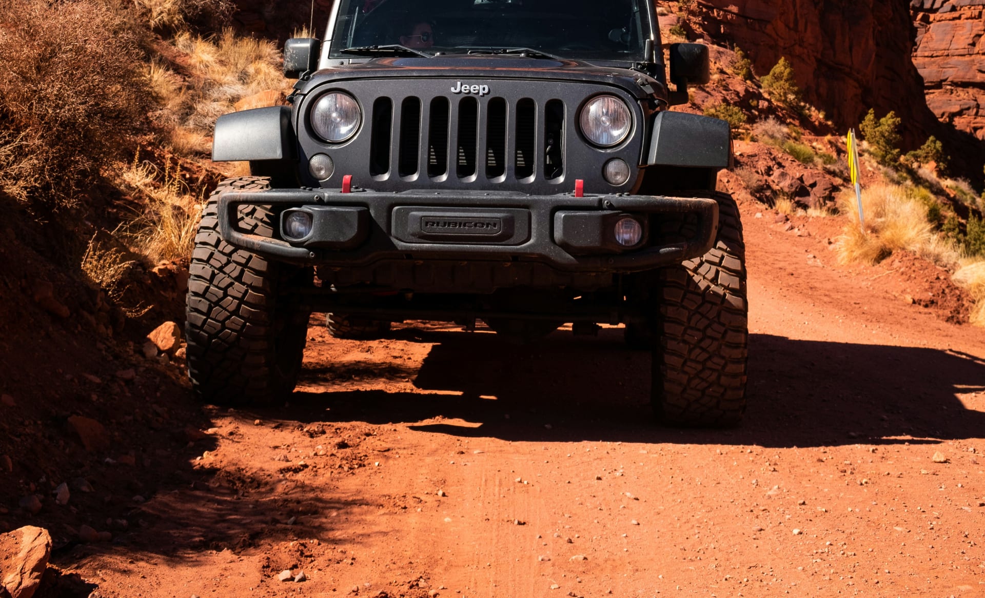
The opening section of the Moab Rim Trail is what gives the route its reputation and what separates committed drivers from casual visitors. From the Kane Creek Boulevard trailhead, the road climbs immediately onto exposed slickrock with grades steep enough that the trail's first turn delivers more elevation gain than some entire trails offer.
What the climb delivers: The first quarter mile of the Moab Rim Trail is a continuous slickrock ascent that requires committed throttle, proper tire grip, and confidence in vehicle capability. The terrain is hard sandstone with intermittent loose surface in transition zones, and the grade rises steadily to the point where rear-axle traction becomes the limiting factor. Drivers who hesitate at the first significant pitch frequently find themselves needing to back down to flat terrain, which is itself a non-trivial maneuver on slickrock.
The reality of the slickrock surface: Slickrock derives its name from the historical experience of horses sliding across the smooth sandstone when wet, and the principle still applies to vehicles. Dry slickrock provides excellent tire grip for properly tired vehicles. Wet slickrock becomes dangerously slippery, and conditions can change quickly with afternoon thunderstorms or seasonal precipitation. Checking the Moab weather guide before any technical trail attempt is one of the better habits a Moab visitor can develop, and the Moab Rim is one of the trails where ignoring weather forecasts produces the most consistent rescue calls.
Technical specifics:
The initial climb features sustained slickrock grades that demand 4LO low-range engagement from the trailhead onward
33 inch all-terrain tires are the practical minimum; 35 inch aggressive tires significantly improve confidence on the steeper transitions
Stock rental Wranglers from major brands prohibit off-road use entirely, transferring damage liability to the renter the moment tires leave pavement; a proper Moab Jeep rental is non-negotiable for legitimate access
Driver confidence matters as much as vehicle capability on the initial pitches; hesitation creates more problems than committed throttle does
The Z-Turn and the Technical Ledges
The middle section of the Moab Rim Trail contains the route's most photographed obstacles and the technical challenges that drivers either talk about for years or remember as the moment they decided to turn around. The Z-Turn in particular has earned a place in Moab trail mythology that bigger trails sometimes can't match.
What the Z-Turn delivers: The Z-Turn is a tight switchback maneuver carved into the slickrock where the trail navigates a series of ledges with extremely limited room for error. The maneuver requires precise wheel placement, multiple deliberate adjustments, and the kind of slow committed driving that distinguishes experienced trail drivers from confident ones. Full-size vehicles and longer wheelbases struggle more than shorter Wranglers; the section was effectively designed around the geometry of compact 4x4s.
The ledge sequences: Beyond the Z-Turn, the route features multiple ledge sections requiring careful line selection, intentional articulation, and willingness to scrape skid plates as part of the experience rather than as a failure mode. Lockers are not technically required for all of these obstacles, but the experience improves significantly with them engaged. Solo vehicles can run the trail, but the route is better managed with a partner vehicle that can spot lines, take photos, and provide recovery if anything stops working.
The comparison reality: Within the broader Moab technical trail network, the Moab Rim ranks below Poison Spider Mesa and the famously demanding Cliffhanger Trail in pure technical difficulty, but its short distance concentrates the technical content in a way that those longer trails don't. The route is more committed per mile than Hell's Revenge, making it the trail where many drivers first encounter the upper end of their comfort zone.
Technical specifics:
The Z-Turn rewards short wheelbases and aggressive approach angles; modified Wranglers handle it confidently while full-size pickups struggle
Lockers improve confidence on multiple ledge sections without being absolutely mandatory in dry conditions
Skid plate contact is part of the trail experience rather than a failure mode; vehicles without proper protection sustain damage that more capable rigs absorb without consequence
Driver experience compounds vehicle capability; the Moab Rim is more rewarding on a second or third trip than as a first technical trail attempt
The Rim and the Overlook: What the Climb Actually Earns
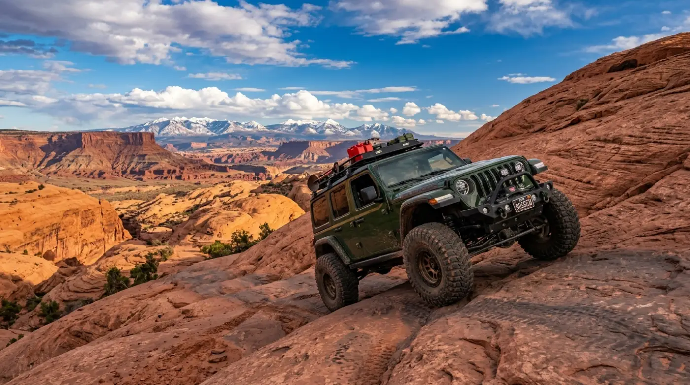
The payoff at the top of the Moab Rim Trail is the reason the climb is worth committing to. After roughly three miles of technical driving from the river, the trail crests the rim of the Behind the Rocks plateau and opens onto broad slickrock terrain with panoramic views that justify the work to reach them.
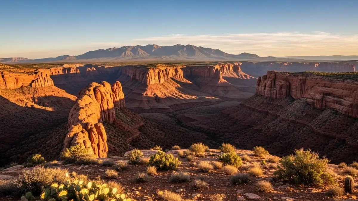
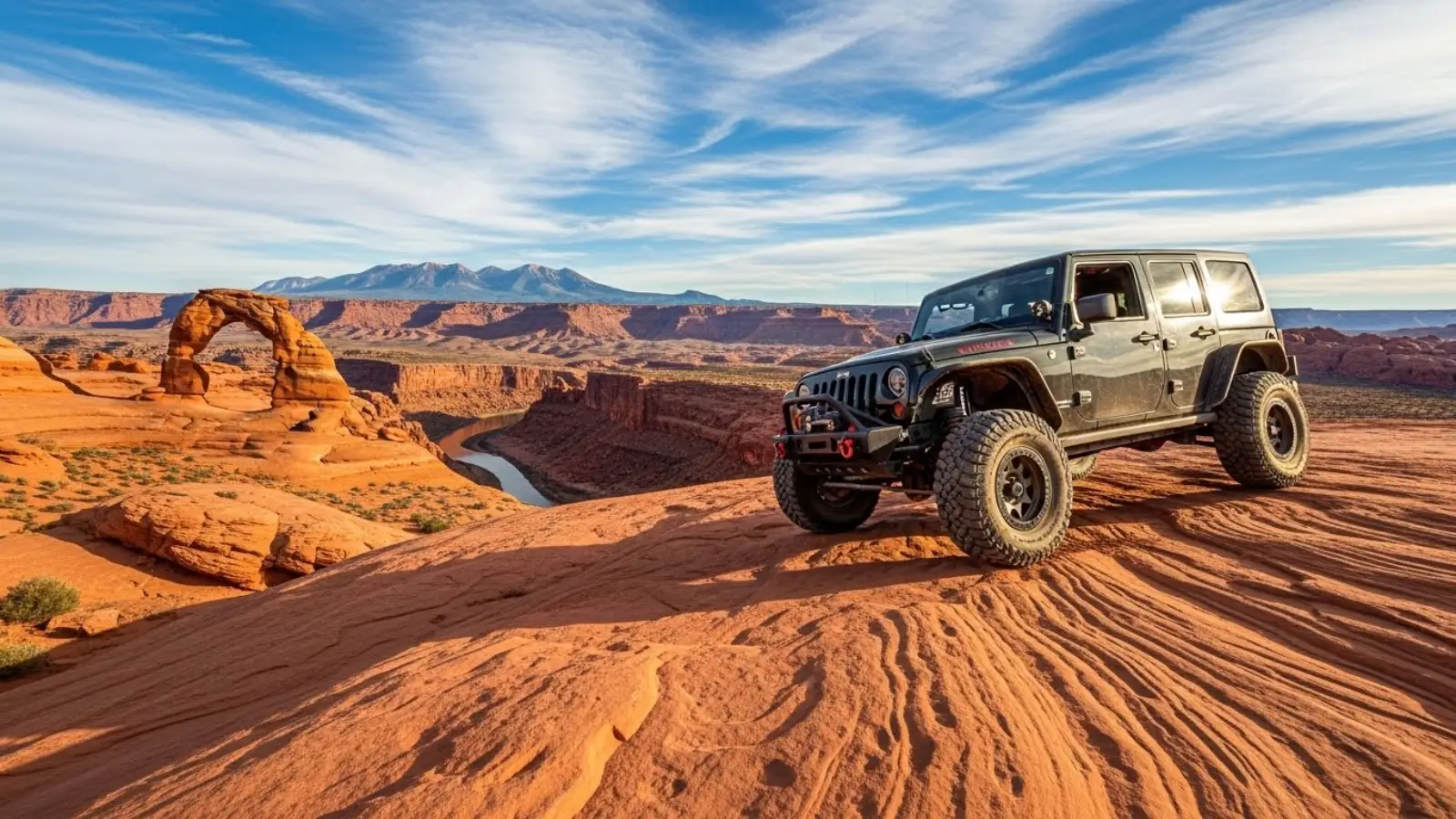
What the rim delivers: The view from the rim spans the Colorado River corridor 940 feet below, the entire Moab Valley with the town visible to the north, the La Sal Mountains rising 12,000-plus feet to the east, and the broken canyon country of the Behind the Rocks Wilderness stretching to the south and west. The perspective is fundamentally different from any view available from the valley floor or the standard scenic overlooks around Moab, and the relative effort required to reach it means the rim is rarely crowded even during peak tourist season.
The slickrock playground: Beyond the views, the rim itself opens onto broad slickrock terrain with multiple driveable bowls, fins, and slickrock features that provide additional exploration for drivers wanting to extend the trip beyond a quick photo stop. The terrain at the top is significantly less technical than the climb required to reach it, making the rim a comfortable spot for relaxed driving, snacks, and the kind of conversations that happen after committed driving challenges get processed.
Logistics: The rim provides natural turnaround points for the return descent. Most drivers spend 30 to 60 minutes at the rim before beginning the return; photographers and visitors combining the trip with extended exploration of the rim slickrock can easily double that time.
Hidden Valley: The Optional Hiking Extension
For travelers who reach the rim and want to extend the experience beyond the vehicle, the Hidden Valley hiking trail connects from the Moab Rim Trail's upper sections into a network of foot trails accessing terrain that vehicles can't reach.
What it involves: Hidden Valley is a hiking-only trail that begins from a junction off the Moab Rim Trail's rim section and continues into the broader Behind the Rocks Wilderness. The trail provides access to remote slickrock terrain, intact petroglyph panels, and viewpoints over both Moab Valley and the more remote canyon system to the south. The hike is moderate in difficulty with significant exposure in places.
The trade-off: Adding Hidden Valley extends the Moab Rim trip from a half-day to a full-day commitment. Travelers planning to include the hike should bring proper footwear, additional water, and time. The combination of vehicle technical driving and foot-based exploration delivers a more complete experience of the rim than either approach alone provides.
Logistics: The Hidden Valley trailhead is marked at the junction; vehicles park at the rim while hikers continue on foot. The hike's full length depends on chosen turnaround points, with several reasonable destinations between one and four miles from the trailhead.
Three Ways to Combine the Moab Rim Trail with Other Adventures
Moab Rim and Potash Road
The Moab Rim Trail and Potash Road sit on opposite sides of the Colorado River corridor, making them natural complements for a full-day or two-day Moab itinerary. Potash Road delivers paved scenic driving with petroglyph stops and dramatic canyon views, while Moab Rim provides the technical challenge and overhead perspective.
The character: Run Potash Road in the morning as a warm-up scenic drive and a chance to see the petroglyph panels and the Wall Street climbing area, then tackle the Moab Rim Trail in the afternoon for the technical content. The pairing provides a complete picture of how the Colorado River corridor functions in this part of the Moab landscape.
The logistics: Both trailheads are accessible from Moab proper without significant driving between them. The combination works comfortably as a single full day for travelers willing to push the timing or as a relaxed two-day pairing for travelers prioritizing depth over speed.
Moab Rim and Hell's Revenge
Pairing the Moab Rim Trail with Hell's Revenge gives drivers two of the area's most photographed technical experiences in a single weekend. Both trails feature significant slickrock content, both reward proper vehicle capability, and both are short enough to combine without exhausting either the driver or the rig.
The character: Hell's Revenge delivers a flowing slickrock experience with the optional Hell's Gate obstacle as a discrete extreme challenge, while Moab Rim concentrates its technical content into a shorter route with the Z-Turn as the defining moment. Together they provide a representative sample of why Moab anchors the off-road tourism industry the way it does.
The trade-off: Running both trails in a single day is feasible but tight. The more rewarding pairing splits the trails across two days with time for rim exploration, photography, and the kind of relaxed touring that turns a technical weekend into a memorable one.
Moab Rim and Shafer Trail
For drivers who want to combine the Moab Rim's concentrated technical content with a longer scenic backcountry experience, pairing with the Shafer Trail into Canyonlands creates a multi-day itinerary that covers the full range of what the Moab area offers.
The character: Moab Rim provides the technical climbing challenge with concentrated difficulty. Shafer delivers the dramatic switchback descent into Canyonlands National Park and connects to the broader White Rim Road network for travelers planning multi-day backcountry trips with proper permits.
The trade-off: The pairing requires two to three days minimum and proper attention to vehicle capability across both trails. Drivers running this combination should plan rest, fuel, and meal logistics carefully; the trails are short enough individually that travelers underestimate the cumulative fatigue of consecutive technical days.
Driving the Moab Rim Trail: Direction, Timing, and Honest Preparation
Direction decision: The standard direction for the Moab Rim Trail is uphill from the Kane Creek Boulevard trailhead, with the descent following the same route on the return. The uphill direction is the appropriate orientation for the trail's grade and obstacle geometry. Some drivers attempt the descent as the more challenging direction, which delivers a different experience but also greater risk on the technical sections.
Timing: Spring (March through May) and fall (September through October) provide the optimal conditions for the Moab Rim Trail. Summer brings extreme heat that affects both drivers and vehicles, with slickrock surfaces reaching temperatures that can cause tire concerns. Winter offers solitude and dramatic light but introduces the risk of ice in shaded sections and the trail closures that follow precipitation.
Budget 3 to 5 hours for the round-trip drive without significant exploration; add another 1 to 2 hours for proper time at the rim and for incorporating the Hidden Valley side hike. Drivers compressing the trip into a quick photo run underestimate the time the technical sections require and frequently end up rushing the return.
What to bring:
Minimum one gallon of water per person; the exposed slickrock climbing and the sun exposure at the rim dehydrate faster than visitors typically anticipate
Sun protection regardless of season; slickrock glare is intense and the rim has no significant shade
Closed-toe footwear with real tread for spotting obstacles, walking around the rim, or hiking the Hidden Valley extension
A weather check immediately before departure; the Moab Rim is one of the trails where wet conditions create real danger, and afternoon thunderstorms can develop quickly during monsoon months
Recovery gear including straps and a basic toolkit; the trail is short enough that help arrives eventually if needed, but self-sufficiency is always the better plan
A spotter or partner vehicle for the technical sections if traveling with limited trail experience
Why Cliffhanger for the Moab Rim Trail
The Moab Rim Trail's reality is that its concentrated technical content separates it from beginner-friendly Moab routes clearly and early. The initial slickrock climb eliminates stock vehicles within the first quarter mile, the Z-Turn and ledge sections demand proper articulation and tire grip that standard rentals can't provide, and the rental SUVs that visitors typically arrive with prohibit unpaved use entirely. The visitors who fall into those gaps experience the trailhead and turn around, missing the rim payoff that justifies the entire route.
Cliffhanger's Moab location is the natural starting point for the Moab Rim Trail done right.
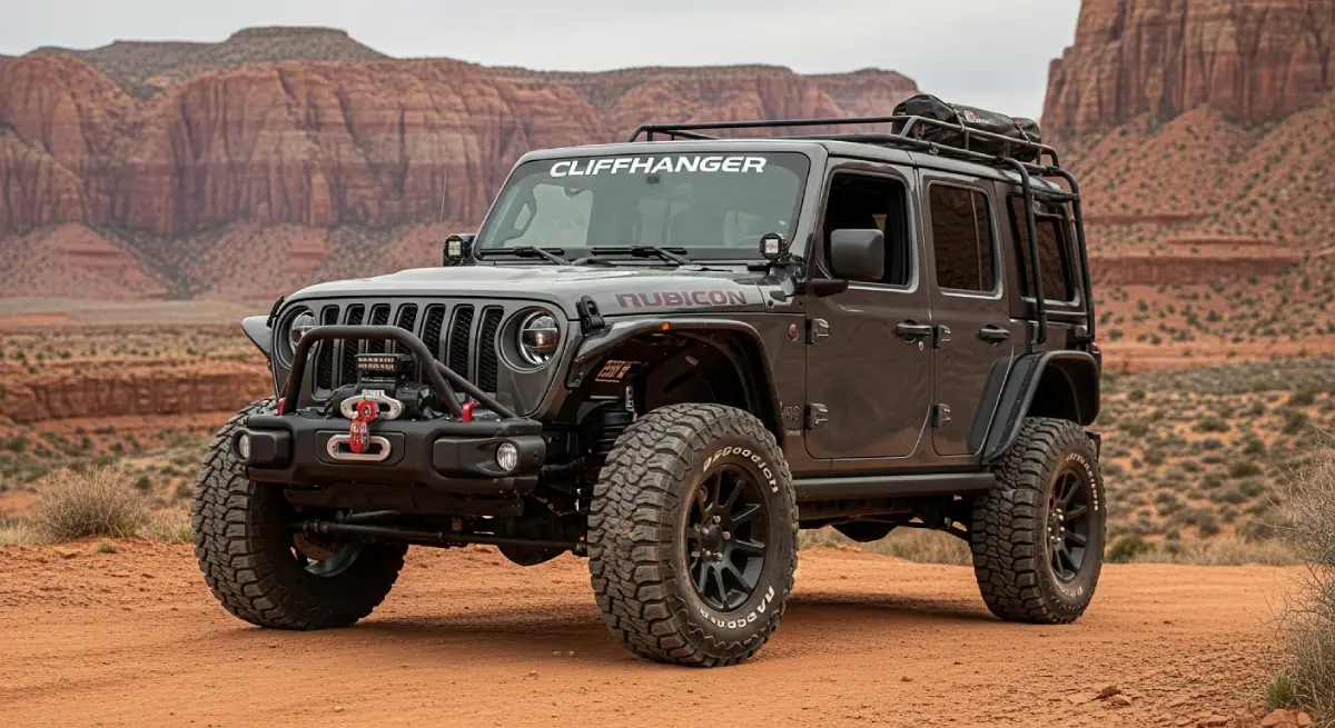
What Cliffhanger's Moab Rubicons provide:
2.5 inch lift with 35 inch aggressive tires: the clearance and grip baseline that the initial climb and the ledge sections actually demand
Extreme Rubicons with 3.5 inch lift and 39 inch tires: the configuration for drivers wanting maximum confidence on the Z-Turn and the most committed obstacle sections
Full skid plate protection: oil pan, transmission, and transfer case coverage that turns rock contact on the ledge sections into a non-event rather than a trip-ending damage moment
Locking differentials: the actual articulation hardware that the most technical sections of the trail reward, not the AWD AUTO modes that fail on real terrain
4LO low-range capability: genuine low-range gearing for sustained slickrock climbing and controlled technical descents
Trail-permission contracts: explicit authorization for the Moab Rim Trail and the broader Moab technical trail network, with damage and recovery terms structured around real off-road use
Local staff with current conditions: trail status changes with weather; Moab-based staff know the Rim's current state before you head out
The Moab Rim Trail is one of the more distinctive technical routes available in the immediate Moab area. It rewards proper preparation with concentrated technical driving, the famously demanding Z-Turn section, and a rim overlook delivering some of the best panoramic perspective available anywhere in the regional trail network. It also creates consistent recoveries and damage disputes from vehicles and drivers that arrived without honest assessment of what the climb actually demands. For travelers planning a complete trip to the region, pairing the Moab Rim with the broader Moab attractions network turns a single trail outing into the kind of itinerary the area was built to deliver.
Cliffhanger exists to make sure your trip falls in the first category.
Ready to drive the Moab Rim Trail in a vehicle built for every section of the climb? Contact Cliffhanger Jeep Rentals in Moab and let's put together the configuration that makes the route what it's supposed to be.