What Nobody Tells You About Moab Attractions
Here's what the tourism brochures conveniently omit about Moab attractions: the most-photographed destinations sit in two national parks that absorb roughly 80 percent of visitor traffic while the rest of the region's defining experiences hide on BLM land most travelers never reach, the rental SUV that brought you to town is contractually prohibited from accessing most of the named attractions you came to see, and the difference between a Moab trip that hits the postcard photos and one that delivers the genuine character of this corner of Utah is measured in vehicle capability and willingness to drive past the visitor center.
Moab isn't a single attraction or a checklist of national park overlooks. It's a 1.8-million-visitor adventure economy built around a 5,300-resident town, surrounded by some of the most concentrated public land in the lower 48, with a defined slate of legendary 4x4 trails, slickrock formations, river corridors, ancient cultural sites, and high-desert scenery that have anchored Western adventure tourism for fifty years. The town itself is the most concentrated outdoor recreation infrastructure in the country. The terrain surrounding it produces the recreation that brings visitors in the first place.
The travelers who get the most out of Moab attractions are the ones who arrive understanding that the destinations splitting their itinerary between park admission and backcountry capability deliver the most complete version of what this region actually offers.
Moab Attractions at a Glance
Total attractions covered: 20+ named destinations across national parks, BLM backcountry, river corridors, and town infrastructure
Annual visitors: 1.8+ million across the Moab region, with Arches and Canyonlands accounting for the majority
Typical visit duration: 3 days minimum for a representative experience; 5 to 7 days to access the destinations beyond the headline parks
Vehicle requirement: Any vehicle handles the paved scenic drives; high-clearance 4WD opens the named trails, slickrock formations, and remote viewpoints that define the region
Best season: March through May and September through October for optimal conditions; summer brings extreme heat, winter delivers solitude with weather complications
Permit considerations: Standard national park entrance fees at Arches and Canyonlands; backcountry permits required for specific areas including White Rim Road and certain canyoneering routes
What the region delivers: Moab attractions span every category of outdoor and adventure tourism. The two anchor national parks (Arches and Canyonlands) deliver paved scenic drives accessible to any vehicle. The named 4x4 trails (Hell's Revenge, Fins N Things, Poison Spider, and dozens of others) require capable vehicles and deliver the slickrock and ledge experiences that brought off-road tourism to Moab in the first place. The Colorado River corridor provides rafting, paddling, and scenic float trips. Dead Horse Point State Park offers some of the region's most dramatic overlooks without the national park traffic. The cultural and historical layer includes petroglyph panels, ghost town ruins, and movie filming locations that span a century of regional development.
Public land context: The vast majority of Moab attractions sit on federal public land managed by the National Park Service or the Bureau of Land Management. This designation matters: the BLM-managed trails, viewpoints, and recreation areas surrounding Moab are accessible without permits or fees for most users, while the national park destinations require entrance fees and increasingly include timed-entry reservation systems during peak season.
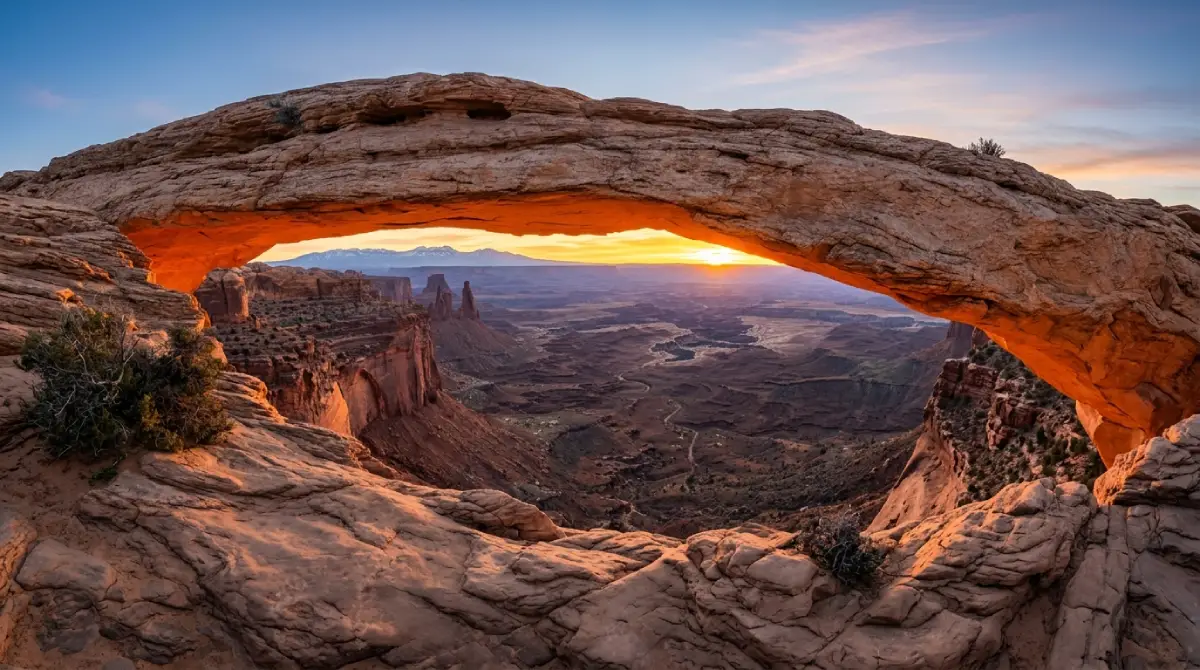
Arches National Park: The Headline Attraction
Arches National Park sits five miles north of Moab and delivers the photographs that bring most visitors to the region in the first place. The park preserves over 2,000 documented natural stone arches, including some of the most recognizable rock formations on the continent.
What the park delivers: The 18-mile scenic drive runs from the visitor center to the Devils Garden trailhead with regular pullouts at the park's most famous formations. Delicate Arch, Landscape Arch, the Windows section, and Balanced Rock all sit on or near the main road. The park requires a timed-entry reservation system from April through October, with reservations released months in advance and selling out quickly for peak weekends.
The signature destinations: Delicate Arch is the most photographed natural arch in the world and the formation that appears on Utah license plates. The 3-mile round-trip hike to the arch is the park's defining experience and worth the early morning effort to beat both heat and crowds. Landscape Arch, accessible from the Devils Garden trailhead, spans 306 feet and ranks among the longest natural arches anywhere. The Windows section delivers three major arches in a concentrated area accessible via short, level walks from the parking area.
Technical specifics:
Arches requires a standard entrance fee covered by the America the Beautiful pass
Timed-entry reservations are required from April 1 through October 31 for vehicles entering between 7 AM and 4 PM
The scenic drive is paved and accessible to any vehicle in normal conditions
Off-road and backcountry routes within the park (Salt Valley Road, Tower Arch via 4x4) require high-clearance vehicles and deliver experiences most park visitors never see
Canyonlands National Park: The Bigger Story
Canyonlands sits west of Moab and delivers a fundamentally different experience than Arches. The park covers 337,598 acres divided into four distinct districts, each requiring separate access, with the Island in the Sky district as the most-visited and the Maze district as the most remote.
What the districts deliver: Island in the Sky is the most-visited Canyonlands district, accessible via paved scenic drive with regular overlook stops including Mesa Arch, Grand View Point, and Green River Overlook. The district sits on a mesa top 1,500 feet above the surrounding canyon system, delivering panoramic perspectives that explain the park's scale better than any individual stop can. The Needles district, two hours south of Moab, offers more developed hiking infrastructure and the colorful sandstone formations the district is named for. The Maze and the Rivers districts are genuinely remote and accessible only via committed backcountry routes.
The signature experiences: Mesa Arch sunrise is the most-photographed sunrise in the Western United States, with photographers regularly arriving an hour before dawn to claim positions. The Shafer Trail descent from Island in the Sky to the canyon floor below is among the most dramatic vehicle routes in any national park. The White Rim Road's 100-mile loop through the park's middle district supports multi-day backcountry trips for travelers with the right vehicles and permits.
Technical specifics:
Canyonlands requires a standard entrance fee separate from Arches; the America the Beautiful pass covers it
Island in the Sky's scenic drive is paved and accessible to any vehicle
The Shafer Trail, White Rim Road, and most Canyonlands backcountry require high-clearance 4WD with low-range capability
White Rim Road requires advance permits managed through the National Park Service, typically reserved months ahead
The Named 4x4 Trails: Moab's Defining Recreation
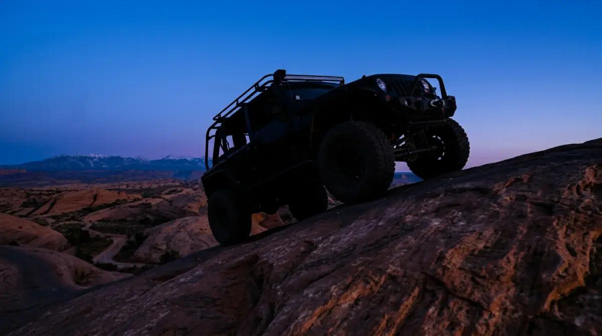
The named off-road trails surrounding Moab are the destinations that made the town an international adventure tourism brand. These trails deliver experiences that the national parks cannot, with terrain ranging from approachable slickrock loops to genuinely technical rock-crawling routes.
The headline trails: Hell's Revenge is Moab's signature slickrock trail. The 6.5-mile loop features steep climbs, dramatic descents, and the optional Hell's Gate obstacle that separates confident drivers from overconfident ones. Fins N Things delivers a more flowing slickrock experience with the famous rollercoaster section that pitches vehicles dramatically across a series of sandstone fins. Poison Spider Mesa climbs from the Colorado River to overlook Canyonlands with the technical Waterfall obstacle and multiple committed ledges. Top of the World rewards a moderate climb with a 6,800-foot overlook delivering panoramic views across canyon country. Cliffhanger Trail features narrow ledge sections where mirrors fold in and exposure that turns passengers into walkers.
The supporting network: Beyond the headline trails, the Moab region contains dozens of named routes spanning every difficulty level. Gemini Bridges Road delivers an easy approach to twin natural sandstone arches and serves as a gateway to the connected Mag 7 trail network. The Shafer Trail offers the dramatic switchback descent into Canyonlands. Onion Creek Road provides a scenic creek-crossing route with minimal technical demand. Pritchett Canyon ranks among the most technical legitimate Jeep trails in the country.
Technical specifics:
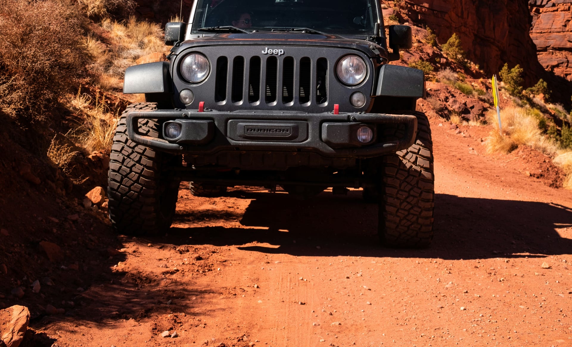
The named Moab trails require high-clearance 4WD with proper modifications; stock rental Wranglers from major brands prohibit off-road use entirely
Most legitimate Moab trails sit on BLM land with no permit requirements for day use
Trail conditions change with weather; clay-content surfaces become dangerously slick when wet
Cell service is unreliable on most trails; offline maps and basic recovery gear are non-negotiable
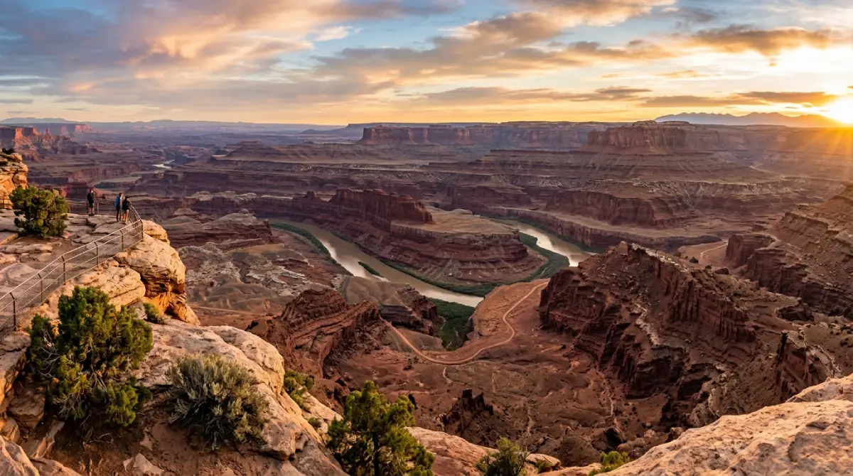
Dead Horse Point State Park: The Underrated Anchor
Dead Horse Point State Park sits between Arches and Canyonlands and consistently delivers one of the region's most dramatic views with a fraction of the national park traffic. The park preserves a 2,000-foot promontory above a sweeping bend in the Colorado River, with the Island in the Sky district visible across the canyon system.
Why it earns the stop: The main overlook delivers the photograph that makes most visitors' Moab albums regardless of where they captured it. The park sees substantially fewer visitors than the surrounding national parks while delivering scenery that arguably exceeds either one for sheer panoramic impact. The development includes a visitor center, paved overlook trails, camping infrastructure, and yurts for visitors interested in elevated camping.
The cinematic context: Dead Horse Point appears in dozens of films, including the closing scene of Thelma & Louise filmed at the canyon rim. The location continues to attract production crews for commercials, films, and photography campaigns drawn by the dramatic canyon exposure.
Logistics: Dead Horse Point charges a Utah state park entrance fee separate from any federal park passes. The America the Beautiful pass does not cover state parks. The drive from Moab to Dead Horse Point takes roughly 35 minutes via paved Utah Highway 313.
The Colorado River Corridor: Water-Based Attractions
The Colorado River runs along Moab's eastern edge and supports the second major recreation economy in the region after off-road tourism. River-based attractions span from gentle scenic floats to technical whitewater rafting through Cataract Canyon downstream.
The flatwater section: The Colorado River through Moab itself runs as relatively gentle Class I-II water, supporting scenic float trips, paddleboarding, kayaking, and family rafting. Multiple outfitters in town support day trips ranging from two hours to full-day excursions. The river corridor delivers a fundamentally different perspective on the canyon country than land-based viewpoints provide.
The whitewater section: Cataract Canyon, downstream of Moab in Canyonlands National Park, contains some of the most significant whitewater in the American West. Multi-day trips through Cataract Canyon range from three to seven days and require either outfitter-supported expeditions or significant private trip experience and permits. The whitewater season runs primarily May through July with snowmelt-driven flows.
Riverside attractions: The Colorado River corridor north of Moab along Utah Highway 128 (the Upper Colorado River Scenic Byway) is among the most underrated drives in the region. The byway follows the river through dramatic canyon country with multiple recreation sites, camping areas, and viewpoints across its 44-mile length. Fisher Towers, accessible via a short side road from Highway 128, delivers a spectacular hiking destination at the base of dramatic sandstone spires.
Technical specifics:
River trips through licensed outfitters do not require participant permits; permits are handled at the outfitter level
Private river trips through Canyonlands National Park sections require advance permits with limited annual allocations
The Colorado River's flow varies dramatically by season; spring snowmelt produces the highest water, late summer and fall the lowest
Sun exposure on the river is intense regardless of season; serious sun protection and hydration are baseline requirements
Cultural and Historical Attractions
The Moab region's cultural and historical layer adds dimension that pure landscape tourism misses. Ancestral Puebloan rock art, mining-era ghost towns, and film history all overlay the geological foundation that brings most visitors.
The petroglyph sites: The Moab area contains some of the most accessible rock art in the Southwest. Sego Canyon, north of Moab, preserves panels from multiple cultural periods spanning 8,000 years of human presence. The Birthing Scene panel near Moab and the Newspaper Rock panel on the Indian Creek corridor toward the Needles district deliver concentrated examples of Ancestral Puebloan and Fremont rock art accessible without significant hiking.
The Hollywood connection: Moab has hosted film productions since the 1930s, with director John Ford's Westerns establishing the region's cinematic identity. The Moab Museum of Film and Western Heritage documents the production history and the locations spread across the surrounding terrain. Dead Horse Point, Mineral Bottom, the Shafer Trail, and dozens of other sites have appeared in films ranging from Thelma & Louise to Mission Impossible.
The mining legacy: The uranium boom of the 1950s briefly transformed Moab into a mining boomtown, with infrastructure and abandoned claims still visible across the region. The Shafer Trail itself originated as a uranium hauling route widened from earlier cattle paths. Ghost town remnants and historic mining sites accessible from the named trail network add a documentary layer to backcountry trips.
What to Plan: Timing, Logistics, and Honest Preparation
Trip duration: A representative Moab trip requires three days minimum to access the headline attractions without rushing. Five to seven days opens up the backcountry destinations, river time, and side trips that separate a casual Moab visit from a complete one. Travelers compressing the region into two days inevitably miss most of what makes it distinctive.
Timing: Spring (April through May) and fall (September through October) deliver optimal conditions across temperature, trail access, and visitor traffic. Summer brings extreme heat regularly exceeding 100 degrees, with slickrock surfaces hot enough to cause tire concerns and outdoor activity demanding pre-dawn starts. Winter offers solitude and dramatic snow-on-red-rock scenery but complicates trail access and shortens daylight windows significantly.
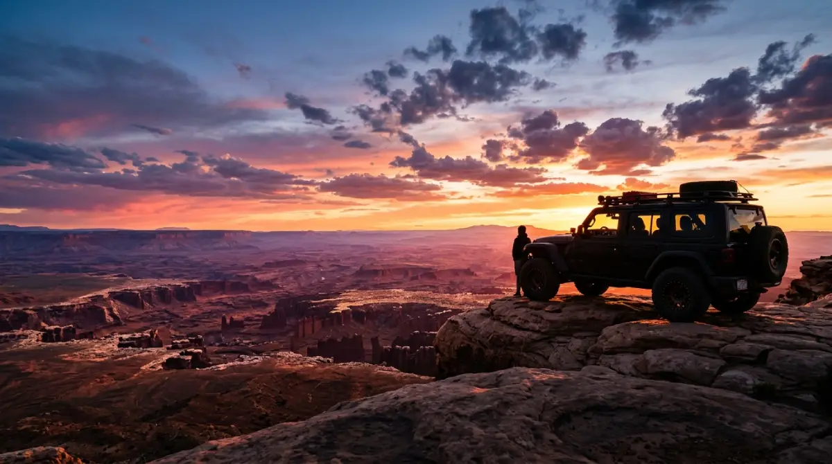
The vehicle question: The single most impactful planning decision for a Moab trip is the vehicle. Travelers arriving with stock rental SUVs are functionally limited to paved scenic drives and the most accessible park trails. Travelers arriving with modified Jeeps, or renting them locally, gain access to the named trails, backcountry viewpoints, and remote attractions that define the region. The math on the upgrade favors the capable vehicle the moment any legitimate off-road component enters the itinerary.
What to bring:
Minimum one gallon of water per person per day; Moab's high desert dehydrates faster than most visitors anticipate
Sun protection across the board; slickrock glare is intense even in winter conditions
Closed-toe footwear with real tread for hiking and any walking around canyon edges
Layered clothing spanning 30 degree temperature swings between dawn and afternoon
Offline maps for trails and backcountry routes; cell service drops on most named trails
A weather check immediately before any backcountry departure; rain transforms trail conditions quickly
Why Cliffhanger for Your Moab Attractions Itinerary
The structural reality of Moab attractions is that the most distinctive experiences sit beyond the national park entrance stations on terrain that demands capable vehicles. The major rental brands prohibit off-road use, transferring damage liability the moment tires leave pavement. Stock crossovers cannot navigate the named trails that built Moab's reputation. AWD SUVs lack the actual low-range gearing that technical descents require. The visitors who fall into those gaps experience Moab as a scenic-drive checklist rather than the adventure destination it actually is.
Cliffhanger's Moab location is the natural starting point for an itinerary that includes the full range of regional attractions.
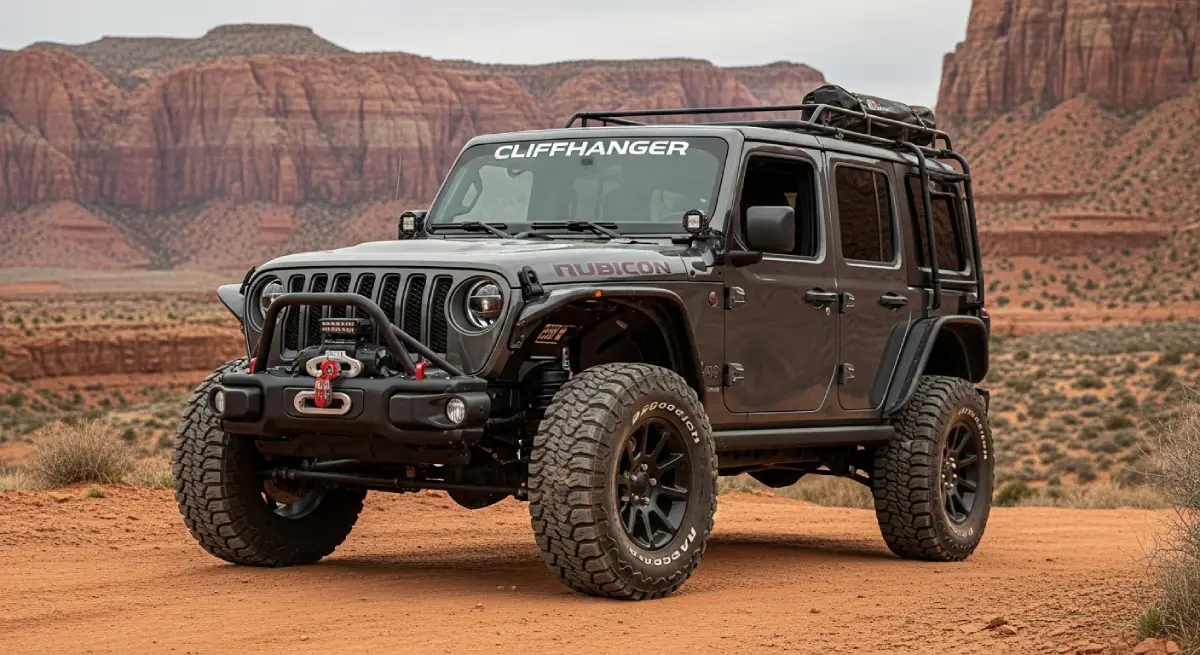
What Cliffhanger's Moab Rubicons provide:
2.5-inch lift with 35-inch aggressive tires: clearance and grip for the slickrock trails, backcountry viewpoints, and named routes that stock vehicles cannot handle
Extreme Rubicons with 3.5-inch lift and 39-inch tires: the configuration for Poison Spider, Cliffhanger Trail, Pritchett Canyon, and the technical extensions that turn a Moab trip into a complete one
Full skid plate protection: oil pan, transmission, and transfer case coverage that turns rock contact into a non-event rather than a trip-ending damage moment
4LO low-range capability: the actual low-range gearing that the named technical descents require, not the AWD AUTO modes that fail on real terrain
Trail-permission contracts: explicit authorization for the named Moab trails including Hell's Revenge, Fins N Things, Poison Spider, Top of the World, and the connected BLM network
Local staff with current conditions: trail status changes with weather; Moab-based staff know the conditions before you head out
The attractions defining Moab span national park overlooks, slickrock trails, river corridors, cultural sites, and the backcountry viewpoints that interstate travelers never reach. The list rewards proper preparation with one of the most concentrated adventure tourism experiences available in the United States. It also creates consistent disappointment for visitors who arrived with vehicles that limited them to the most-photographed and most-crowded subset of what the region actually offers.
Cliffhanger exists to make sure your trip falls in the first category.
Ready to experience the full range of Moab attractions in a vehicle built for every destination on the list? Contact Cliffhanger Jeep Rentals in Moab and let's put together the configuration that makes your trip what it's supposed to be.