What the Mighty 5 Itineraries Consistently Get Wrong
Here's what nearly every Utah road trip guide omits: five of the most dramatic landscapes on the continent sit directly adjacent to backcountry terrain that standard rental vehicles can't access, the most photographed views in Canyonlands and Capitol Reef require high-clearance 4WD to reach, and the experience of driving through Utah's canyon country from inside a legitimate off-road vehicle versus a standard sedan fundamentally changes what the trip actually is.
Utah road trips aren't just loops between national park entrance stations. The state contains over 200 miles of backcountry Jeep trails around Moab alone, multiple 4x4 routes that penetrate the remote sections of Canyonlands that most visitors never see, and a concentration of red rock terrain in southeastern Utah that rewards proper vehicles with landscapes that don't exist anywhere in the accessible paved world.
The difference between a good Utah road trip and an unforgettable one isn't which parks you hit or how many days you spend—it's whether you're driving something that can actually access the terrain those parks contain.
The Two Versions of a Utah Road Trip
Before building an itinerary, it's worth being direct about the distinction that shapes every Utah road trip decision.
The Paved Version
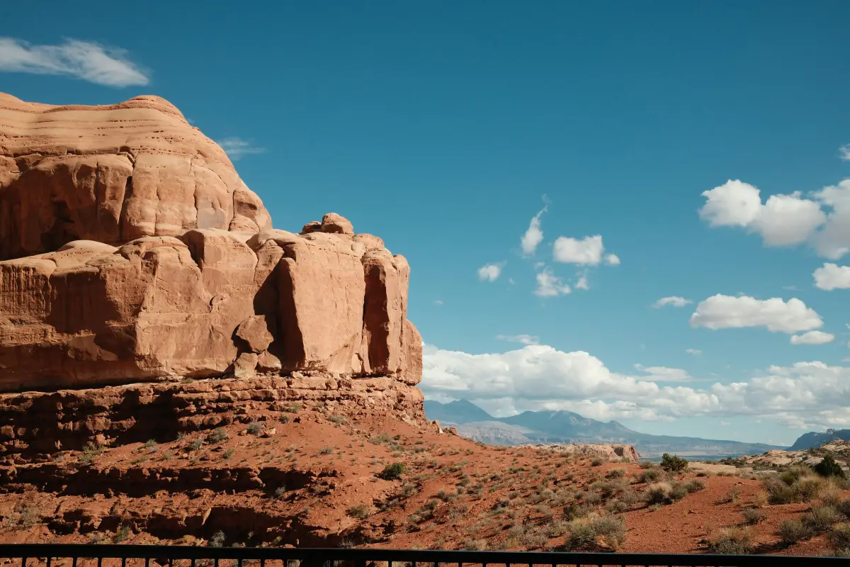
Utah's highway network delivers genuinely spectacular scenery. Scenic Byway 12 between Bryce Canyon and Capitol Reef ranks among the most dramatic paved drives in America. US-191 through Moab, Highway 313 to Dead Horse Point, the park road through Arches—these routes are legitimately beautiful and accessible to any vehicle.
Paved route characteristics:
Consistent accessibility
Any rental car, minivan, or RV handles these roads without concern. No ground clearance requirements, no 4WD needed, no technical driving demands.
The Mighty 5 loop
Zion, Bryce Canyon, Capitol Reef, Arches, and Canyonlands connected by paved highways creates the famous Utah loop most visitors complete. Approximately 700 miles total depending on routing, typically covered in 7–10 days.
Crowded entry points
Arches National Park now requires timed entry reservations during peak season. Zion's canyon shuttle is mandatory for private vehicles most of the year. The most famous viewpoints attract significant traffic from spring through fall.
The ceiling
Most visitors complete the Mighty 5 loop, collect the views, and consider Utah done. This is a reasonable trip. It is also a fraction of what Utah actually offers to drivers with proper vehicles.
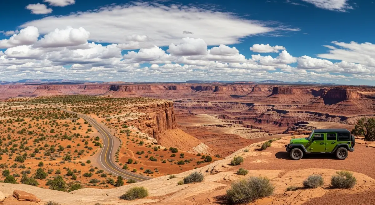
The 4x4 Version
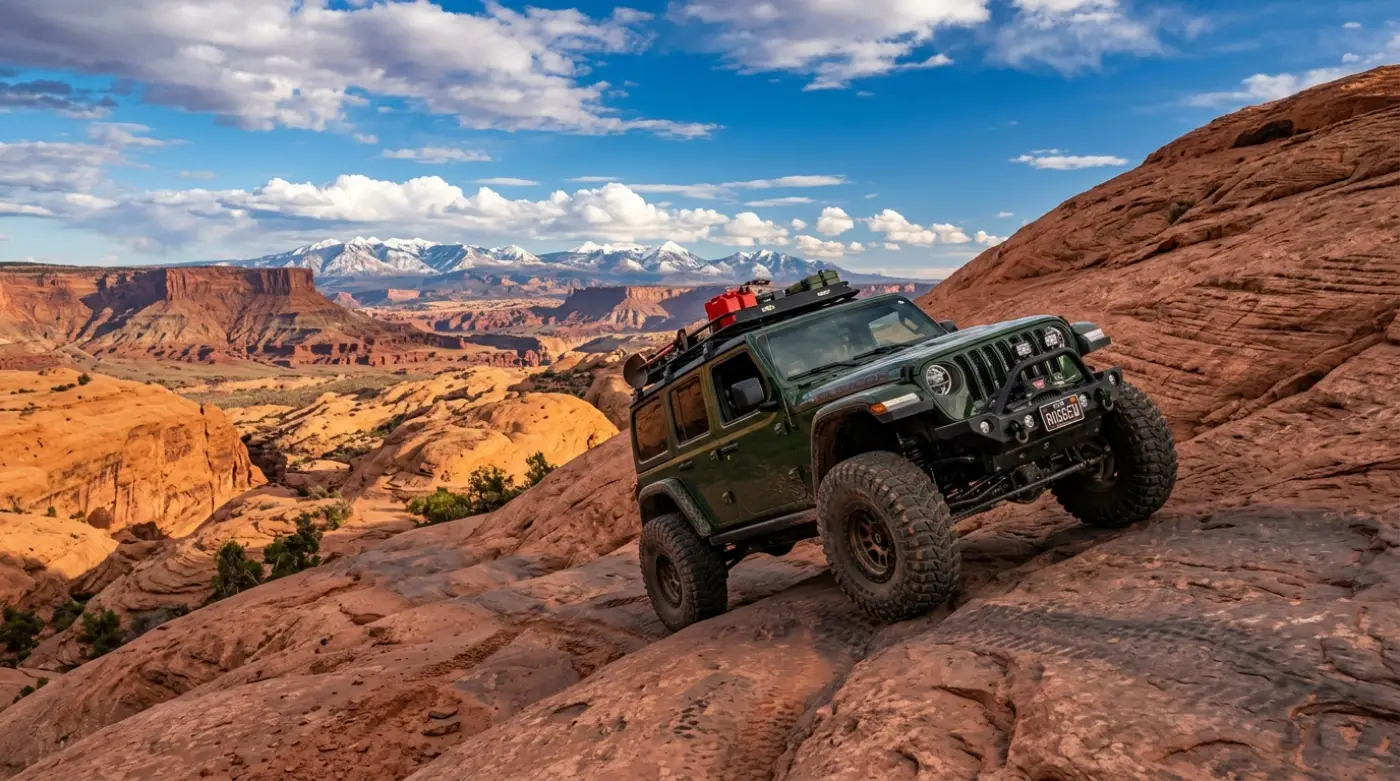
The moment you leave pavement in southeastern Utah, the landscape opens up in ways the highway system can't deliver. The White Rim Road circling Island in the Sky in Canyonlands, the Cathedral Valley loop inside Capitol Reef, Hell's Revenge and Fins and Things in Moab's Sand Flats—these are the routes that explain why Utah is the destination for serious backcountry travel.
4x4 route characteristics:
Vehicle requirements that matter
High-clearance 4WD is the practical minimum for Utah's serious backcountry. The combination of deep sand sections, embedded slickrock, and shelf roads on routes like the White Rim Road and Elephant Hill in Canyonlands demands proper ground clearance, low-range gearing, and tires built for the terrain.
Rental restriction reality
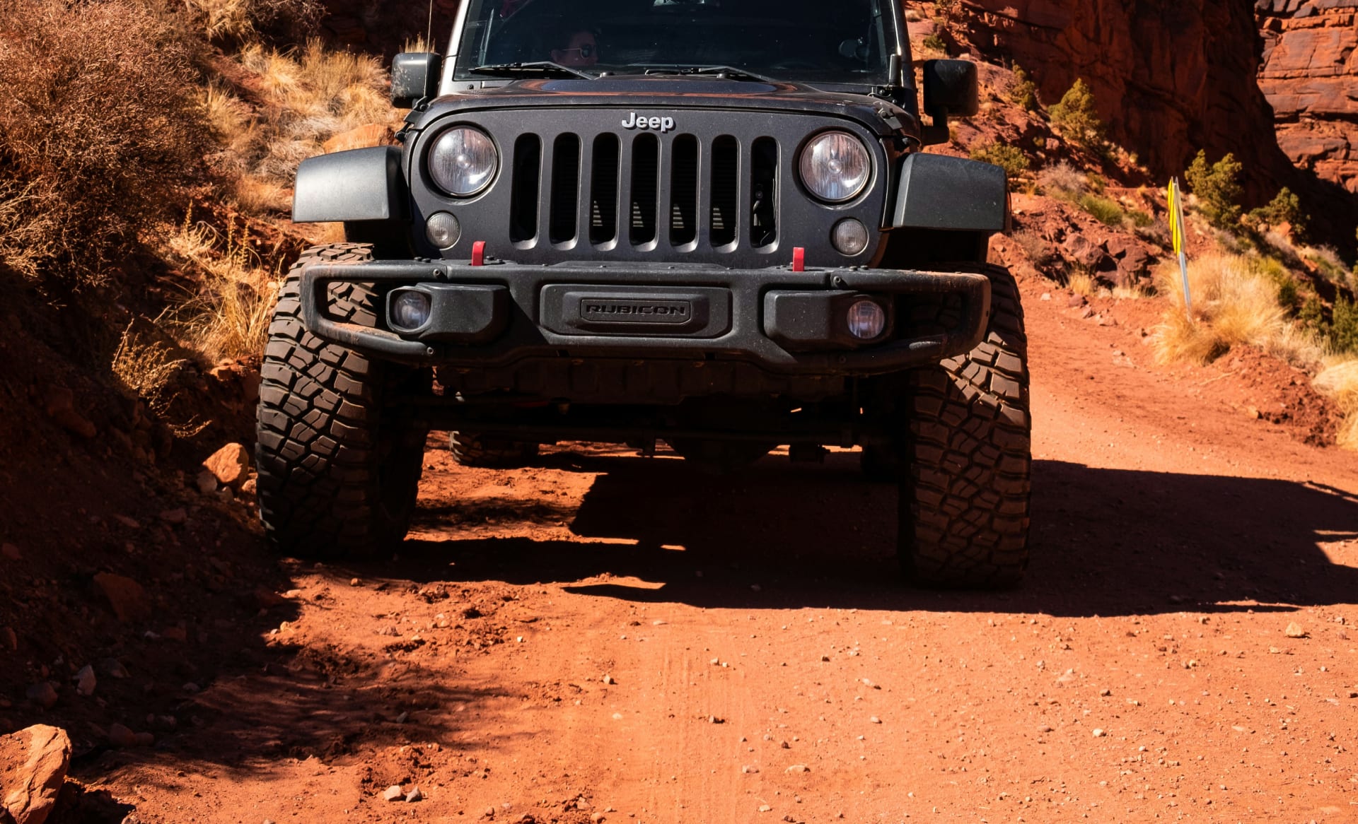
Most major rental companies explicitly prohibit unpaved road travel. Their insurance doesn't cover damage from off-pavement driving, making standard rental SUVs useless for the routes that define Utah's backcountry. This is the gap Cliffhanger exists to fill.
Terrain that earns the views
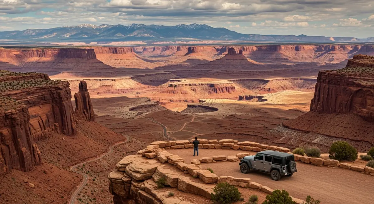
Dead Horse Point from 2,000 feet above the Colorado River's horseshoe bend, the Temple of the Sun and Moon formations in Capitol Reef's Cathedral Valley, Canyonlands' White Rim Road with cliff exposure in every direction—these don't exist from the pavement.
The Core Routes Worth Building an Itinerary Around
Moab — The Backcountry Hub
Moab anchors every serious Utah road trip itinerary for one reason: no other town in the American West provides comparable access to legitimate backcountry 4x4 terrain within minutes of a functioning town.
Hell's Revenge Utah's most accessible technical slickrock trail starts five minutes from downtown Moab. The route climbs petrified sandstone domes above the Moab Valley, featuring steep ledge climbs, exposed ridge traverses, and the iconic "Hell's Gate" obstacle—a narrow V-notch descent where line selection determines whether you complete the obstacle confidently or roll backwards down 30 feet of unforgiving sandstone. Views of the La Sal Mountains and Arches National Park formations appear throughout.
Difficulty:
Moderate to technical. High-clearance 4WD required.
Time:
3–4 hours including stops.
Fins and Things The Sand Flats Recreation Area east of Moab hosts a network of slickrock trails that reward methodical driving over technical terrain. Fins and Things covers rolling sandstone ridges with exposure sections and constant elevation changes—less dramatic than Hell's Revenge in single-obstacle terms, but more sustained technical engagement over the full route.
Difficulty:
Moderate. High-clearance 4WD required.
Time:
3–4 hours.
Poison Spider Mesa The route climbs from the Colorado River corridor to a mesa top with continuous views down into the river canyon. One of Moab's more physically demanding trails—the climb involves embedded rock, steep grades, and technical sections that test approach angles and clearance throughout.
Difficulty:
Technical. High-clearance 4WD with 4LO recommended.
Time:
4–5 hours.
Canyonlands National Park — White Rim Road and Beyond
Canyonlands divides into three districts—Island in the Sky, The Needles, and The Maze—and each one delivers increasingly remote backcountry experiences. The park entrance fee ($35 per vehicle, 7-day pass) applies throughout.
White Rim Road — Island in the Sky The 100-mile White Rim Road circles the Island in the Sky mesa at the canyon's second tier, 1,200 feet below the mesa top and 1,000 feet above the Colorado and Green rivers. The views in every direction from this route are among the most dramatic in the national park system—sheer canyon walls, river meanders visible far below, and the mesa towering above with no indication of the road from the overlooks most park visitors see.
Typically driven as a 2–3 day overnight trip with camping at designated sites along the route. Day sections are possible from the Moab side.
High-clearance 4WD required throughout. Multiple sandy wash crossings and technical sections.
Permits required for overnight camping. Book well in advance during peak season.
Elephant Hill — The Needles District The Needles district's Elephant Hill trail system provides access to some of the most remote and visually complex terrain in Canyonlands—the sandstone spire formations that give the district its name, slot canyon access, and complete solitude compared to the Island in the Sky crowds.
Park staff rate Elephant Hill at 5–10 difficulty on their scale. Serious high-clearance 4WD with experienced drivers only.
The park entrance south of Moab requires approximately an hour of highway driving to reach.
Capitol Reef National Park — Cathedral Valley
Capitol Reef is consistently described as Utah's most underrated national park, and the reason most visitors leave without understanding the park's full character is vehicle limitation. The paved scenic drive and Highway 24 corridor deliver impressive canyon and reef scenery, but the Cathedral Valley loop in the park's northern section requires a high-clearance 4WD vehicle and rewards it with formations that rank among the most otherworldly landscapes in Utah.
Cathedral Valley Loop The 60-mile dirt loop through Capitol Reef's northern district accesses the Temple of the Sun and Temple of the Moon—massive sandstone monoliths rising 500 feet from the valley floor with no other structures visible in any direction. The isolation and scale of these formations make them among the most striking in the Southwest.
High-clearance 4WD required. The Fremont River crossing near the loop's start requires checking water levels before attempting.
Two to three hours minimum to complete the full loop with stops.
Cell service nonexistent. Download offline maps and check current road conditions at the visitor center before departing.
Scenic Drive and Grand Wash Capitol Reef's paved scenic drive extends south from the visitor center through the Waterpocket Fold terrain. The dirt Capitol Gorge Road at the drive's end and the Grand Wash corridor provide additional access requiring either high clearance or careful driving in standard vehicles. The Pioneer Register—a sandstone wall where settlers inscribed their names in the late 1800s—sits at the end of a short canyon walk.
Scenic Byway 12 — The Connector
Any Utah road trip itinerary connecting the southern parks needs to account for Scenic Byway 12 between Bryce Canyon and Capitol Reef. This 124-mile paved route is accessible to any vehicle and ranks consistently among the most scenic drives in North America—justified.
Key sections:
Escalante and Grand Staircase
— The route passes through the edge of Grand Staircase-Escalante National Monument. High-clearance vehicles can access Hole-in-the-Rock Road southward toward Lake Powell and slot canyon hiking destinations like Peekaboo Gulch and Spooky Canyon.
Hogback Ridge
— The road narrows to a single lane across a sandstone ridge with drop-offs on both sides and views extending 50+ miles into the monument. Genuinely dramatic driving on pavement.
Boulder
— The tiny town of Boulder, where Burr Trail Road begins. The paved section of Burr Trail eastward through Capitol Reef's southern boundary provides some of the most dramatic paved canyon driving in Utah, transitioning to dirt that requires high clearance for the full route through to Bullfrog Marina.
Building the Itinerary: Cliffhanger's Utah Locations
The challenge of planning a Utah 4x4 road trip around standard rental vehicles is the same as Colorado—most companies prohibit unpaved driving entirely, turning the backcountry routes that define Utah into off-limits terrain for anyone who hasn't planned specifically for it.
Moab: The anchor location for any southeastern Utah itinerary. Moab positions you within minutes of Hell's Revenge, Fins and Things, Poison Spider Mesa, Potash Road, and the entry points for both Arches and Canyonlands. Starting here with a Cliffhanger vehicle means every major route in the area is accessible without logistics complications. Local staff provide current trail conditions, honest capability assessments, and trip planning assistance before you head out.
Vernal: Cliffhanger's Vernal location serves northeastern Utah and provides access to Dinosaur National Monument, the Uinta Basin backcountry, and the Nine Mile Canyon corridor—one of the longest outdoor art galleries in the world, with thousands of Fremont and Ute petroglyphs lining the canyon walls across 40 miles of maintained dirt road.
Vehicle specifics at Utah locations:
Modified Jeep Rubicons: 2.5-inch lift, 35-inch tires, full skid plate protection
Extreme Rubicons: 3.5-inch lift, 39-inch tires for the most demanding terrain
No rental restrictions on unpaved roads
Recovery equipment included: tow straps, shackles, proper recovery points
Local knowledge on current conditions before every trip
Timing and Practical Planning
Season reality:
Utah's backcountry operates on different seasonal logic than Colorado's high passes. Most Moab-area trails stay accessible longer—spring and fall are peak seasons, with March through May and September through November delivering the best combination of temperature, light, and dry trail conditions. Summer heat from June through August makes morning starts essential; trail surfaces can exceed 120°F by midday.
Flash flood awareness:
Utah's canyon terrain creates flash flood risk that doesn't exist in Colorado's mountains. Afternoon thunderstorms in summer can send water through canyons from storms 20 miles away with no warning. Check weather forecasts for the entire watershed before driving any canyon route, not just the sky above your location. This applies especially to Capitol Reef's Cathedral Valley crossing and any wash-bottom route in Grand Staircase-Escalante.
Park passes and permits:
America the Beautiful Annual Pass ($80) covers entrance fees for all five national parks and pays for itself on any trip covering multiple parks.
Arches National Park timed entry reservations required April through October. Book weeks in advance during peak season.
Canyonlands White Rim Road overnight camping requires advance permits. Day use requires no permit but fills early.
Capitol Reef has no timed entry currently, but check current policies as they change.
Cell service and navigation:
Cell service disappears quickly outside of Moab and Vernal. Download offline maps via Gaia GPS or similar before leaving town. The Cathedral Valley loop, White Rim Road, and most Sand Flats Recreation Area trails have zero cell coverage for their entire length.
The Utah Road Trip That Justifies the Drive
Utah road trips come in two versions. The paved Mighty 5 loop delivers world-class scenery and accessible national park experiences that justify the trip on their own terms. The 4x4 version delivers the canyon country the way it actually exists—massive, remote, technically demanding, and entirely worth the preparation.
Hell's Revenge, the White Rim Road, Cathedral Valley, Elephant Hill—these routes represent what Utah's backcountry offers when you approach it with the right equipment. None of them are accessible to standard rental restrictions and highway tires. All of them reward proper vehicles with terrain that doesn't exist anywhere along the paved routes.
Cliffhanger Jeep Rentals in Moab and Vernal provides the vehicles Utah's actual backcountry requires—modified Rubicons without rental restrictions, local staff who know current conditions, and recovery equipment included because backcountry driving makes it necessary.
The canyon country is out there. The question is whether you're driving something capable of getting into it.
Ready to build a Utah road trip around what the state actually offers beyond the entrance stations? Contact Cliffhanger Jeep Rentals and let's put together an itinerary with vehicles built for every mile of it.