Here's what the glossy travel brochures conveniently omit about Shafer Trail: the narrow two-way road barely wider than your vehicle perched 1,000 feet above the canyon floor, the 16% gradient switchbacks where one steering mistake means tumbling down exposed cliff faces, and the harsh reality that "high-clearance recommended" actually means "stock rental SUVs bottom out regularly on the rock ledges tourists didn't see coming."
Shafer Trail isn't just another scenic dirt road where enthusiasm substitutes for capability—it's a 19-mile unpaved descent through Canyonlands National Park that drops 1,500 vertical feet on switchbacks so exposed that passengers instinctively lean away from drop-offs while drivers white-knuckle the steering wheel. The difference between experiencing Shafer Trail as the adventure of a lifetime versus an expensive recovery operation fundamentally depends on honest vehicle capability assessment and understanding that "moderate difficulty" in Moab operates on completely different standards than wherever you're visiting from.
Understanding Shafer Trail's Place in Moab Off-Road History
Shafer Trail represents one of Moab's most historically significant backcountry roads—a route that transformed from Native American resource access path to sheep herding trail to uranium mining road to recreational adventure that now attracts hundreds of drivers annually seeking that perfect combination of accessible challenge and spectacular scenery.
From Native Trails to Atomic Age Mining Roads
The Shafer Trail follows terrain originally used by Native Americans accessing mesa-top resources, then adopted by sheep herders moving flocks to better winter foraging on the canyon floor. But the trail's modern form emerged during the 1950s uranium boom when the Atomic Energy Commission widened and extended the route to accommodate trucks hauling uranium-bearing rock from the backcountry down to Moab processing facilities.
John "Sog" Shafer—the Mormon pioneer settler after whom the trail is named—established early ranching operations in this area. His family's legacy persists in the trail name, though few modern visitors realize they're driving a route that once moved uranium ore that fueled Cold War nuclear programs.
The Atomic Energy Commission's road improvements created the foundation for today's recreational route. Many backcountry roads throughout the Moab area used for off-road adventures today owe their existence to 1950s mining infrastructure—roads built to extract resources that now provide access to adventure.
The Transition to Recreation
When Canyonlands National Park was established in 1964, Shafer Trail's purpose began shifting from industrial use to recreation. Ranchers received ten-year grazing extensions, but eventually the route transitioned completely to recreational use. By the time grazing ended, off-road enthusiasts had discovered Shafer Trail's unique combination of accessibility, stunning scenery, and legitimate challenge.
The famous photograph of a Volkswagen Bug traversing Shafer Trail in 1965 captures the transition era—when visitors still drove the route in vehicles that would be considered absurdly inadequate by modern standards. That VW driver either possessed exceptional skill or enjoyed extraordinary luck, because Shafer Trail in a rear-engine, rear-wheel-drive car with minimal ground clearance represents the kind of poor decision-making that results in expensive recoveries.
Today, hundreds of visitors annually experience the thrill of descending 1,500 feet through colorful sandstone formations on switchbacks that test both vehicle capability and driver nerve. But "hundreds annually" also means you won't be alone—Shafer Trail's popularity creates traffic management challenges on a road where passing requires coordination and courtesy.
Shafer Trail Route Options and Key Features
Shafer Trail offers multiple route configurations depending on whether you combine it with Potash Road, connect to White Rim Trail, or simply drive the trail as an out-and-back experience from Canyonlands National Park.
The Traditional Shafer Trail Route
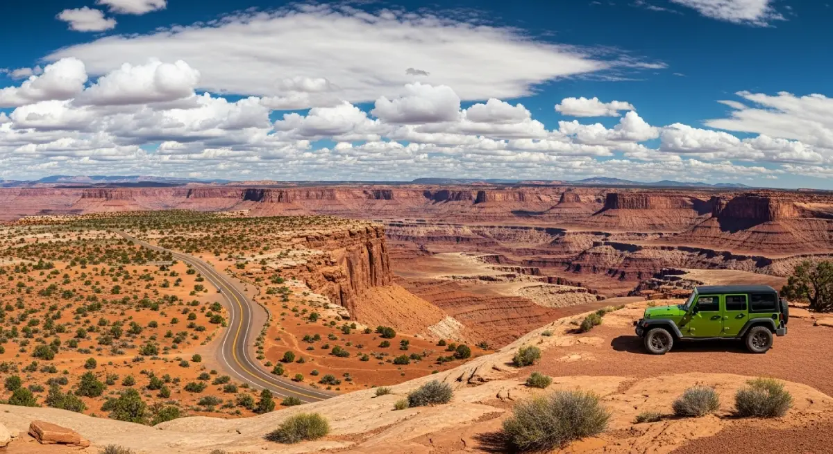
The standard Shafer Trail configuration runs approximately 19 miles from Highway 191 via Potash Road (State Route 279) to Island in the Sky Road in Canyonlands National Park—or vice versa depending on your preferred direction.
Starting from Moab (east to west):
From Moab, head north on Highway 191, then turn west onto Potash Road (SR-279). This paved scenic drive follows the Colorado River through stunning canyon terrain for approximately 16.5 miles until pavement ends and dirt road begins. The transition point marks the official Shafer Trail trailhead.
From here, the unpaved road climbs gradually through canyon terrain, passing notable features including:
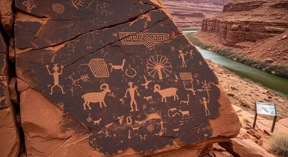
Indian Petroglyphs: Well-marked rock art sites along Potash Road provide glimpses into centuries of human presence in this landscape. Stop, photograph, but don't touch—oils from hands damage ancient rock art.
Jug Handle Arch: Natural sandstone arch visible from the road, representing the geological processes that created this entire landscape.
Poison Spider Mesa Area: Views of Poison Spider Mesa—one of Moab's most technically challenging Jeep trails that makes Shafer Trail look easy by comparison.
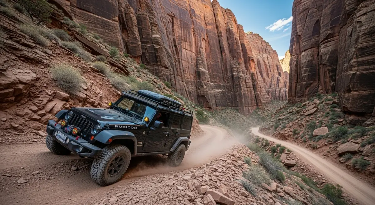
The road continues climbing until reaching the famous Shafer Switchbacks—the section that defines this trail's character and creates those dramatic photographs tourists share endlessly.
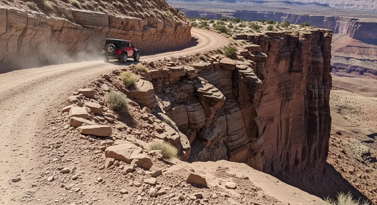
The Shafer Switchbacks: This section descends (or ascends, depending on direction) approximately 1,500 vertical feet through massive sandstone cliffs via tight switchbacks barely wider than a full-size vehicle. The exposure is genuine—drop-offs of 1,000+ feet with minimal guardrails and road surfaces that feel narrower than they actually are due to psychological impact of the exposure.
After the switchbacks, the trail reaches the White Rim Junction—where serious backcountry adventurers can connect to the 100-mile White Rim Trail loop requiring overnight permits and multi-day commitment. For Shafer Trail drives, you continue straight, eventually climbing out of the canyon and connecting to Island in the Sky Road approximately one mile from the Canyonlands Visitor Center.
Starting from Canyonlands (west to east)
Many drivers prefer starting from Canyonlands and driving east toward Moab for psychological reasons—descending the switchbacks feels less intimidating than climbing them while staring at exposure. From the visitor center, drive north on Island in the Sky Road for about one mile, then turn onto Shafer Canyon Road. After approximately 2.5 miles of relatively easy dirt road, you reach the switchback descent.
Driving west to east means tackling switchbacks first when you're fresh and focused, then enjoying easier terrain afterward. It also means ascending gradually through canyon terrain on Potash Road rather than descending—some drivers find this less nerve-wracking.
The Advanced Route via Gemini Bridges and Long Canyon
For experienced off-roaders with proper vehicles and previous trail experience, an alternative route adds Gemini Bridges and Long Canyon to the adventure—creating a full day of technical driving that connects multiple trail systems.
This advanced configuration starts at Gemini Bridges Trailhead off Highway 191, overlands to the impressive twin 200-foot natural arches, connects to Highway 313, then enters Long Canyon Road—a challenging route featuring steep walls, blind corners, soft powdery dirt sections, and a narrow rock arch you drive through that requires spotting and precise wheel placement.
Long Canyon connects to Potash Road near Jug Handle Arch, where you join the traditional Shafer Trail route. This extended adventure requires significant additional time (6-8 hours total), previous off-road experience, and vehicles with capabilities exceeding what's needed for standard Shafer Trail. Don't attempt this configuration as your first Moab trail experience.
Shafer Trail Difficulty Rating and Vehicle Requirements
Shafer Trail operates in that challenging space between "accessible to most high-clearance 4WD vehicles" and "requires genuine off-road capability beyond what casual tourists possess." The trail's moderate difficulty rating reflects several factors that separate confident driving from white-knuckle anxiety.
Official Difficulty Rating: Moderate (2-3 out of 10)
By Moab standards, Shafer Trail earns a 2-3 difficulty rating out of 10—significantly easier than technical rock-crawling trails like Hell's Revenge (6/10) or Poison Spider Mesa (8/10), but meaningfully harder than graded dirt roads requiring only cautious driving.
This "moderate" rating assumes:
High-clearance 4WD vehicle with low-range gearing (4LO)
Experienced driver comfortable with off-camber situations and exposure
Dry trail conditions (wet conditions escalate difficulty dramatically)
Reasonable traffic allowing safe passing at pull-outs
Daylight driving with good visibility
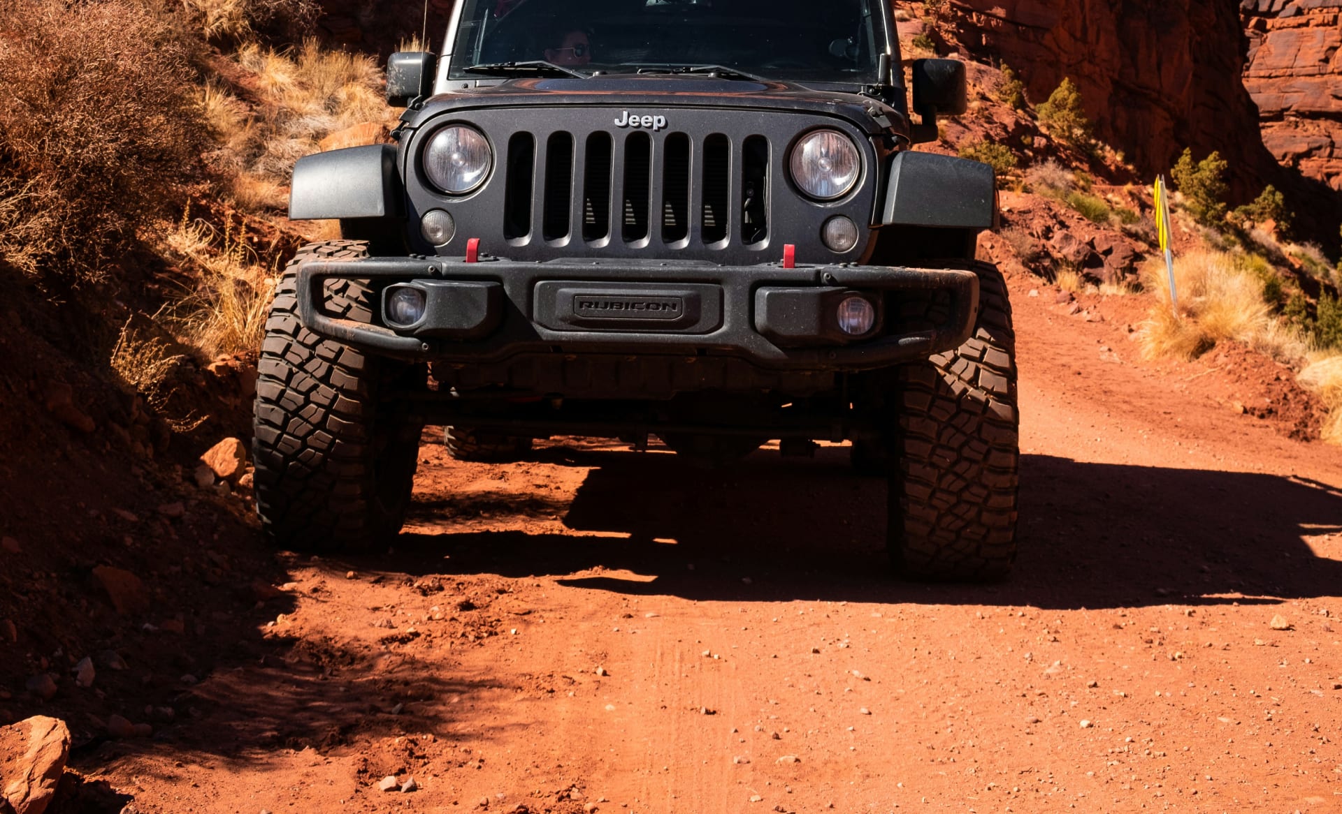
Stock Jeep Wranglers, 4Runners, and similar vehicles handle Shafer Trail confidently when driven by operators who understand their vehicles' capabilities and limitations. The trail doesn't require rock sliders, differential lockers, or 35-inch tires—but it absolutely requires more capability than a crossover SUV with "AWD" badge provides.
Vehicle Requirements That Actually Matter
Ground clearance: Minimum 8-9 inches, preferably 10+ inches. The trail features embedded rocks, small ledges, and sections where undercarriage scraping occurs even with decent clearance. Clearance matters less on Shafer Trail than on technical rock-crawling routes, but bottoming out still happens to low vehicles.
Four-wheel drive with low-range gearing (4LO): Mandatory. The switchback grades approach 16% in sections—steep enough that maintaining control requires low-range gearing. 4LO provides the engine braking needed for controlled descents and the torque multiplication needed for climbing without excessive throttle.
All-terrain or mud-terrain tires: Road tires slide on dusty switchbacks and provide inadequate traction on embedded rocks. Proper off-road tires with aggressive tread patterns deliver the grip needed for confident control.
Functional brakes in good condition: Extended descents generate heat that reveals brake system weaknesses. Vehicles with marginal brake performance develop fade problems on long downhills, creating dangerous situations where stopping power degrades.
Adequate fuel capacity: The complete Potash Road to Canyonlands route consumes more fuel than tourists expect due to low-speed driving, low-range operation, and extended distance. Start with a full tank.
What "High-Clearance Vehicle Recommended" Actually Means
National Park Service documentation states "high-clearance 4WD vehicles with low-range gear (4LO) are highly recommended" for Shafer Trail. This language represents careful bureaucratic phrasing that avoids saying "stock crossover SUVs get stuck and damaged regularly."
When NPS says "highly recommended," they mean "technically possible for skilled drivers in marginally capable vehicles under perfect conditions, but realistically you need proper equipment." The tourists who attempt Shafer Trail in rental crossovers with "4WD Auto" modes discover why recommendations exist after they bottom out, puncture oil pans, or require recovery assistance.
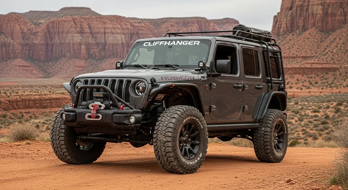
Cliffhanger's modified Rubicons exceed Shafer Trail requirements significantly—meaning you experience the trail confidently rather than anxiously wondering whether your vehicle can handle what's ahead. Stock Rubicons handle Shafer Trail easily; modified Rubicons make it feel easy.
Shafer Trail's Most Intimidating Sections
While Shafer Trail maintains moderate overall difficulty, specific sections create the psychological and technical challenges that define the experience.
The Shafer Switchbacks: Where Exposure Meets Technical Demand
The Shafer Switchbacks represent the trail's signature challenge—the section featured in countless photographs and the obstacle that tourists either love or fear depending on their comfort with exposure.
What makes the switchbacks challenging:
Narrow road width: The switchbacks were built for uranium ore trucks, not modern full-size trucks. Two-way traffic requires coordination and courtesy. When meeting oncoming vehicles, one driver must back up to a pull-out—which means backing downhill on steep grades with limited visibility and significant exposure.
Steep gradients: Sections approach 16% grade—steep enough that momentum management becomes critical. Lose too much speed climbing and you risk stalling on steep sections. Carry too much speed descending and brakes overheat while you struggle to maintain control.
Genuine exposure: The switchbacks descend 1,500 feet through cliff bands with drop-offs exceeding 1,000 feet. The road surface sits mere feet from edges that drop into space. Guardrails exist in limited sections but don't provide continuous protection.
Loose surface material: Dust, small rocks, and sandy sections reduce traction during turns. The outside edge of switchback corners often features loose material that slides under tires if you drift too wide.
Off-camber sections: Some switchback turns slope toward the outside—meaning gravity pulls your vehicle toward the edge. This off-camber geometry requires constant steering correction and creates the sensation of sliding sideways even when maintaining proper line.
Driving the Switchbacks: Direction Matters Psychologically
Descending (driving west to east): Descending means staring directly at exposure while steering through tight turns. The visual intimidation factor peaks when descending because you see exactly how far you'd fall if something went wrong. However, descending also means gravity helps maintain forward momentum, reducing the risk of stalling on steep sections.
Ascending (driving east to west): Climbing the switchbacks means the exposure sits behind you rather than directly in your field of view—psychologically easier for many drivers. However, ascending requires maintaining momentum on steep grades without excessive throttle that could break traction and without losing so much speed you stall mid-climb.
Neither direction is objectively safer—personal comfort with exposure determines which feels better.
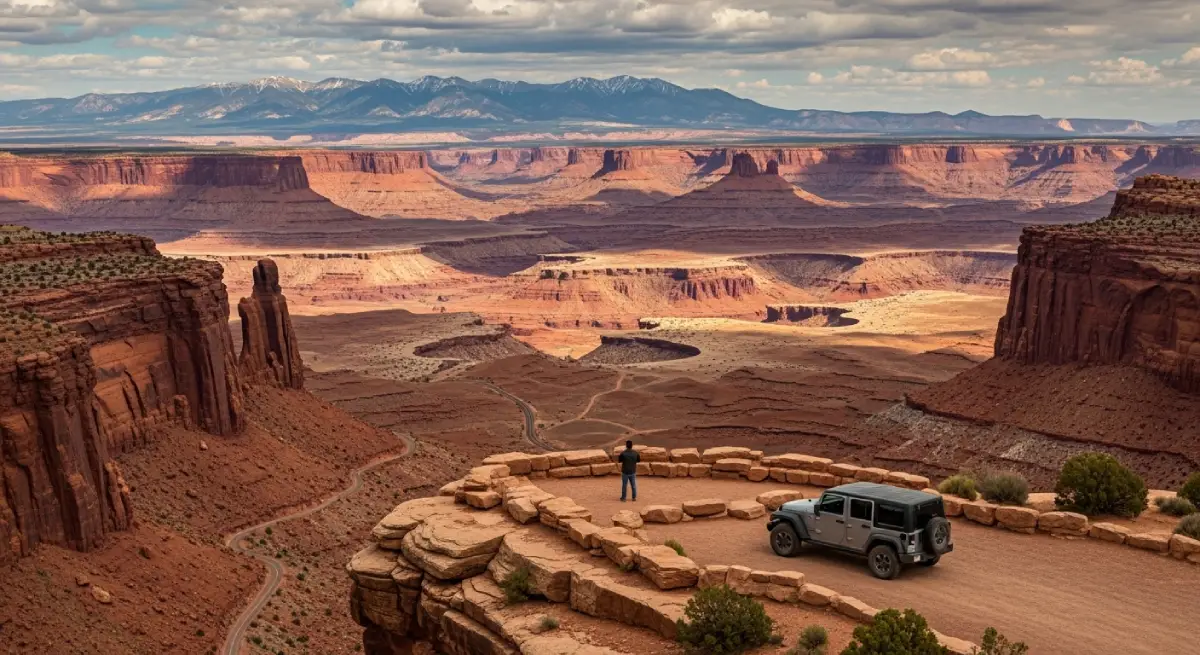
Thelma and Louise Point: Instagram Fame Meets Real Danger
Thelma and Louise Point—named after the famous 1991 film's climactic scene—represents Shafer Trail's most photographed location. The overlook provides spectacular views across canyon country, but it also demonstrates why this trail demands respect.
The movie scene featured a 1966 Ford Thunderbird sailing off the cliff edge into the canyon below—a fitting metaphor for what happens when confidence exceeds capability on routes like Shafer Trail. The filming location has become a pilgrimage site for movie fans and adventure seekers, creating traffic congestion at a point where road width barely accommodates stopped vehicles.
When stopping at Thelma and Louise Point, pull completely off the traveled portion of the road. The overlook sits at a section where the road widens slightly, but "wider" is relative—you're still on a narrow shelf hundreds of feet above the canyon floor. Vehicles parked carelessly force oncoming traffic dangerously close to the edge.
The Initial Descent from Island in the Sky
If starting from Canyonlands, the initial descent from Island in the Sky plateau creates immediate psychological challenge. Within 2.5 miles of leaving paved road, you transition from easy driving to exposed switchbacks with minimal warmup. The sudden difficulty jump catches tourists unprepared—one moment you're on well-maintained dirt road, the next you're navigating tight switchbacks with genuine consequences.
This abrupt transition serves as effective filtering—drivers who feel uncomfortable immediately recognize they're out of their depth and can turn around before committing to sections with limited turning space. If the initial switchbacks create anxiety that interferes with safe driving, turn around. There's no shame in recognizing limits.
Weather and Seasonal Considerations for Shafer Trail
Shafer Trail's accessibility varies dramatically with weather and season—conditions that transform the route from straightforward scenic drive to dangerous or impassable.
Summer: Heat and Afternoon Thunderstorms
Summer brings Moab's most comfortable morning temperatures but also creates afternoon hazards. July and August see 100°F+ air temperatures regularly, with exposed rock surfaces exceeding 110°F. Starting Shafer Trail mid-afternoon means extended driving through peak heat when vehicle cooling systems strain and human comfort declines rapidly.
More significantly, summer monsoon season brings violent afternoon thunderstorms that appear with minimal warning. Lightning strikes, flash flood potential, and sudden visibility reduction from rain or hail create genuine danger on exposed switchbacks where you can't simply pull off and wait out weather.
Summer strategy: Start early morning (6-8 AM), complete the drive before noon, and avoid afternoon thunderstorm windows (typically 2-6 PM). Monitor weather forecasts obsessively and postpone if thunderstorms are predicted.
Spring and Fall: Optimal Conditions with Unpredictable Weather
Spring (April-May) and fall (September-October) provide the most comfortable temperatures for Shafer Trail adventures. Morning temps in the 50-70°F range, afternoon highs in the 70-80°F range, and generally stable weather patterns make these seasons ideal.
However, spring brings temperature volatility—40°F+ swings between morning and afternoon are normal. Pack layers because the 75°F afternoon that feels perfect drops to 35°F by evening. Spring precipitation, though less frequent than summer monsoons, tends toward longer-duration storms that impact trail accessibility more significantly.
Fall offers the most reliable weather patterns with smaller temperature swings and less precipitation than spring. October specifically represents optimal Shafer Trail conditions—comfortable temps, stable weather, beautiful lighting, and autumn colors in the La Sal Mountains visible from various points along the route.
Winter: Solitude and Serious Hazards
Winter Shafer Trail appeals to adventurers prioritizing solitude over optimal conditions. You'll have the trail largely to yourself as tourist numbers drop dramatically. However, winter conditions create hazards that escalate difficulty significantly.
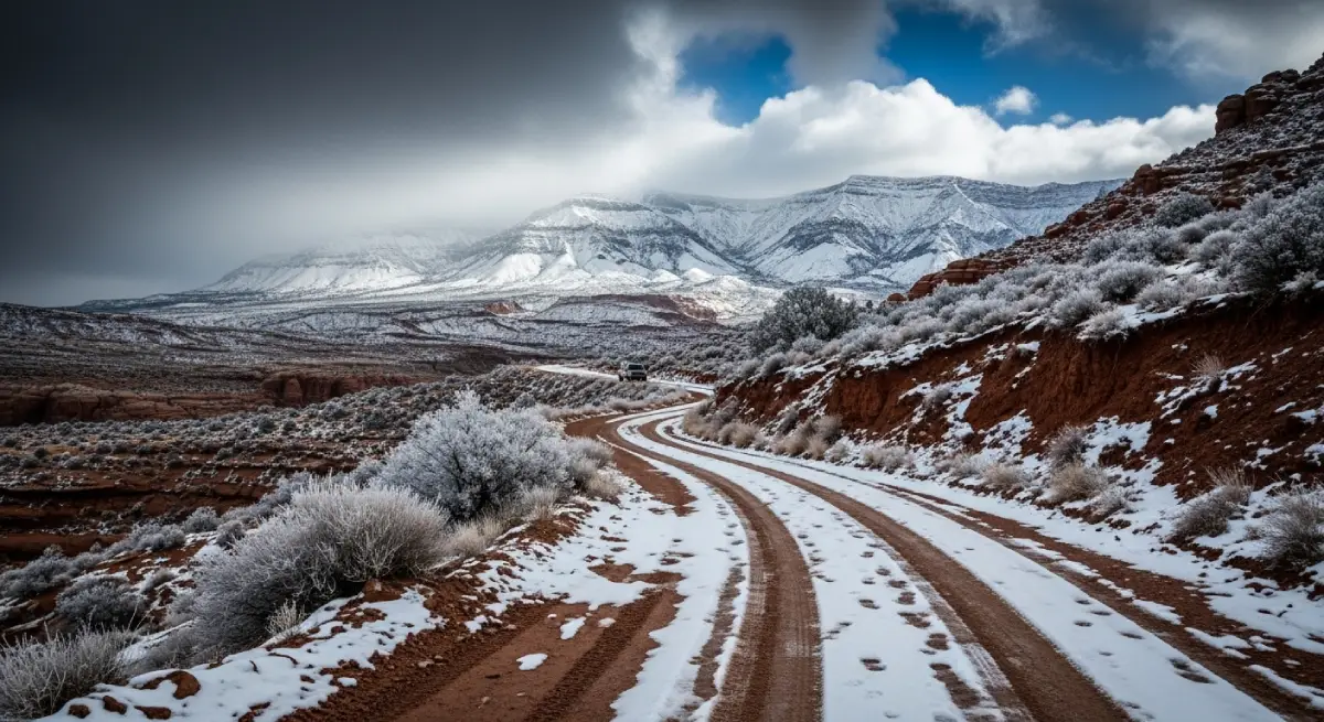
Freezing temperatures: December-February brings overnight lows in the 20s°F with daytime highs only reaching the 40-50°F range. At higher elevations along the trail, temperatures remain below freezing for extended periods. Cold affects vehicle batteries, fluid viscosity, and tire flexibility.
Snow and ice: Canyonlands receives 3+ inches of average snowfall in December alone. Snow accumulation on switchbacks creates traction nightmares. Ice forms on shaded sections, remaining invisible until tires lose grip. Black ice on exposed switchbacks where melted snow refreezes overnight creates conditions where even proper 4WD vehicles slide helplessly.
Impassable conditions: The National Park Service closes Shafer Trail frequently during winter due to snow or ice. Even when technically open, conditions may be genuinely impassable for recreational drivers. Attempting Shafer Trail in marginal winter conditions represents poor judgment—the consequences of getting stuck or losing traction on exposed switchbacks escalate dramatically in freezing temps.
Wet Trail Conditions: When "Moderate" Becomes "Dangerous"
The National Park Service explicitly warns "The Shafer Trail is slippery and often impassable when wet or icy." This isn't cautious bureaucratic language—this is stating reality that wet sandstone and clay-based dirt roads become ice-rink slippery.
Wet Shafer Trail transforms from moderate difficulty to genuinely hazardous. The exposed switchbacks that provide adequate traction when dry offer almost none when wet. Vehicles slide sideways on grades that felt manageable in dry conditions. Stopping distances increase dramatically. Recovery from mistakes becomes nearly impossible.
Never attempt Shafer Trail:
During active precipitation
Within 24 hours of significant rainfall
When rain or snow is forecast
When morning frost or ice is visible
The consequences of sliding off wet switchbacks into 1,000-foot drops justify extreme caution regarding weather conditions.
Safety Considerations and Common Mistakes
Shafer Trail's moderate difficulty rating creates complacency—tourists assume "moderate" means "safe for anyone in a 4WD rental" when it actually means "manageable for experienced drivers with appropriate vehicles under good conditions."
Traffic Management on Narrow Sections
Shafer Trail operates as a two-way road barely wider than a single vehicle through many sections. Meeting oncoming traffic requires coordination, courtesy, and often backing up significant distances to reach pull-outs wide enough for passing.
Right-of-way protocols:
Uphill traffic (vehicle facing uphill) has right-of-way
Vehicle closest to a pull-out backs up to that location
Larger/longer vehicles should generally be accommodated by smaller vehicles when determining who backs up
Use pull-outs liberally to allow faster traffic to pass
The switchback sections present particular challenges because visibility remains limited until vehicles are nearly adjacent. Driving slowly through switchbacks provides time to react when meeting oncoming traffic. Aggressive driving creates situations where neither vehicle can stop safely before reaching the other.
Height Anxiety and Passenger Panic
The exposure on Shafer Trail switchbacks triggers genuine anxiety in people uncomfortable with heights. Passengers often experience panic responses even when drivers remain comfortable. This psychological response creates safety issues when passengers distract drivers or demand that trips end mid-route.
Managing height anxiety:
Honestly assess comfort levels before committing to the trail
Stop at Shafer Canyon Overlook before driving the trail to preview exposure levels
Passengers should sit on the passenger side (away from edge when descending west to east)
Drive smoothly and predictably—sudden movements amplify anxiety
Take breaks when anxiety escalates rather than pushing through
If anxiety interferes with safe driving, turn around. The overlook at the top provides spectacular photography without requiring you to drive the entire trail.
Mechanical Failures in Remote Locations
Cell service disappears completely once you descend from Island in the Sky plateau. If mechanical problems strand you on Shafer Trail, you're 10-20 miles from help with no way to call for assistance. Self-sufficiency becomes mandatory rather than recommended.
Minimum emergency equipment:
Spare tire in good condition (not the compact temporary spare)
Jack and lug wrench that actually work
Basic tools (wrenches, screwdrivers, pliers)
Tire repair kit or plug kit
Recovery straps/shackles
First aid kit
Water (1 gallon per person minimum)
Food for unexpected delays
Emergency communication device (satellite messenger or PLB)
The tourists who attempt Shafer Trail with bald spare tires, incomplete jack sets, and zero emergency supplies discover why preparation matters when they puncture tires 15 miles from anywhere.
Underestimating Distance and Time Requirements
Shafer Trail's 19-mile length sounds manageable until you realize that 19 miles of unpaved, technical terrain requires 3-4 hours of driving when accounting for photo stops, slow sections, traffic coordination, and navigation. The tourists who start Shafer Trail at 3 PM discover they're finishing in darkness—not a situation you want on exposed switchbacks with limited visibility.
Realistic time planning:
Potash Road to Canyonlands: 3-4 hours minimum
Out-and-back from either direction: 6-8 hours total
Add 2-3 hours if combining with White Rim access or extended photography
Start early (7-9 AM) to ensure daylight completion
Running out of daylight on Shafer Trail is entirely avoidable through proper planning. Don't start late assuming you'll "just drive faster"—the trail doesn't allow rushing safely.
The Cliffhanger Advantage for Shafer Trail Adventures
Shafer Trail's moderate difficulty means properly capable vehicles handle the route confidently without anxiety about damage or capability limitations. This is where Cliffhanger's modified Rubicons deliver value that extends beyond technical capability into psychological confidence.
Vehicles Purpose-Built for Backcountry Access
Our modified Rubicons exceed Shafer Trail requirements in every category:
Ground clearance: Lifted suspension provides clearance margins that eliminate anxiety about embedded rocks or small ledges. You drive confidently knowing undercarriage contact won't occur.
Aggressive tire compounds: Purpose-designed off-road tires deliver traction that transforms dusty switchbacks from "careful navigation" to "controlled driving." The difference between adequate tires and proper tires becomes obvious on exposed sections where traction matters.
Enhanced cooling systems: Extended low-speed driving generates heat that stresses cooling systems. Our vehicles include upgraded radiators and transmission coolers that maintain safe temperatures throughout extended trail adventures.
Comprehensive protection: Skid plates protect critical components from impacts that would disable stock vehicles. You drive over obstacles confidently rather than creeping over each rock wondering if it'll crack your oil pan.
Local Knowledge About Current Conditions
Our Moab location staff drive Shafer Trail regularly and provide real-time condition updates:
Current weather impacts and trail accessibility
Traffic patterns and optimal timing to avoid congestion
Specific sections requiring extra attention based on recent conditions
Alternative routes if Shafer Trail is closed or conditions are marginal
This local expertise prevents those expensive mistakes where tourists commit to trail sections they shouldn't attempt because they lacked current information.
The Psychological Value of Proper Equipment
Shafer Trail in a stock rental SUV creates constant anxiety about capability—"Can my vehicle handle this? Am I going to get stuck? Will I damage something?" This anxiety interferes with enjoyment and creates tension that makes driving less safe.
Shafer Trail in a modified Rubicon specifically designed for terrain exceeding this trail's demands provides psychological confidence that transforms the experience. You focus on scenery, photography, and enjoying the adventure rather than worrying about vehicle capabilities.
Beyond Shafer Trail: Connecting to Additional Adventures
Shafer Trail serves as gateway to extended backcountry exploration for adventurers seeking more than a single-day drive.
White Rim Trail Connection
Serious backcountry enthusiasts connect Shafer Trail to the White Rim Trail—a 100-mile loop circumnavigating Island in the Sky that requires 2-3 days, overnight camping permits, and genuine self-sufficiency. The White Rim Junction on Shafer Trail provides access to this legendary route.
White Rim demands capabilities and commitment beyond Shafer Trail significantly. If Shafer Trail feels challenging, White Rim is not appropriate. However, for experienced overlanders with proper equipment, the Shafer-White Rim combination delivers multi-day adventure through some of Canyonlands' most remote terrain.
Potash Road Attractions
Even without driving Shafer Trail proper, Potash Road from Moab to the Shafer Trail trailhead provides spectacular scenic driving with notable stops:
Petroglyphs:
Multiple rock art panels
Corona Arch Trailhead:
3-mile round-trip hike to spectacular arch
Jug Handle Arch:
Visible from road
Colorado River Access:
Multiple points for photography
Potash Road alone justifies the drive for tourists wanting backcountry scenery without committing to Shafer Trail's technical demands.
Combining Shafer Trail with Other Moab Adventures
Multi-day Moab itineraries often combine Shafer Trail with technical rock-crawling trails like Hell's Revenge or Fins and Things. This progression from moderate (Shafer) to difficult (Hell's Revenge) allows skill and confidence building while experiencing diverse terrain types.
Cliffhanger's local staff can design multi-day itineraries that combine appropriate trails based on your experience level and objectives—ensuring you challenge yourself without attempting routes beyond current capabilities.
Experience Shafer Trail With Confidence and Proper Capability
Shafer Trail from canyon floor to Island in the Sky plateau through 1,500 feet of exposed switchbacks represents Moab backcountry access at its most visually spectacular. The moderate difficulty rating, historical significance, and connection to Canyonlands National Park make this route essential for adventurers seeking that perfect balance between accessibility and genuine challenge.
But experiencing Shafer Trail safely requires honest capability assessment and appropriate equipment. The switchbacks, exposure, remote location, and weather variability create conditions where vehicle limitations become safety concerns rather than minor inconveniences. Stock rental SUVs might technically complete the trail under perfect conditions with skilled operators—but "might" and "technically" create anxiety that interferes with enjoyment and safety.
Cliffhanger Jeep Rentals eliminates that gap between tourist optimism and backcountry reality. Our modified Rubicons exceed Shafer Trail demands significantly while our local expertise provides the current condition information that prevents expensive mistakes. When vehicle capability exceeds trail requirements, you focus on scenery, photography, and adventure rather than worrying whether your equipment can handle what's ahead.
Ready to experience Shafer Trail's 19 miles of switchbacks, exposure, and spectacular canyon scenery with confidence that comes from proper capability? Contact Cliffhanger Jeep Rentals and discover why thousands of adventurers trust us for trails where moderate difficulty still demands genuine respect and proven equipment.
The 1,500-foot descent through colorful sandstone walls on narrow switchbacks is waiting—but Shafer Trail reveals its complete character only to those who approach with appropriate vehicle capability rather than optimistic assumptions about what "moderate difficulty" actually means.