What Nobody Tells You Before You Drive From Moab to Las Vegas
Here's what the mapping apps conveniently omit about the Moab to Las Vegas drive: the fastest route they recommend passes within reach of five national parks, three national monuments, and some of the most photographed terrain in the American West and most travelers blow past every one of them in pursuit of an arrival time, the elevation swings between Moab's 4,000 foot desert floor and the high plateau crossings between the two cities are significant enough to affect both vehicles and route timing, and the genuinely scenic version of this drive isn't a single recommended route at all but a choice between two distinct corridors that deliver fundamentally different experiences.
The Moab to Las Vegas drive isn't a transit between two desert cities. It's a 460 mile journey through southern Utah's high desert plateau country, across some of the most concentrated public land in the lower 48, and into the Mojave Desert basin where Las Vegas sits in its valley below the surrounding mountain ranges. The route passes the entrances to Capitol Reef, Bryce Canyon, and Zion national parks on the southern option, or threads through Glen Canyon Recreation Area and across the Arizona Strip on the alternate corridor. Done right, the drive is one of the better national park road trips available anywhere.
Hundreds of thousands of travelers make some version of the Moab to Las Vegas drive each year. The ones who get the most out of it and avoid the "we drove right past Bryce" regrets that single day routing produces are the ones who arrive understanding their route options and what each one actually delivers.
Moab to Las Vegas at a Glance
The basics: 460 miles via the standard southern route through Capitol Reef and Bryce; 480–520 miles depending on detours and the Page/Lake Powell alternate
Drive time: 7–8 hours direct via I-70 and I-15 with minimal stops; 10–12 hours with the scenic southern Utah routing; a full two to three days to do the route justice
Elevation range: 4,026 feet at Moab to 9,000+ feet crossing Boulder Mountain (highest point on the southern scenic route), down to Las Vegas's 2,000 feet
States covered: Utah, Arizona, and Nevada, with significant time on the Arizona Strip depending on route choice
Typical season: Year round, with the highest scenic sections (Boulder Mountain, Cedar Breaks) closing seasonally and summer heat through southern Utah and Nevada exceeding 110°F regularly
Vehicle requirement: Any vehicle handles the paved scenic route; high clearance 4WD opens the backcountry detours and slot canyon access that make the trip memorable
What it covers: The Moab to Las Vegas corridor connects two of the most visited destinations in the American West through some of the most varied terrain on any drive in the region. The southern route follows Utah's Highway 12 widely considered one of the most scenic drives in the country through Capitol Reef and toward Bryce Canyon before continuing to Zion and the final descent into Nevada. The northern alternate runs the interstate corridor through St. George before reaching Las Vegas. The drive can be compressed into a single long day on the fast route, or stretched across two to three days with overnights in the gateway towns to make the national parks genuinely accessible.
Designated status: Significant portions of the scenic route carry formal Scenic Byway designation, including Utah Highway 12 (designated an All American Road, one of only a few dozen routes in the country with that status) and the Trail of the Ancients connecting some of the corridor's cultural sites. Capitol Reef, Bryce Canyon, and Zion national parks all sit on or near the southern route, with Cedar Breaks National Monument as an additional high elevation stop.
The Fast Route: I-70 and I-15
The interstate route is the version most travelers default to when speed matters more than scenery. It's genuinely efficient roughly 460 miles of well maintained highway that connects Moab to Las Vegas in 7–8 hours of driving when conditions cooperate.
What the route delivers:
From Moab, the route runs north on US-191 to connect with I-70 westbound, crosses central Utah through Salina, descends through the canyon country toward the I-15 junction near Cove Fort, and runs I-15 south through Cedar City, St. George, and the Virgin River Gorge before the final descent into the Las Vegas Valley.
The scenic highlights even on the fast route:
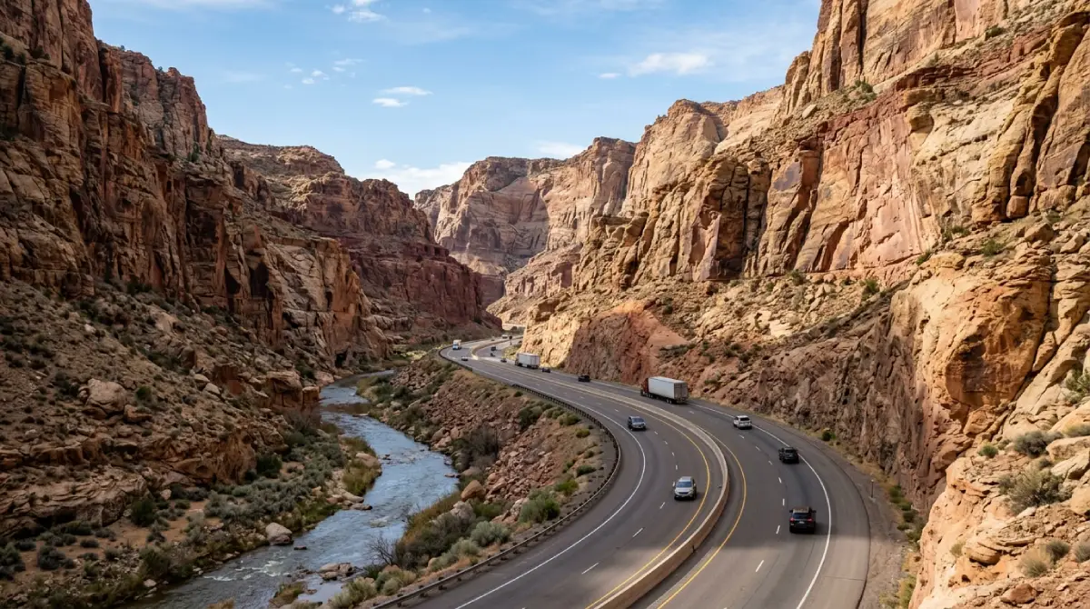
The Virgin River Gorge stretch of I-15 between St. George and the Nevada state line is among the most dramatic interstate corridors in the country a narrow canyon section where the highway threads alongside the Virgin River through sheer-walled gorge terrain. The descent from the Utah Nevada border into Las Vegas Valley itself delivers a dramatic visual reveal of the city below the surrounding ranges.
Technical specifics:
The I-70/I-15 route is entirely paved and accessible to any vehicle in normal conditions
Summer driving through the lower elevation sections regularly exceeds 110°F; cooling system stress, tire pressure changes, and vehicle reliability all become genuine concerns
The Virgin River Gorge section narrows and curves significantly; large vehicles and trailers should plan accordingly
Cell service is reliable along most of the interstate corridor, with intermittent gaps in the remote stretches of central Utah
The trade off:
The interstate route is fast and reliable but it's also the version that skips essentially every reason to drive between Moab and Las Vegas rather than fly. Capitol Reef, Bryce Canyon, Zion, the Grand Staircase Escalante backcountry, and Cedar Breaks all sit off this route. Travelers prioritizing arrival time over experience choose this version; travelers planning a road trip choose the scenic alternative.
The Scenic Route: Utah Highway 12 and the National Parks
The scenic version of the Moab to Las Vegas drive runs through southern Utah's national park corridor and delivers what's widely considered one of the most spectacular road trips in the country. The route adds time and miles to the trip but converts a transit slog into a destination in itself.
What the scenic routing delivers:
From Moab, the scenic route runs south on US-191 to I-70 west, exits onto Utah Highway 24 toward Capitol Reef National Park, continues onto Utah Highway 12 (the All American Road) through Boulder, Escalante, and Bryce Canyon, descends to Highway 89, and connects through Zion National Park and into the I-15 corridor for the final approach to Las Vegas.
The three day version:
Splitting the scenic route across three days transforms it from a long drive into a national park road trip. Day one: Moab to Capitol Reef with an overnight in Torrey. Day two: Highway 12 through Grand Staircase Escalante to Bryce Canyon, overnight near Bryce. Day three: Bryce to Zion to Las Vegas. This version is the difference between catching glimpses of these parks from the highway and actually experiencing them.
Technical specifics:
Highway 12 is paved and accessible to any vehicle but features significant elevation changes, tight curves through Hogback section, and weather sensitivity through the Boulder Mountain crossing
The Boulder Mountain pass on Highway 12 reaches 9,600 feet; winter closures and weather restrictions apply seasonally
National park entrance fees apply at each stop along the scenic route; the America the Beautiful pass covers them and pays for itself within two or three park visits
Backcountry side routes off Highway 12 require high-clearance 4WD; the Grand Staircase Escalante backcountry contains genuine off road terrain for travelers with the right vehicle
Capitol Reef National Park: The First Major Stop
The first scenic stop on the southern Moab to Las Vegas route is Capitol Reef National Park, roughly 150 miles into the trip. Capitol Reef is the least visited of Utah's Mighty Five national parks and the one most likely to deliver a genuine sense of discovery rather than crowded scenic drives.
What the park delivers:
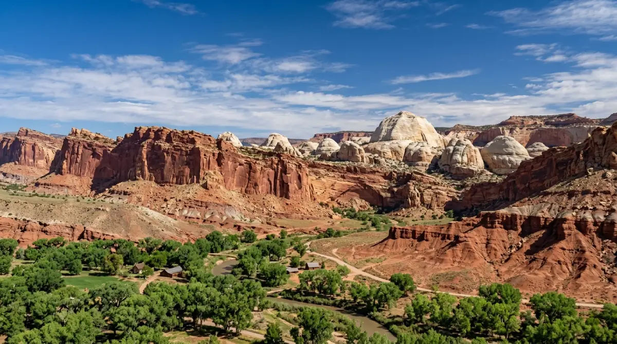
Capitol Reef preserves the Waterpocket Fold a 100 mile long warp in the Earth's crust that creates the dramatic geological terrain the park is named for. The main park area along Highway 24 includes the historic Fruita orchards, the Capitol Reef Scenic Drive, and panoramic overlooks accessible by any vehicle.
Why it earns the stop:
The park adds 1–3 hours to the Moab to Las Vegas drive depending on how deep travelers go. The scenic drive alone is 8 miles round trip and accessible to any vehicle; the backcountry roads into the Cathedral Valley district require high clearance 4WD and significant additional time. The Fruita historic district's pie shop the actual operating bakery in the historic Gifford House is a legitimate destination for travelers timing their stop around it.
Logistics:
Capitol Reef charges a modest entrance fee for the scenic drive; the main highway through the park is free. The town of Torrey, immediately west of the park, provides the most natural overnight base for travelers tackling the scenic route across multiple days.
Highway 12 Through Grand Staircase Escalante
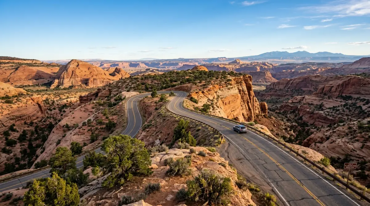
The 122-mile stretch of Utah Highway 12 from Torrey to Bryce Canyon is the route's defining scenic segment and one of the most photographed roads in the country. The highway crosses Boulder Mountain at 9,600 feet, runs the Hogback section where the road follows a narrow ridge with dramatic drop offs on both sides, and threads through the Grand Staircase Escalante National Monument's most accessible terrain.
The scenic highlights:
The Hogback section between Boulder and Escalante delivers the route's most dramatic driving a section of highway built on a narrow ridge with sheer drops on both sides and panoramic views across the broken desert plateau country in every direction. Calf Creek Falls, accessible via a 6 mile round trip hike from the highway, is among the most rewarding waterfall hikes in the region.
The backcountry access:
Highway 12 provides the primary access to the Grand Staircase Escalante National Monument's backcountry roads Hole in the Rock Road, the Burr Trail, and the Cottonwood Canyon Road all branch off the scenic corridor. These routes range from improved gravel to genuinely technical 4WD terrain and access slot canyons, remote viewpoints, and cultural sites that the highway corridor alone can't reach.
Escalante:
The town of Escalante sits roughly at the midpoint of Highway 12 and provides the natural base for travelers planning to explore the surrounding backcountry. Services include gas, food, and lodging at small town scale; the visitor center on the highway provides current road condition information for the backcountry routes.
Bryce Canyon National Park: The Hoodoo Amphitheater
Bryce Canyon sits at the western end of Highway 12 and delivers the route's most distinctive geological landscape an amphitheater filled with thousands of hoodoo rock formations colored in shades of orange, red, and white. The park's elevation (8,000–9,000 feet at the rim) makes it cooler than most of the Utah corridor and a welcome respite from summer heat.
What the park delivers:
Bryce's main scenic drive runs 18 miles along the rim with regular overlooks at Sunrise Point, Sunset Point, Inspiration Point, and Bryce Point. Each overlook delivers a fundamentally different perspective on the hoodoo amphitheater below. The Navajo Loop and Queens Garden trails descend from the rim into the hoodoos themselves and are accessible to most travelers in good condition.
The elevation reality:
Bryce's elevation catches many summer travelers off guard. Temperatures at the rim run 15–20°F cooler than the surrounding lowlands, weather can develop quickly, and the altitude affects unacclimatized visitors. Layered clothing and water are non negotiable even on warm looking summer mornings.
Logistics:
Bryce Canyon charges a standard entrance fee covered by the America the Beautiful pass. The gateway communities of Bryce Canyon City, Tropic, and Cannonville provide lodging in escalating proximity to the park entrance. Most travelers visit Bryce as a half day to full day stop; serious photographers and hikers can fill multiple days.
Zion National Park: The Final Major Stop
Zion sits roughly 80 miles from Bryce and 160 miles from Las Vegas, anchoring the final major scenic stop on the southern route. The park's combination of sheer sandstone cliffs, the Virgin River canyon system, and famously challenging hikes makes it the mostvisited national park in Utah and one of the most visited in the entire system.
What the park delivers:
Zion Canyon's main scenic drive is closed to private vehicles most of the year, with park shuttles providing access from the visitor center to the canyon's interior stops. The shuttle system runs efficiently but adds time to a Zion visit; travelers compressing the park into a brief stop should account for shuttle logistics in their planning.
The signature experiences:
The Narrows hike walking up the Virgin River through a slot canyon is among the most distinctive hiking experiences in the national park system, accessible without a permit for the bottom up dayhike. Angels Landing, the park's most famous strenuous hike, now requires a permit obtained through a lottery system and demands genuine fitness and comfort with exposure.
Logistics:
Zion charges a standard entrance fee covered by the America the Beautiful pass. The town of Springdale immediately outside the park provides full services and lodging at gateway town prices. Through traveling visitors who can't commit a full day to Zion can drive the Zion Mount Carmel Highway through the park's east entrance, experiencing the famous switchbacks and the tunnel without engaging the shuttle system or the main canyon stops.
Planning Your Moab to Las Vegas Drive: Timing, Route, and Honest Preparation
Route decision:
The interstate route is the right choice for travelers prioritizing speed, traveling with significant time constraints, or driving in winter conditions that close the higher scenic routes. The scenic route through Highway 12 is the right choice for travelers with two to three days available and any interest in the national parks the corridor passes through.
Timing:
Spring (April–May) and fall (September–October) deliver the optimal conditions for the scenic route. Summer brings extreme heat in the lower elevations (Capitol Reef and Zion regularly exceed 105°F) and the highest visitor traffic at all the parks. Winter closes some of the scenic route's highest sections and complicates park access but can be the right window for travelers who prefer empty parks and don't mind cold weather driving.
The two to three day question:
The single most impactful planning decision for the Moab to Las Vegas drive is whether to do it in one day or spread it across multiple days. The one day version is achievable on the interstate route and acceptable for travelers who simply need to get between the cities. The multi day version, with overnights in Torrey, Escalante, and Springdale, transforms the drive into a national park road trip and makes the corridor's best stops genuinely accessible.
What to bring:
Plenty of water; the entire corridor runs through high desert and dehydration develops faster than most travelers anticipate
Layered clothing spanning desert heat to mountain cool; the elevation range produces 30°F+ temperature swings within a single day
The America the Beautiful pass for travelers planning multiple national park stops; it pays for itself within two or three entrances
Closed toe footwear with real tread for any planned hiking; the parks' best experiences require walking on uneven terrain
A weather check immediately before departure and along the route; weather can develop quickly across the corridor's elevation range
Offline maps for any backcountry side routes; cell service drops on the Highway 12 backcountry roads and in parts of the Grand Staircase Escalante region
Why Cliffhanger for Your Moab to Las Vegas Adventure
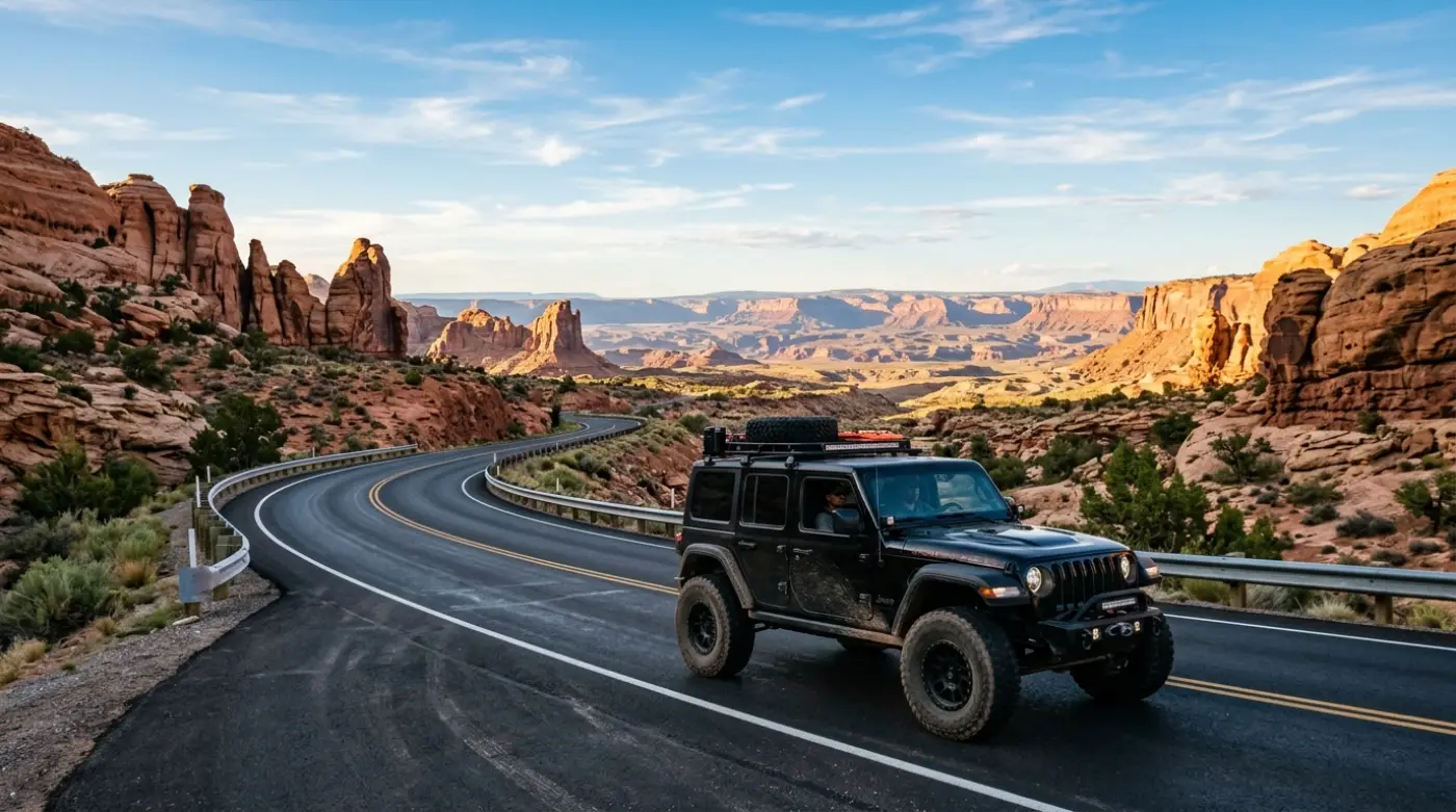
The Moab to Las Vegas drive's structural reality is that the interstate version and the scenic version are genuinely different trips and the scenic version's best content sits off the main highway corridor on backcountry roads that demand the right vehicle. Hole in the Rock Road, the Burr Trail, the Cathedral Valley district of Capitol Reef, and the slot canyon access points across Grand Staircase Escalante all require high-clearance 4WD that standard rental SUVs can't provide and their contracts prohibit.
Cliffhanger's Moab location is the natural starting point for a Moab to Las Vegas trip done right.
What Cliffhanger's Moab Rubicons provide:
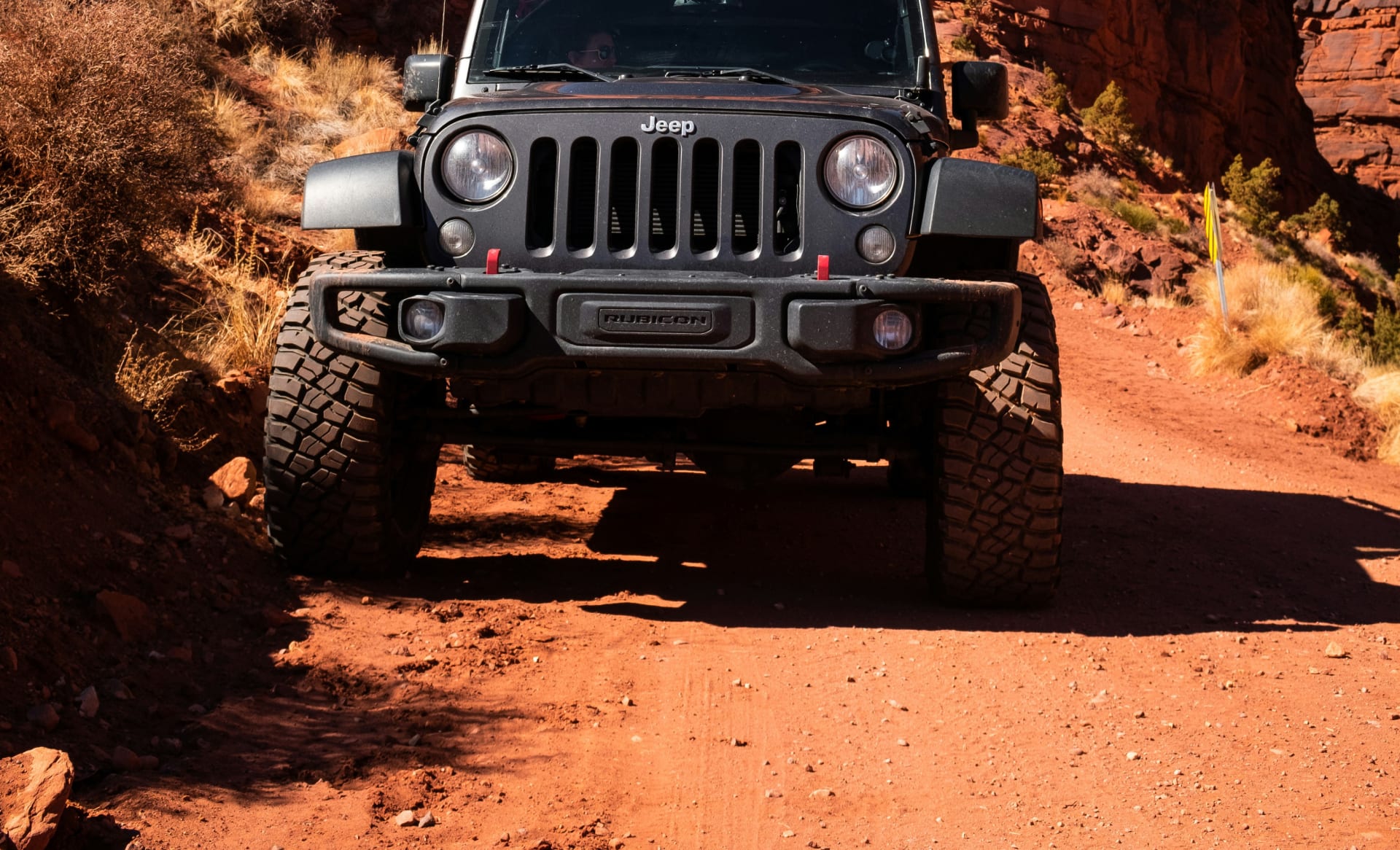
2.5-inch lift with 35-inch aggressive tires: clearance and grip for the backcountry detours off the scenic corridor that stock vehicles and rental SUVs can't handle
Extreme Rubicons with 3.5-inch lift and 39-inch tires: the configuration for Cathedral Valley, the Hole in the Rock Road's lower sections, and the most technical Grand Staircase-Escalante routes
Full skid plate protection: oil pan, transmission, and transfer case coverage that turns rock contact into a non-event rather than a trip ending damage moment
4LO low-range capability: the actual low range gearing that the backcountry routes require not the AWD AUTO modes that fail on the sandy washes and rocky descents typical of southern Utah's side roads
Trail permission contracts: explicit authorization for the named backcountry routes and BLM corridors, with damage and recovery terms structured around real off road use rather than excluding it
Zion area pickup option: Cliffhanger's Zion location provides return flexibility for travelers who want to drop the vehicle at the western end of the corridor rather than committing to a Moab round-trip
The Moab to Las Vegas drive is one of the better national park road trips available anywhere. It rewards proper preparation with five national parks within reach, the Highway 12 All American Road, Grand Staircase Escalante's backcountry, and the desert and canyon scenery that puts this corner of the country in the same conversation as anywhere on the continent. It also leaves travelers who treat it as a simple interstate slog wondering what all the scenery off the highway actually held.
Cliffhanger exists to make sure your trip falls in the first category.
Ready to drive from Moab to Las Vegas in a vehicle built for every detour worth taking? Contact Cliffhanger Jeep Rentals in Moab and let's put together the configuration that makes the drive what it's supposed to be.