Here's what the Moab tourism websites conveniently gloss over about Moab elevation: the 4,025-foot base altitude creates a dangerous false sense of security that diverts attention from the actual threats killing visitors—extreme heat reaching 100°F+ on 41 days per year, dehydration rates that steal bodily fluids twice as fast as sea level, and a "triple threat" environment of heat, intense sun, and bone-dry air that sends over 100 people to search and rescue in Grand County every single season.
Moab elevation operates by different rules than Colorado's high mountain passes. While Colorado's 12,000+ foot trails attack visitors with altitude sickness and oxygen deprivation, Moab's moderate elevation means most visitors experience minimal altitude effects—and that's precisely where the danger begins. Tourists who've researched Colorado altitude preparation arrive in Moab thinking they've dodged the elevation bullet, only to discover that Utah's high desert reserves an entirely different set of consequences for the unprepared.
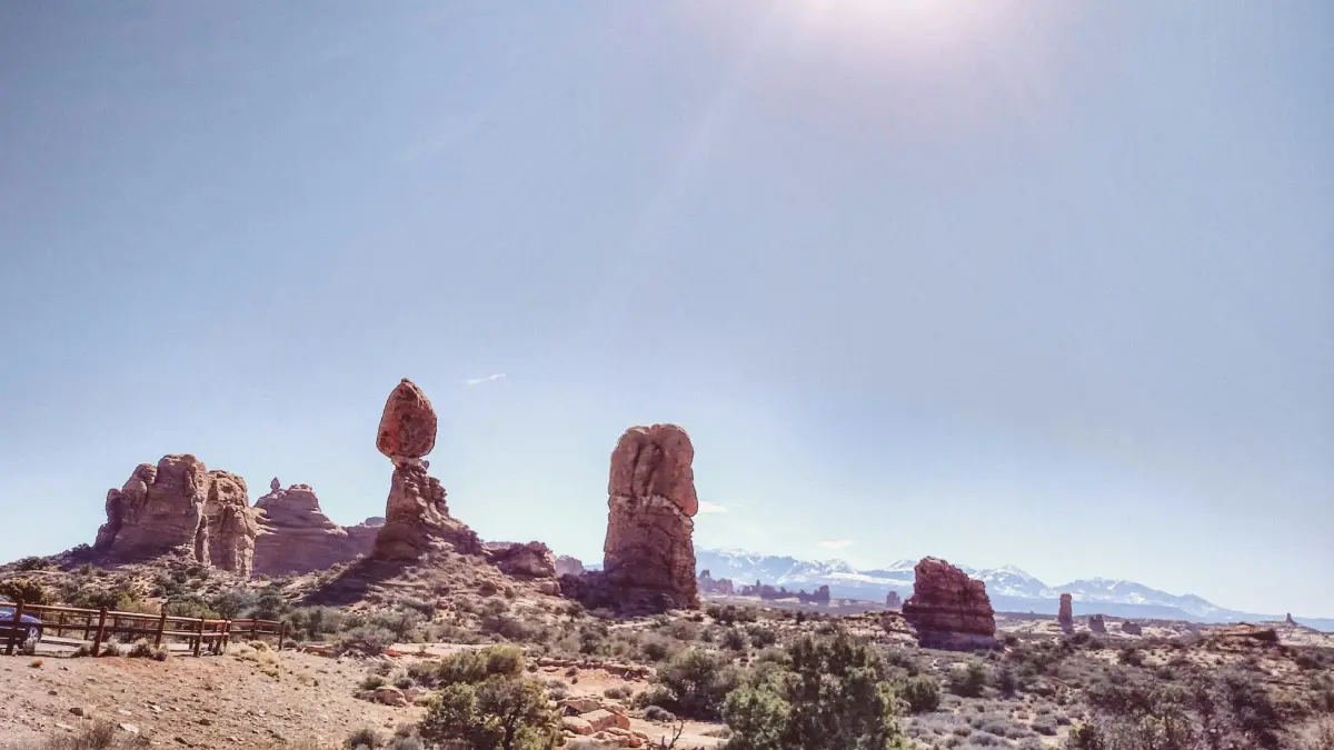
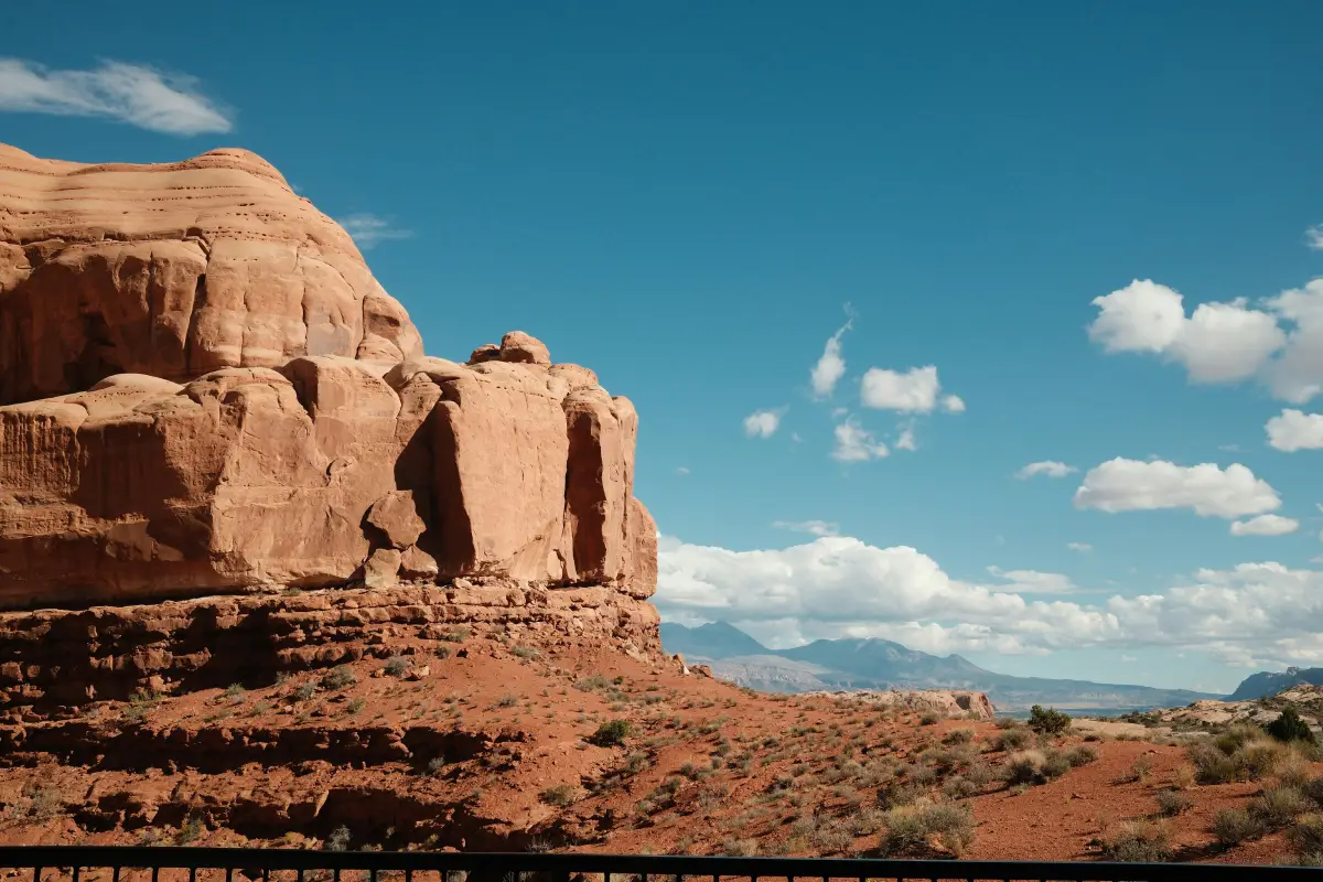
The reality is that Moab's elevation profile spans from 4,025 feet in town to over 7,000 feet on trails like Top of the World, with the La Sal Mountains soaring to 12,721 feet as a backdrop. But elevation numbers tell only part of the story. In Moab, the combination of moderate altitude with extreme desert conditions creates compounding challenges that catch visitors off-guard precisely because they're expecting altitude problems rather than heat-related emergencies.
Understanding Moab's Elevation Profile
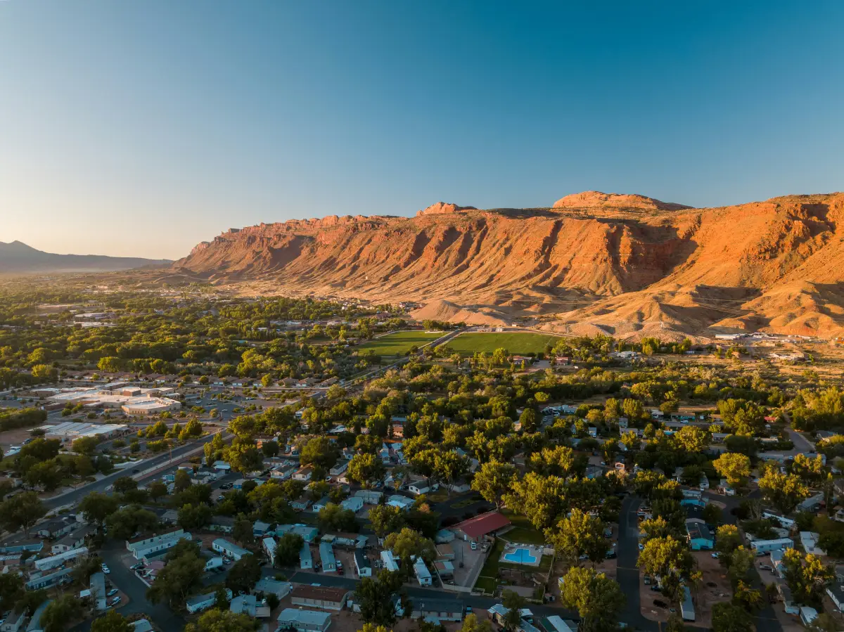
Moab sits on the Colorado Plateau at 4,025 feet above sea level—significantly lower than Colorado's mountain towns but high enough to meet the clinical definition of "high altitude" that begins at 4,000 feet. This positioning creates unique conditions that visitors from both coastal lowlands and mountain regions consistently misunderstand.
Moab Town and Surrounding Elevations
The town of Moab itself maintains a relatively consistent elevation around 4,025 feet, situated just south of the Colorado River in a valley surrounded by dramatic sandstone formations. But the trails and attractions that draw visitors climb significantly higher:
Arches National Park: 4,085 feet at the visitor center to 5,653 feet at Elephant Butte
Canyonlands Island in the Sky: approximately 6,000-6,200 feet on the mesa top
Dead Horse Point State Park: 5,900 feet at the famous overlook
Top of the World trail summit: 7,050 feet with 3,000-foot cliff exposure
Poison Spider Mesa summit: 5,200 feet above the Colorado River valley
The elevation gain from town to popular viewpoints means visitors routinely climb 1,500-2,000 feet during a single day of exploration—often without recognizing the cumulative physiological impact when combined with desert heat and minimal shade.
The La Sal Mountains: Moab's Hidden High Country
Rising dramatically behind Moab's red rock landscape, the La Sal Mountains reach 12,721 feet at Mount Peale—creating an elevation range within the greater Moab area that rivals anything in Colorado. These snow-capped peaks provide the scenic backdrop for countless Moab photographs while offering a legitimate high-altitude escape from summer desert heat.
The 8,600+ foot elevation difference between Moab town and the La Sal summits means visitors can experience everything from desert heat exhaustion to genuine altitude sickness within a single day's drive. Those seeking relief from 100°F valley temperatures find significantly cooler conditions in the La Sal alpine zones—but also encounter the altitude-related challenges they thought they'd avoided by choosing Moab over Colorado.
Why Moab's "Moderate" Elevation Creates False Security
The clinical threshold for altitude effects begins around 4,000 feet—precisely where Moab sits. Research indicates altitude sickness can develop at elevations as low as 4,000-5,000 feet, particularly for visitors ascending rapidly from sea level. Moab's positioning right at this threshold means some visitors experience symptoms while others feel nothing unusual.
The Altitude Sickness Probability at Moab Elevation
At Moab's base elevation of 4,025 feet, altitude sickness risk remains relatively low for most healthy visitors. The air contains approximately 12% less oxygen than sea level—noticeable during exertion but rarely debilitating. Symptoms that do develop tend toward mild effects: slightly faster breathing on climbs, minor headaches, and quicker fatigue during physical activity.
However, as visitors climb to Canyonlands' 6,200-foot mesa tops or tackle trails approaching 7,000 feet, they enter elevation ranges where 15-25% of unacclimatized visitors experience some degree of acute mountain sickness. The progression happens gradually enough that many people attribute their symptoms to heat, dehydration, or simple tiredness rather than recognizing altitude as a contributing factor.
The real danger isn't altitude sickness itself—it's the way moderate altitude symptoms mask and compound the effects of heat and dehydration that pose far greater immediate threats in Moab's desert environment.
The Altitude-Heat Combination Most Visitors Ignore
Moab's elevation doesn't exist in isolation—it combines with extreme desert conditions to create what locals call the "triple threat" environment: intense heat, bright sun, and dry air that together extract more from the human body than any single factor alone.
At 4,000+ feet elevation, the thinner atmosphere provides less protection from solar radiation. UV intensity increases approximately 4% for every 1,000 feet of elevation gain, meaning Moab's visitors absorb significantly more damaging radiation than they would at sea level beaches. The dry air—often below 20% humidity during summer—accelerates evaporation from skin and lungs, causing dehydration that visitors don't notice because their sweat evaporates before they feel wet.
The Wilderness Medical Society found that fluid loss occurs twice as fast at high elevations compared to sea level. Combined with Moab's extreme heat—where summer highs regularly exceed 100°F—visitors can become dangerously dehydrated while feeling like they're barely sweating at all.
The Real Threat: Moab's Extreme Heat Environment
While visitors research altitude preparation, Moab's actual killer operates through temperature rather than thin air. The statistics tell a story that tourism marketing carefully understates.
Summer Heat by the Numbers
Moab experiences extreme heat that transforms the red rock paradise into a genuine survival environment:
41 days per year with temperatures exceeding 100°F
109 days per year above 90°F
July temperatures commonly reaching 100°F+ with 50% of days exceeding that threshold
Slickrock surface temperatures reaching 130-140°F during peak afternoon heat
Temperature swings of 35+ degrees between daily highs and overnight lows
The hottest period typically runs from 3 PM to 5 PM—precisely when afternoon explorers find themselves deep into trails with limited shade and diminishing water supplies. Search and rescue teams report that most heat-related emergencies involve visitors who underestimated afternoon conditions or overestimated their ability to complete planned activities before peak heat arrived.
Dehydration: The Silent Emergency
One National Park Service report documented a hiker lost for eight hours in 100-degree heat, seriously dehydrated until helicopter rescue. Outside Moab, a father and daughter died in Canyonlands after running out of water in similar midday conditions. Grand County search and rescue teams log over 100 calls per season, with dehydration and navigation errors representing the most common causes.
The dehydration mechanism in Moab's environment operates unlike humid climates where visible sweating provides warning. In the desert's dry air, perspiration evaporates instantly—your body loses fluids without the tactile feedback that normally triggers thirst. By the time you feel genuinely thirsty, you're already significantly dehydrated. By the time you feel symptoms like headache, dizziness, or fatigue, you may be approaching a medical emergency.
Recommended water consumption in Moab's summer environment: one gallon per person per day minimum for moderate activity, with additional electrolyte replacement for extended exertion. Most visitors underestimate this requirement dramatically.
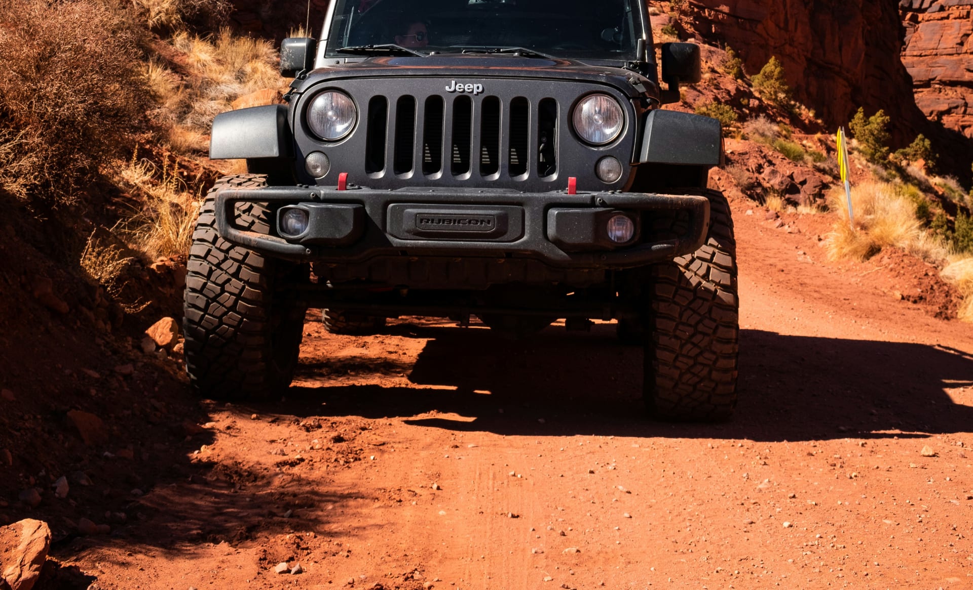
How Moab Elevation Affects Off-Road Adventures
The elevation considerations for Moab's famous 4x4 trails differ substantially from Colorado's high-altitude passes—but vehicle and driver preparation remain equally critical for different reasons.
Vehicle Performance at Moab Elevation
At 4,025 feet base elevation, naturally aspirated engines lose approximately 12% of their sea-level horsepower—noticeable but manageable for most capable vehicles. Trails climbing toward 7,000 feet increase that loss to roughly 20%, which affects power delivery during technical obstacles where momentum matters.
However, the greater vehicle concern in Moab isn't elevation-induced power loss—it's heat management. Engines working hard on technical slickrock during 100°F+ ambient temperatures face cooling challenges that compound with even moderate power reduction. Transmission fluid temperatures climb during sustained low-speed crawling. Brake systems handling steep descents on hot rock generate heat with less atmospheric cooling efficiency than at lower, cooler elevations.
The combination creates a vehicle stress profile unlike Colorado's cold high-altitude challenges. In Colorado, altitude saps power while cold temperatures help cooling systems cope. In Moab, moderate altitude reduces power slightly while extreme heat overwhelms cooling capacity simultaneously.
Trail-Specific Elevation Challenges
Moab's legendary trails each present unique elevation profiles that affect both driver and vehicle performance:
Hell's Revenge operates in the Sand Flats Recreation Area, climbing through petrified sand dunes and slickrock fins. The trail's technical challenges—Hell's Gate, Mickey's Hot Tub, the Escalator—demand precise throttle control and vehicle articulation at elevations where moderate power loss combines with heat-induced fatigue to degrade driver performance during critical maneuvers.
Poison Spider Mesa climbs from the Potash Road trailhead to a 5,200-foot summit overlooking Moab, the Colorado River, and Castle Valley. The 1,200-foot elevation gain through sustained technical terrain tests both vehicle cooling systems and driver endurance. The mesa-top exposure offers no shade while the descent demands brake management through already-heated systems.
Top of the World reaches 7,050 feet—Moab's highest commonly-driven viewpoint—through increasingly technical terrain that requires 35-inch tires and significant lift to complete. The 3,000-foot cliff exposure at the summit combines elevation effects, heat exposure, and psychological challenge in ways that test experienced drivers.
White Rim Road in Canyonlands provides 100 miles of backcountry driving at elevations around 5,000-6,000 feet, typically requiring two days to complete. The extended duration means cumulative effects of heat, dehydration, and moderate altitude compound over time rather than resolving when you reach pavement.
Preparing for Moab's Elevation and Environment
Successful Moab adventures require preparation strategies that address the unique combination of moderate altitude and extreme desert conditions—not simply altitude OR heat in isolation.
Hydration Strategy That Actually Works
Pre-hydration begins days before your Moab arrival. Drink extra water the day before desert activity, again before sleep, and immediately upon waking. The goal is entering the desert environment with fully-hydrated tissues rather than trying to catch up while already losing fluids faster than you can replace them.
During activity, drink before you feel thirsty—thirst indicates dehydration already in progress. Carry more water than you think necessary, then bring additional reserves. Electrolyte replacement becomes critical during extended exertion, as water alone can't replace the salts lost through perspiration. Salty snacks, electrolyte tablets, or sports drinks supplement plain water effectively.
Recognize that dehydration symptoms—headache, fatigue, dizziness, irritability—overlap with altitude sickness symptoms. In Moab's environment, dehydration is the more likely cause and should be addressed first through aggressive fluid intake and activity reduction.
Timing Your Adventures Around Heat
The strategic approach to Moab activities involves scheduling around the sun rather than fighting it:
Start activities at dawn, ideally reaching trailheads before 7 AM
Complete strenuous activity by 11 AM-noon before peak heat develops
Reserve afternoon hours (1 PM-5 PM) for air-conditioned driving, river activities, or complete rest
Resume exploration during evening golden hour when temperatures moderate
This schedule conflicts with casual vacation instincts to sleep in and explore leisurely, but it represents the approach that experienced Moab visitors and locals consistently follow. The desert rewards early risers with cooler temperatures, better light for photography, smaller crowds, and dramatically reduced heat-related risk.
Altitude Acclimatization for Sensitive Visitors
For visitors arriving from sea level who plan to tackle higher-elevation trails in the La Sal Mountains or extended time at Canyonlands' 6,200-foot mesa tops, gradual acclimatization helps:
Spend the first day at Moab's base elevation, limiting strenuous activity while your body adjusts to 12% less oxygen. Hydrate aggressively and avoid alcohol, which worsens both altitude adjustment and dehydration. Get adequate sleep—rest accelerates acclimatization.
On subsequent days, gradually increase elevation exposure and activity intensity. Monitor for altitude symptoms and descend if they worsen. Recognize that heat effects compound altitude effects, making symptom identification more challenging.
For visitors with previous altitude sickness history or underlying respiratory conditions, consult a physician about preventive medications like acetazolamide before attempting higher-elevation Moab activities.
The Cliffhanger Advantage in Moab's Environment
Cliffhanger Jeep Rentals operates a Moab location specifically because understanding how Moab's unique environment demands different preparation than our Colorado operations in Silverton, Telluride, and Durango. The challenges differ, but the importance of proper equipment and local expertise remains identical.
Vehicles Prepared for Desert Conditions
Our modified Rubicons handle Moab's combination of technical slickrock and extreme heat because they're prepared for both challenges. Upgraded cooling systems manage sustained low-speed crawling in 100°F+ ambient temperatures where stock systems overheat. Complete skid plate protection prevents undercarriage damage on Moab's sharp sandstone features. Aggressive tires provide the grip that slickrock demands while handling the sand and loose rock sections that connect technical obstacles.

The 2.5-3.5 inch suspension lifts with 11.5-13+ inches of ground clearance navigate Moab's ledges and obstacles with capability margins that stock rental vehicles can't match. Steel bumpers with proper approach angles protect against the impacts that become more consequential when you're 20 miles from pavement on the White Rim.
Recovery equipment comes standard because Moab's remote trails mean self-rescue capability matters when the nearest assistance requires hours to arrive.
Local Knowledge That Prevents Emergencies
Our Moab staff understands how the desert environment operates differently than mountain terrain. They know which trails require early-morning starts to avoid afternoon heat exposure. They understand current water availability at trailhead locations and can advise on how much to carry for specific routes. They recognize when conditions—whether extreme heat, monsoon moisture, or seasonal factors—make certain trails inadvisable.
This local expertise prevents the mistakes that generate emergency situations. We don't send unprepared visitors onto trails that exceed their capability or timing windows that invite heat-related problems. Honest assessment of conditions and realistic difficulty ratings—accounting for Moab's unique environment rather than just technical obstacles—come standard with every rental.
Strategic Positioning for Moab's Best Trails
Our Moab location provides direct access to Hell's Revenge, Fins and Things, Poison Spider Mesa, and the surrounding BLM trail network without the hours of highway driving required to reach these destinations from distant rental locations. You spend your time on trails rather than in transit, maximizing adventure hours during cooler morning windows.
For visitors tackling extended routes like White Rim Road or combining Moab exploration with our Colorado locations in Silverton, Telluride, or Durango, we provide the route planning expertise that optimizes your available time while respecting the environmental conditions each destination presents.
Experience Moab Elevation Realistically
Moab elevation operates as a supporting factor in an environmental equation dominated by extreme heat, aggressive dehydration, and the psychological trap of moderate altitude creating false security. The 4,025-foot base elevation won't stop most visitors with acute mountain sickness the way Colorado's 12,000-foot passes do—but it will quietly compound the effects of heat and fluid loss that cause far more emergencies in Utah's canyon country.
The 100+ annual search and rescue calls in Grand County don't come from altitude sickness. They come from visitors who underestimated heat, overestimated water supplies, and misjudged their ability to complete planned activities before conditions turned dangerous. They come from people who prepared for altitude because they'd heard about Colorado's elevation challenges, then discovered Moab attacks through different mechanisms entirely.
Understanding Moab elevation means understanding it as one component in a complex desert environment that demands respect through different channels than mountain terrain. It means planning activities around heat rather than altitude. It means carrying twice the water you think necessary and starting activities before dawn rather than after breakfast.
Cliffhanger Jeep Rentals provides the vehicles, expertise, and honest assessment that help visitors experience Moab's legendary trails—Hell's Revenge, Poison Spider Mesa, the White Rim, and dozens of iconic routes—while respecting the environmental realities that tourism marketing understates.
Ready to experience Moab's slickrock playgrounds, dramatic canyon overlooks, and world-class off-road terrain with proper equipment and local knowledge that prevents the mistakes turning adventures into emergencies? Contact Cliffhanger Jeep Rentals in Moab, Silverton, Telluride, Durango, or Vernal and discover why understanding each destination's unique challenges—whether Colorado's thin air or Utah's desert heat—defines the difference between memorable exploration and expensive rescue.
The red rock awaits. But Moab elevation tells only part of the story—and the visitors who