What the Mighty Five Utah Loop Is Actually Missing
Here's what every Mighty Five Utah itinerary gets wrong: the five national parks that define Utah's reputation as the greatest concentration of canyon scenery in the world contain vast backcountry terrain that the standard loop never touches. The White Rim Road circling Canyonlands' Island in the Sky. Cathedral Valley's sandstone monoliths in the remote northern district of Capitol Reef. The technical routes behind Arches that most visitors see only from paved overlooks. The Mighty Five loop done by standard rental car is genuinely spectacular. Done with a proper 4x4 Jeep, it's a different trip entirely.
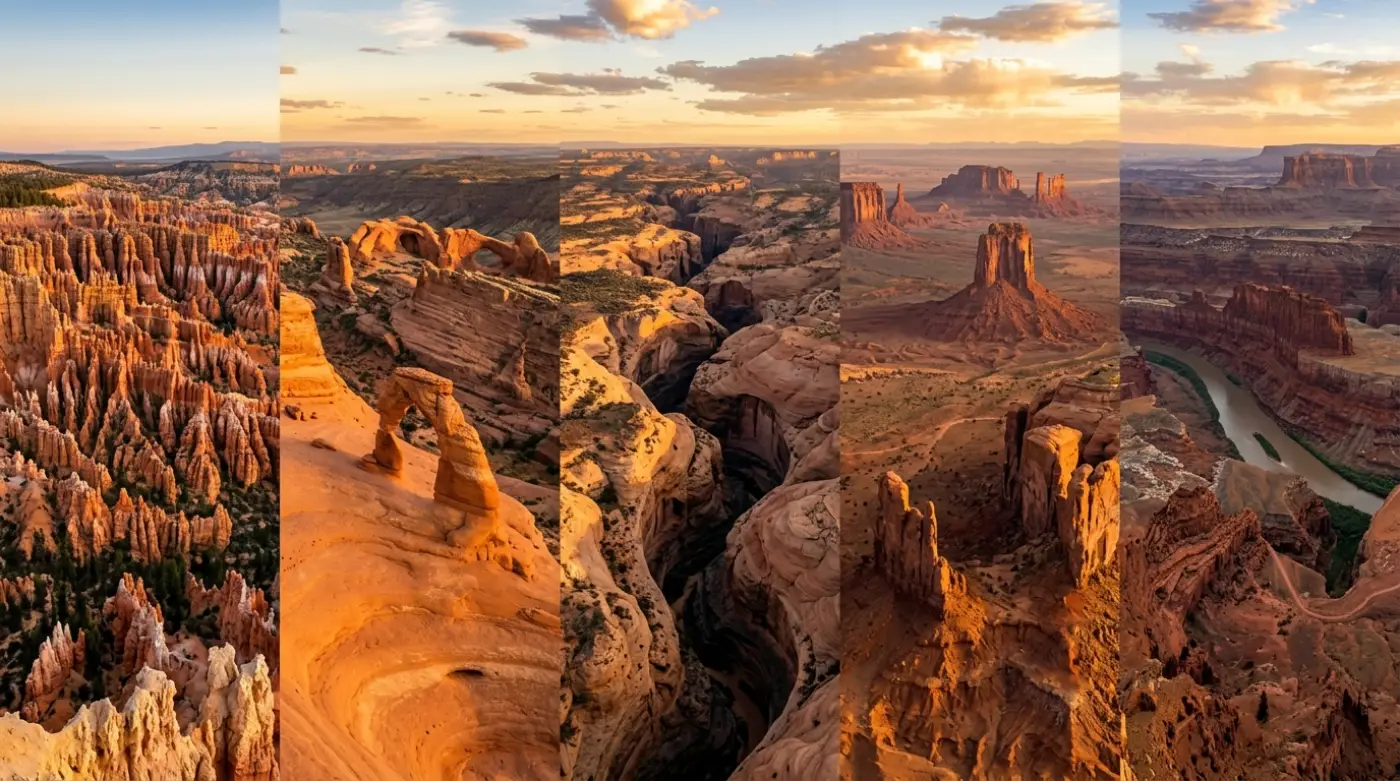
Utah's Mighty Five—Arches, Canyonlands, Capitol Reef, Bryce Canyon, and Zion—attract over 16 million combined visitors annually. The vast majority experience each park from the same paved routes, the same shuttle stops, the same crowded viewpoints. That version of the Mighty Five is real and worth doing. It's also roughly 40 percent of what these parks actually contain.
This guide covers the Mighty Five Utah loop the way a Jeep driver should approach it: park by park, with honest breakdowns of what the paved routes deliver, what 4x4 access unlocks, and how proper vehicle selection changes the experience at each stop.
The Mighty Five Utah: Park by Park Jeep Breakdown
1. Arches National Park
Arches sits five miles north of Moab along US-191, making it the most conveniently positioned of the five parks and the easiest to integrate with Moab's extensive backcountry trail network. The park contains over 2,000 natural stone arches—more than anywhere else on Earth—concentrated into 76,679 acres of red rock terrain above the Colorado River canyon.
What the paved route delivers:
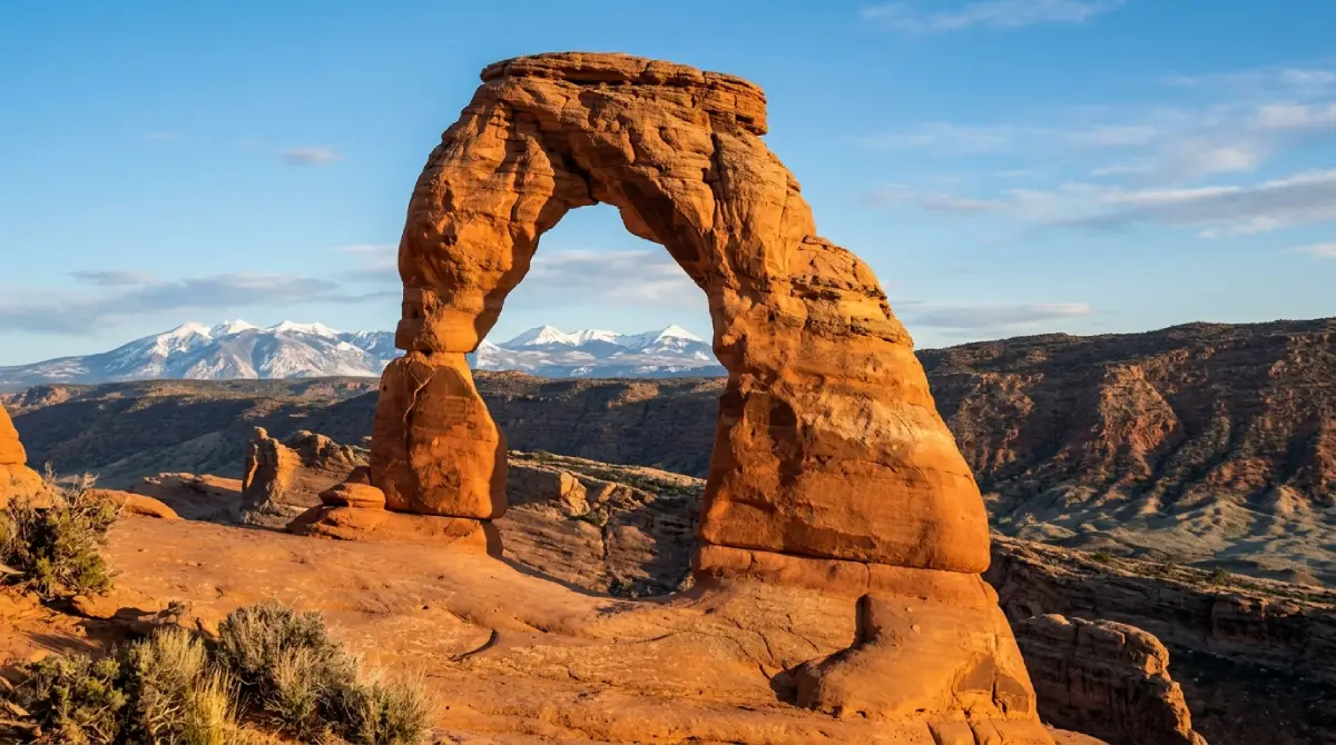
The 36-mile scenic drive from the entrance station covers the park's major formations with parking areas and short walking trails at each. Balanced Rock, the Windows Section, Double Arch, and the Delicate Arch trailhead all sit along this route. Delicate Arch itself—Utah's most photographed formation—requires a 3-mile roundtrip hike from the Wolfe Ranch trailhead with 480 feet of elevation gain across open slickrock. The paved route covers the park's most iconic sights efficiently.
What 4x4 access unlocks:
The Klondike Bluffs area in the park's northern section provides access to Tower Arch and a network of formations removed from the main corridor crowds. The approach involves maintained dirt roads where high clearance provides confidence that stock rental vehicles lack. Elephant Butte Road, Salt Valley Road, and the access routes to more remote arch clusters all favor high-clearance vehicles after weather events when surface conditions deteriorate.
Critical logistics:
Timed entry reservations required April through October. Book weeks or months in advance—summer weekend slots disappear immediately at the 3-month booking window opening.
Entrance fee: $35 per vehicle, 7-day pass.
America the Beautiful Annual Pass ($80) covers all five parks and pays for itself immediately on a Mighty Five trip.
Morning entry before 8 AM or late afternoon arrivals significantly reduce parking and trail congestion.
Moab connection:
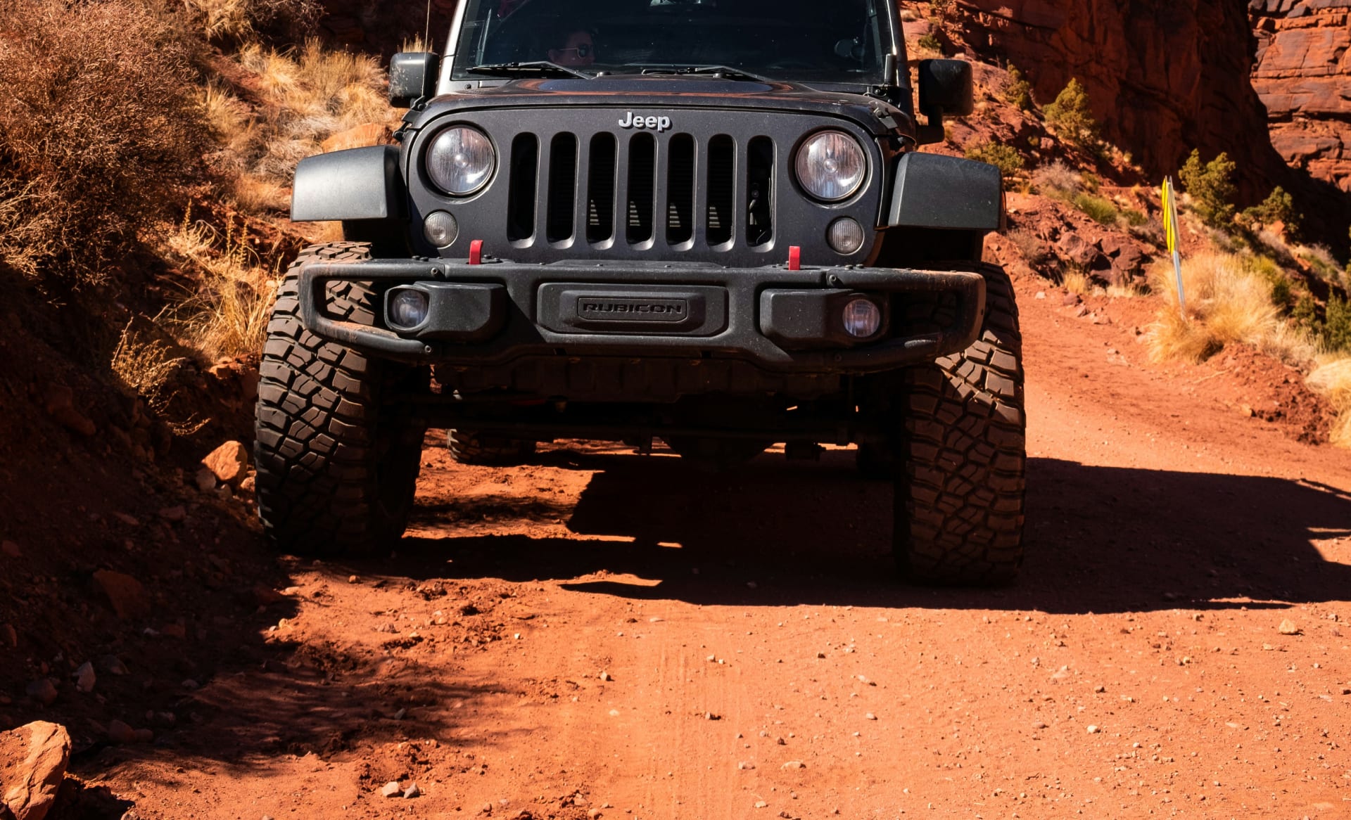
Arches' location adjacent to Moab makes a two-day combination logical—park entry and major formation coverage on day one, Moab's Sand Flats backcountry trails (Hell's Revenge, Fins and Things) on day two with a Cliffhanger Rubicon. The two experiences complement each other: Arches provides the geological context; the Sand Flats trails provide the inside-the-terrain perspective.
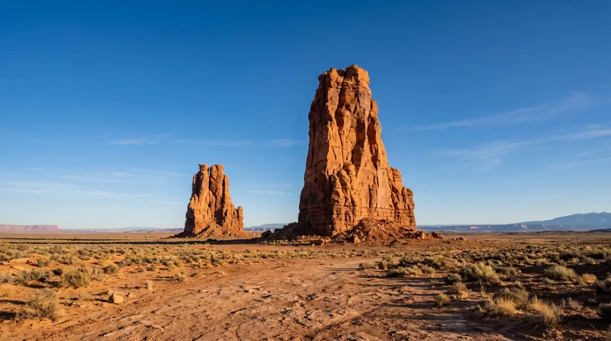
2. Canyonlands National Park
Canyonlands is the largest and least-visited of the Mighty Five—338,000 acres divided into four districts by the Colorado and Green rivers. Island in the Sky, The Needles, The Maze, and the rivers themselves each represent completely different terrain and access requirements. Most Mighty Five itineraries spend a half-day at the Island in the Sky overlooks and consider Canyonlands checked. This is the most significant undersell in the entire loop.
Island in the Sky — The Accessible District:
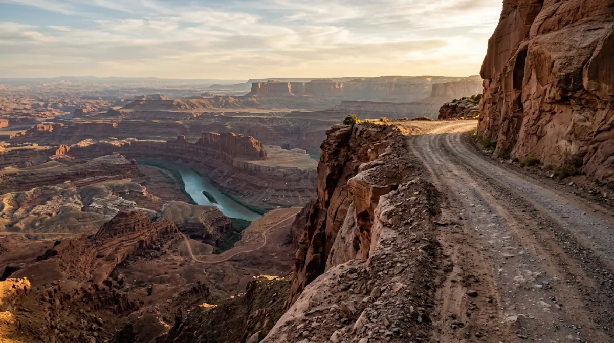
The mesa top district sits 30 miles northwest of Moab via Highway 313. The paved road delivers overlooks of genuinely staggering scale—Mesa Arch at sunrise, Grand View Point's 100-mile panorama, the White Rim Road visible 1,200 feet below. Dead Horse Point State Park sits adjacent on the same mesa access road, with views of the Colorado River's horseshoe bend that rival anything in the region. Any vehicle handles Island in the Sky's paved network.
White Rim Road — The 4x4 Centerpiece:
The 100-mile White Rim Road circles the Island in the Sky mesa on the canyon's second tier, between the mesa top and the river far below. This is Canyonlands' defining Jeep experience—a multi-day backcountry route with canyon walls in every direction, river meanders visible far below, and zero pavement for the entire circuit.
Typically driven as a 2–3 day overnight trip with camping at designated sites requiring advance permit reservation.
High-clearance 4WD with 4LO required throughout. Multiple sandy wash crossings and technical shelf road sections.
The combination of isolation, visual scale, and technical engagement makes this the most rewarding single route in the Mighty Five loop for properly equipped drivers.
The Needles District:
The Needles sits 75 miles south of Moab and receives dramatically fewer visitors than Island in the Sky despite containing equally impressive terrain—the sandstone spire formations that give the district its name, slot canyon access, and route networks reaching deep into the park's backcountry. Elephant Hill is the district's signature 4x4 route, rated 5–10 difficulty by park staff and requiring experienced high-clearance 4WD throughout.
The Maze:
The most remote district in the national park system's most remote corners. High-clearance 4WD with substantial backcountry experience required. The Maze is not a casual addition to a Mighty Five itinerary—it's a multi-day commitment that rewards the few who approach it properly.
3. Capitol Reef National Park
Capitol Reef is consistently called the most underrated park in the Mighty Five, and the reason is straightforward: the portions most visitors see from the highway and paved scenic drive, while genuinely beautiful, represent a fraction of what the park contains. The Waterpocket Fold—a 100-mile wrinkle in the Earth's crust exposing layers of Navajo, Entrada, and Chinle sandstone—runs the park's entire length. Most of it is accessible only by high-clearance 4WD or foot.
What the paved route delivers:
Highway 24 crosses the park east-to-west through the Fremont River canyon with no entrance fee. The paved Capitol Reef Scenic Drive south from the visitor center covers 16 miles of canyon terrain through the Waterpocket Fold with fee required ($20, 7-day). The historic Fruita district, with pioneer-era fruit orchards still producing—visitors can pick fruit in season—sits at the confluence of the Fremont River and the scenic drive. Petroglyphs from the Fremont Culture dating back 1,000 years are visible from Highway 24.
Cathedral Valley — The 4x4 Highlight:
The park's remote northern district contains the Temple of the Sun and Temple of the Moon—isolated sandstone monoliths rising 500 feet from a flat desert valley floor with no other structures visible in any direction. The 60-mile Cathedral Valley loop requires a high-clearance 4WD vehicle and crosses the Fremont River (water level should be checked before attempting). The isolation and visual scale of these formations make them among the most photographed—and least visited—landscapes in the Mighty Five.
Capitol Gorge and Grand Wash:
The unpaved Capitol Gorge Road at the scenic drive's southern end provides access to the Pioneer Register—a sandstone wall where 19th-century settlers inscribed their names—via a short canyon walk. Grand Wash cuts through the Waterpocket Fold with canyon walls narrowing dramatically. Both reward high-clearance vehicles over the standard rental vehicles that technically manage the surface but do so with constant ground clearance concern.
Scenic Byway 12 connection:
Capitol Reef sits on the east end of Scenic Byway 12, the 124-mile paved route connecting it to Bryce Canyon that ranks consistently among North America's most scenic paved drives. The town of Torrey, adjacent to the park's western boundary, serves as the standard overnight base with reliable services before the Byway 12 corridor.
4. Bryce Canyon National Park
Bryce Canyon is the most visually distinctive park in the Mighty Five—its concentration of hoodoos (tall thin rock spires formed by freeze-thaw erosion) in the Pink Cliffs amphitheater creates a landscape that resembles nothing else in the natural world. The park receives over 2.5 million visitors annually, making timing and early arrival more important here than anywhere else in the loop.
What the paved route delivers:
The 18-mile Bryce Canyon Scenic Drive covers the park's full amphitheater from Fairyland Point to Rainbow Point at 9,115 feet elevation. Multiple overlooks along the rim deliver the hoodoo views the park is famous for—Bryce Point, Inspiration Point, Sunset Point, and Sunrise Point all provide different angles on the main amphitheater. Bryce Canyon's paved experience is among the most rewarding in the Mighty Five because the primary attraction (the hoodoo formations) is fully visible from the rim.
Below the rim:
The Navajo Loop and Queen's Garden trails descend into the amphitheater for the inside-the-formation perspective the overlooks can't deliver. These are accessible to most moderately fit visitors but involve significant elevation change—plan accordingly for the climb back out. The combination of Navajo Loop and Queen's Garden as a connecting trail makes a 2.9-mile loop that covers the amphitheater's most dramatic terrain.
Stargazing:
Bryce Canyon holds an International Dark Sky Park designation—at 8,000–9,000 feet elevation with minimal light pollution for miles in every direction, it delivers some of the best night sky visibility in the American West. The park hosts annual Astronomy Festival events. For Mighty Five itineraries with flexibility, a night in the park specifically for stargazing justifies the schedule adjustment.
4x4 considerations:
Bryce Canyon's primary appeal is accessible from the paved rim drive and maintained trails. The park does not have a significant 4x4 backcountry network comparable to Canyonlands or Capitol Reef. High-clearance vehicles provide confidence on the approach road during shoulder season when weather creates surface conditions, but the paved experience here delivers the park's main offerings without backcountry access.
5. Zion National Park
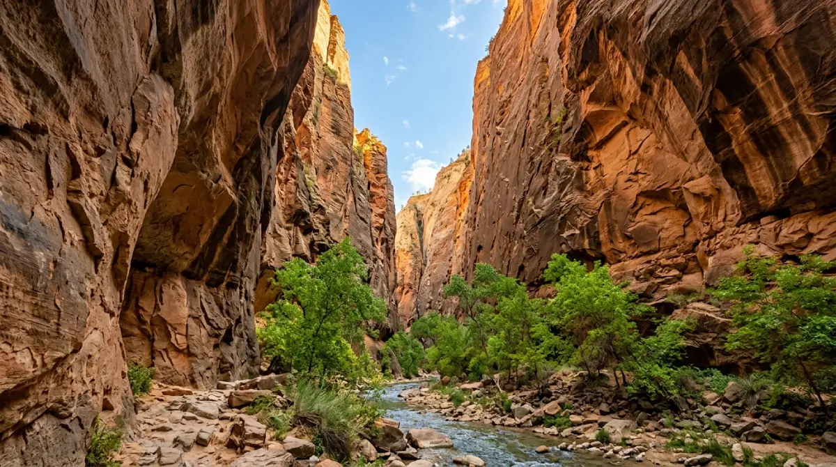
Zion is the most visited park in Utah and the most logistically complex to navigate—the Zion Canyon Scenic Drive is closed to private vehicles from early March through November, requiring the park shuttle system for all canyon access during those months. Planning around this shuttle reality fundamentally shapes the Zion experience.
What the paved and shuttle route delivers:
The 6.5-mile Zion Canyon Scenic Drive follows the Virgin River through the canyon with stops at every major trailhead. The Narrows—a slot canyon hike through the Virgin River between 2,000-foot sandstone walls—begins at the Riverside Walk from the last shuttle stop. Angel's Landing's chain-assisted summit route above the canyon requires a permit lottery. The canyon itself, viewed from below with walls rising 1,500–2,500 feet on both sides, justifies the park's popularity completely.
Zion-Mount Carmel Highway:
The paved Highway 9 crossing the park east-to-west via the Zion-Mount Carmel Tunnel provides one of the most dramatic driving experiences accessible to any vehicle in the Mighty Five. The tunnel emerges onto the Checkerboard Mesa slickrock plateau with immediate and complete change from canyon bottom to open plateau terrain. Oversized vehicles require ranger escort through the tunnel with a fee and advance arrangement.
Kolob Canyons:
The park's northwestern district—accessed from a separate entrance off I-15—offers significant canyon scenery with dramatically fewer visitors than the main Zion Canyon corridor. The 5-mile Kolob Canyons Road provides access without the shuttle system requirement. High-clearance vehicles handle the area's dirt road access points with more confidence after rain.
Shuttle and timing reality:
Shuttles run from early March through November. Arriving before the first shuttle (typically 6 AM) allows private vehicle access to the canyon road—most visitors don't know this.
The Springdale gateway town directly outside the main entrance provides lodging, restaurants, and gear. Reservations months in advance for spring and fall peak seasons.
Zion represents the western endpoint of the standard Mighty Five loop from Moab. Visitors flying in through Las Vegas commonly reverse the route—Zion first, Arches and Canyonlands last.
Vehicle Reality Across the Mighty Five Loop
The Mighty Five loop in a standard rental car is doable and delivers the parks' paved experiences completely. The honest assessment of what that leaves out:
White Rim Road: completely inaccessible
Cathedral Valley: inaccessible or white-knuckle with constant clearance concern
Elephant Hill (Needles): inaccessible for most stock vehicles
Klondike Bluffs (Arches): possible but limited after weather
Moab's backcountry trails: prohibited by virtually every standard rental agreement
Most Mighty Five itineraries spend 7–10 days covering the five parks. Adding a Cliffhanger Rubicon for the Moab and Canyonlands portion transforms the loop's most technically accessible section—the eastern parks—into the complete experience those parks actually contain.
Cliffhanger's Moab location for the eastern loop:
Moab serves as the natural base for Arches and Canyonlands, with Vernal accessible for northeastern Utah access. Starting the Mighty Five loop from Moab with a Cliffhanger rental—covering Hell's Revenge or Fins and Things on arrival day, Arches the following morning, White Rim Road or Canyonlands backcountry on day three—delivers the full version of Utah's eastern canyon country before heading west toward Capitol Reef, Bryce, and Zion.
Vehicle specifics:
Modified Jeep Rubicons: 2.5-inch lift, 35-inch tires, full skid plate protection, 4LO capability
Extreme Rubicons: 3.5-inch lift, 39-inch tires for the most demanding terrain including Elephant Hill
No rental restrictions on unpaved roads—White Rim Road, Cathedral Valley, and Klondike Bluffs all permitted
Local staff provide current conditions and realistic capability assessments before departure
Practical Mighty Five Utah Planning
Route direction:
The standard east-to-west route (Arches → Canyonlands → Capitol Reef → Bryce → Zion) works logistically from Moab or Salt Lake City. West-to-east works from Las Vegas. Neither direction is significantly more efficient—choose based on arrival city.
Minimum time:
Seven days covers all five parks with one to two days each. Ten days allows proper time in Canyonlands' backcountry without rushing the western parks. Two weeks enables the full loop including Capitol Reef's Cathedral Valley and multi-day White Rim Road without compromising any single park.
America the Beautiful Pass:
At $80 annually, the pass covers entrance fees for all five parks and pays for itself within the first two park entries. Buy it at the first entrance station or online before departure.
Seasonal timing:
Spring (March–May) and fall (September–October) deliver the best combination of temperature, trail conditions, and manageable crowds. Summer heat in Arches and Canyonlands exceeds 100°F regularly—morning starts before 7 AM are effectively mandatory June through August. Bryce Canyon's high elevation keeps it significantly cooler. Zion's canyon bottom stays shaded but humid in summer.
Cell service and navigation:
Service disappears consistently outside of Moab, Torrey, Bryce, and Springdale. Download offline maps via Gaia GPS or Google before entering Capitol Reef or Canyonlands specifically. White Rim Road and Cathedral Valley have zero coverage throughout.
The Mighty Five Utah Trip Done Completely
The Mighty Five Utah loop is one of the great American road trips regardless of what vehicle you drive. Five national parks, each with distinct terrain and character, connected by some of the most scenic paved highway in the country. That version of the trip is real and delivers exactly what its reputation promises.
The Jeep version delivers something the standard loop doesn't touch: the White Rim Road at dawn with canyon walls dropping 2,000 feet in every direction, Cathedral Valley's monoliths standing alone in a desert valley that sees a fraction of the visitors the main park corridor does, the Sand Flats trail network that puts Moab's slickrock terrain under your wheels rather than behind a guardrail. These aren't minor additions to the Mighty Five itinerary—they're the parts that make the trip worth doing again.
Cliffhanger Jeep Rentals in Moab and Vernal provides the vehicles the complete Mighty Five experience requires. No rental restrictions, longest days in town, local staff who know current conditions for every route in the loop.
Ready to run the Mighty Five Utah the way it's supposed to be driven? Contact Cliffhanger Jeep Rentals and let's build the itinerary around what these parks actually offer.