difference between its two access routes—one being a maintained graded road suitable for careful 2WD sedans in dry conditions, the other being a steep, rocky, single-lane shelf road that climbs 800+ vertical feet with exposure that makes passengers question their life choices—and the sobering memorial plaque honoring Beau James Daley, the 19-year-old who died in 1999 when his Jeep rolled 160 feet off one of the bridges during an attempted crossing.
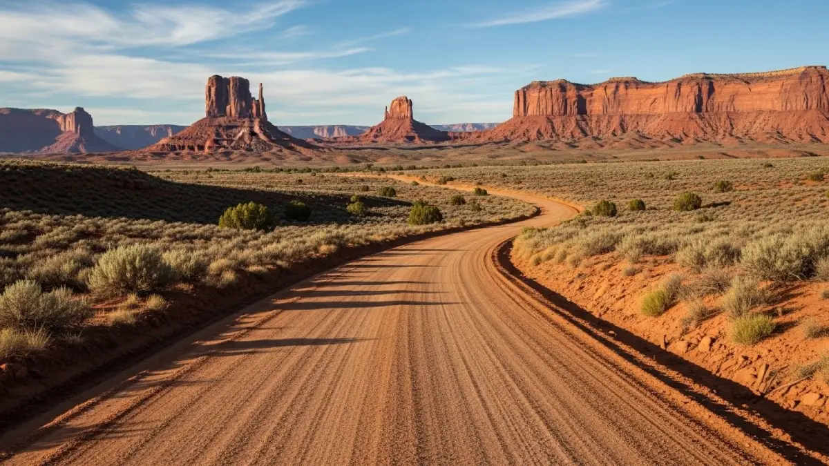
Gemini Bridges isn't just "another beginner 4x4 trail near Moab." It's two distinct experiences sharing the same destination—twin natural sandstone bridges where you view these spectacular formations from above rather than below, unlike virtually every other arch experience in Moab. The confusion stems from calling both routes "Gemini Bridges Trail" when the accessibility, technical demands, and vehicle requirements differ completely depending on which highway you start from.
The marketing creates dangerous expectations: tourists read "beginner-friendly" online reviews from people who drove the easy Highway 313 approach, then confidently attempt the technical Highway 191 shelf road in rental SUVs lacking the clearance, capability, and driver confidence this route demands. The difference between experiencing Gemini Bridges via the easy maintained access versus the challenging technical climb fundamentally depends on honest vehicle assessment and route selection matching your actual capability.
Understanding Gemini Bridges' Two Distinct Approaches
The confusion about Gemini Bridges stems from treating it as a single experience when it's actually two completely different routes converging at the same spectacular geological feature approximately 7 miles from either starting point.
Gemini Bridges: The Easy Highway 313 Approach (5 Miles of Graded Road)
Starting from Highway 313—the paved road leading to Canyonlands National Park's Island in the Sky district and Dead Horse Point State Park—the Gemini Bridges approach provides legitimate accessibility that surprises people expecting typical Moab technical challenges.
Highway 313 approach characteristics:
In dry conditions, standard sedans, crossover SUVs, and even cautious minivans navigate this 5-mile graded dirt road successfully. The road receives regular maintenance from BLM (Bureau of Land Management) and handles moderate traffic from tourists combining Canyonlands visits with Gemini Bridges stops.
The route descends gradually from Highway 313's 6,000+ foot elevation toward the bridges at approximately 5,100 feet. No steep climbs, no white-knuckle shelf roads, no technical obstacles requiring line selection. It's genuinely a "scenic dirt road" rather than off-road challenge.
Unlike the Highway 191 approach, this route doesn't feature sustained single-lane shelf road sections with sheer drop-offs. It's wide enough for opposing traffic to pass comfortably in most sections.
The signed dirt road turnoff appears 12.8 miles west of the Highway 313/US 191 junction, approximately 0.9 miles west of the Mineral Bottom turnoff. Clear signage prevents missing it.
Tourists accessing via Highway 313 should exit the same direction. Continuing toward Highway 191 commits you to the technical descent described below—a completely different experience requiring completely different vehicle capability.
The key phrase is "dry conditions." Recent rain transforms this easy road into slick mud that strands 2WD vehicles. Afternoon thunderstorms in summer create flash flood risk in low areas. Winter snow and ice eliminate 2WD access completely.
This explains why some online reviews describe Gemini Bridges as "easy beginner trail suitable for any vehicle"—they approached via Highway 313, experienced a maintained graded road, and accurately reported their specific experience without mentioning the dramatically different alternative route.
Gemini Bridges: The Technical Highway 191 Approach (7.5 Miles of Challenging Terrain)
Starting from Highway 191 approximately 9.8 miles north of Moab's center (1.2 miles before the Highway 313 junction), the Gemini Bridges approach transforms completely. What was accessible becomes technical. What was graded becomes rocky. What was wide becomes narrow with genuine consequence for mistakes.
Highway 191 approach characteristics:
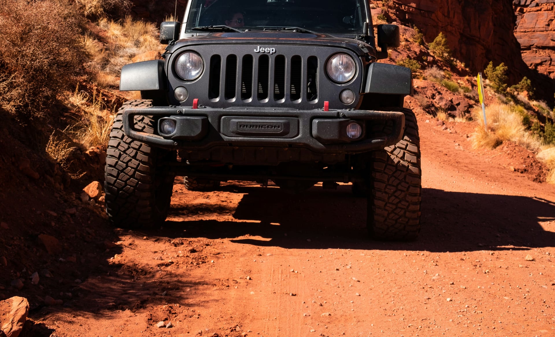
The first mile climbs steeply via embedded rock gardens, high centers that scrape undercarriages, and sections where careful line selection prevents damage. Stock rental SUVs with 8-9 inches clearance constantly bottom out. This isn't opinion—it's mechanical reality.
The climb includes sustained exposure on narrow shelf road carved into canyon walls. The outside edge drops hundreds of feet with minimal margin for error. Meeting opposing traffic (common on weekends) requires one vehicle to carefully back up to the nearest wide spot—which might be 200+ yards distant.
Multiple sections feature loose sand that bogs down vehicles lacking momentum, proper tire pressure, or 4WD engagement. The halfway point includes particularly deep sand that challenges even capable vehicles.
The route gains approximately 800 vertical feet from Highway 191 to the bridges. This isn't gradual—it's sustained technical ascent requiring low-range gearing (4LO) for control and engine braking on descents.
Mountain bikers love the Gemini Bridges descent as part of the Magnificent 7 (Mag 7) trail system. Motorcycles, ATVs, UTVs, full-size 4x4s, and oil/mining service trucks all use this route. Slow down to minimize dust when passing cyclists. Watch carefully around blind corners.
Unlike the regularly maintained Highway 313 approach, this route deteriorates after storms and receives minimal maintenance. Recent rain creates mud. Dry conditions create choking dust. Strong winds on exposed sections create crosswind concerns.
The technical demands explain why experienced off-roaders rate this approach "moderate" or even "difficult"—they're describing the Highway 191 side, not the Highway 313 side. One rider with a stock 2019 Jeep Wrangler Sport reported the Highway 191 approach was "too rough for my wife" despite running Long Canyon Trail comfortably in the same vehicle. Another with a Toyota Sequoia admitted "I was afraid of damaging my vehicle the entire time."
The Bridges Themselves: Why This Destination Justifies the Approach
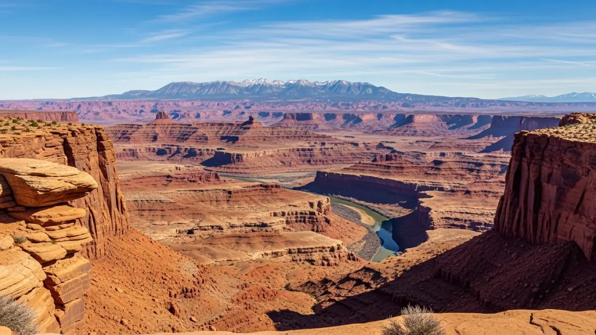
After navigating either route, you reach a parking area approximately 7 miles from your starting highway. A short 0.4-mile roundtrip hike (roughly 300-400 yards) leads to the Gemini Bridges overlook—and this is where the experience becomes uniquely Moab.
What makes Gemini Bridges different:
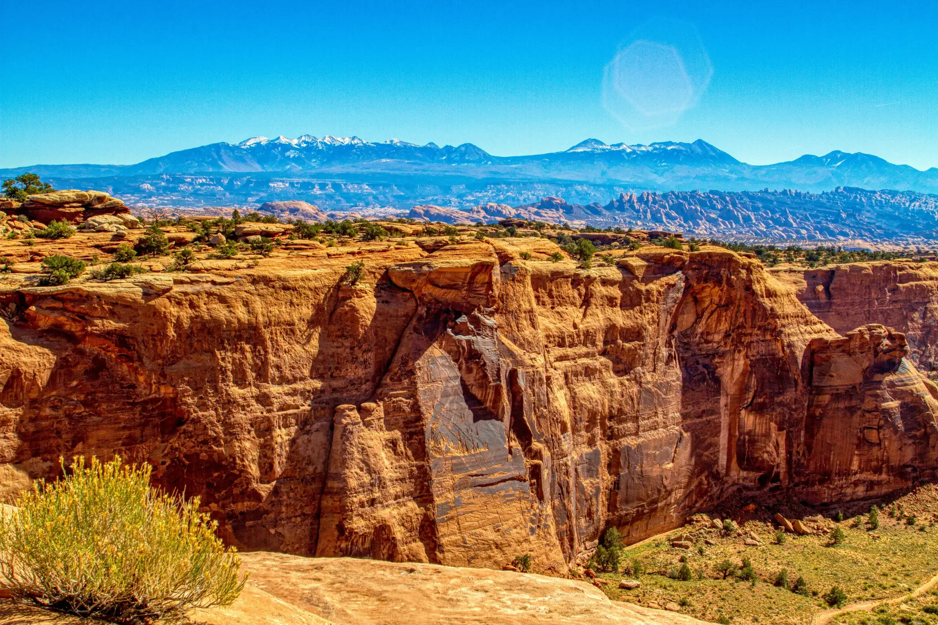
Two sandstone arch formations sit side-by-side, spanning a section of Bull Canyon's rim. Each bridge measures roughly 80-100 feet wide with drops exceeding 160 feet to the canyon floor below. They're not as massive as Corona Arch or Delicate Arch, but the perspective from above creates drama impossible at ground-level arches.
Unlike virtually every other Moab arch experience (Delicate Arch, Corona Arch, Mesa Arch, all Arches National Park formations), you view Gemini Bridges from above rather than below. You're standing on the canyon rim looking down at these natural spans with Bull Canyon's depths visible through the openings.
Both bridges are accessible for walking—though this creates the dangerous temptation that killed at least three people. The bridges are flat-topped and feel stable, but the gaps between them range from 6-10 feet with 160-foot drops below. Multiple people have attempted jumping between bridges. At least two fell to their deaths.
A plaque commemorates the 19-year-old who died when his Jeep rolled off the outer bridge span in 1999. The memorial reads that he "died doing what he loved most"—though as one observer noted, at 19 years old, he likely hadn't experienced enough of life to know if this truly was what he loved most.
Beyond the bridges themselves, the overlook provides dramatic views into Bull Canyon with its colorful layered sandstone walls. The La Sal Mountains dominate the eastern skyline. Moab Valley spreads below to the south.
The short hike from parking follows green paint marks on slickrock. In some areas, the correct path isn't obvious without these markers. The terrain is relatively flat but includes some minor scrambling over rock features.
No restrooms, no water, no services of any kind. What you bring is what you have. Summer heat intensifies quickly on this exposed slickrock with zero shade. Spring and fall provide optimal conditions. Winter ice makes the painted rock surfaces dangerously slippery.
The bridges justify the effort—but only when approached via route matching your vehicle capability. Experiencing spectacular geology isn't worth vehicle damage, expensive recovery, or worse.
The Memorial Plaques and Deadly History
Gemini Bridges' accessibility—particularly how easy the formations feel to walk on—creates false confidence about safety margins. The consequences of that false confidence appear in multiple memorial plaques and documented deaths.
Documented fatalities:
At least two people have died attempting to jump the 6-10 foot gap between the twin bridges. What looks manageable from the approach becomes frightening when you're standing at the edge staring down 160+ feet. The landing surface on the opposite bridge isn't level, and missing means falling into the canyon.
Beau James Daley was 19 years old when his Jeep rolled off the outer bridge span while attempting to drive across it. He fell 160 feet. The accident ended any practice of driving onto the bridges—you can no longer access them by vehicle, only on foot.
At least one memorial references an ATV accident. The combination of slickrock surfaces, speed, and proximity to deadly drops creates ongoing risk for motorized recreation.
The safety warnings that don't exist:
The bridges and overlook have zero protective barriers. Parents with small children need constant vigilance. The BLM posted signs warn "Don't let kids play around the Bridges; a fall here would be certain death"—but signs are minimal and easily ignored by excited visitors.
While the deaths are documented and plaques exist, there are no clear signs prohibiting jumping attempts. The 6-foot gap looks tempting to athletic young men who routinely underestimate consequences.
The painted slickrock trail becomes ice rink when wet or frozen. Morning frost in spring/fall creates slippery conditions invisible to visitors accustomed to grippy dry sandstone. Afternoon thunderstorms create lightning risk with zero shelter available.
The bridges themselves aren't inherently dangerous—it's the combination of spectacular views, flat walkable surfaces, tempting gaps, and human overconfidence that creates the deadly pattern. Respect the exposure. Supervise children aggressively. Skip the athletic stunts. The geology is impressive enough without adding unnecessary risk.
Mountain Bike Integration and Multi-Use Challenges
Gemini Bridges plays a crucial role in Moab's mountain bike infrastructure—specifically as part of the Magnificent 7 (Mag 7) trail system that includes 61 miles of interconnected singletrack and jeep roads. This creates traffic conflicts vehicle drivers must understand.
Mountain bike usage patterns:
Many mountain bikers start at Highway 313, ride various combinations of Mag 7 singletrack trails, then descend Gemini Bridges road back to Highway 191 as their exit route. This means heavy bike traffic flowing downhill on the same narrow shelf road where 4x4s are climbing uphill.
The Gemini Bridges route intersects with Gold Bar Rim Trail, Bull Canyon Trail, Four Arches Trail, and multiple other mountain bike routes. Expect bikes suddenly emerging from side trails you didn't know existed.
Mountain bikes descending at 15-25 mph around blind corners meet 4x4s climbing at 3-5 mph. Neither can see the other approaching. Dust clouds from vehicle traffic obscure visibility for everyone.
Drive slowly enough to minimize dust, especially when you see cyclists ahead. Give bikes plenty of space when passing—many riders are exhausted from long Mag 7 loops and don't have full control. Use horn before blind corners to announce presence.
Saturday and Sunday bring peak traffic from both vehicles and bikes. Weekday visits reduce conflicts significantly but don't eliminate them—serious mountain bikers ride mid-week to avoid crowds.
Engine noise prevents hearing approaching bikes. Dust clouds prevent seeing them. Radio communication doesn't exist between vehicles and bikes. The system relies on everyone driving/riding cautiously and assuming traffic around every blind corner.
The multi-use designation makes Gemini Bridges trail accessible to more recreationists but creates genuine safety concerns absent on vehicle-only routes like Hell's Revenge or Poison Spider Mesa. Factor this into your route decision—if dealing with mountain bike traffic on narrow exposed shelf roads sounds stressful, choose the Highway 313 approach or skip Gemini Bridges entirely for other Moab trails.
The Vehicle Capability Gap That Strands Tourists
The progression from "easy beginner trail" marketing to technical Highway 191 reality creates the vehicle requirement gap that generates those search-and-rescue statistics and expensive recovery costs common throughout Moab's backcountry.
Why rental SUVs fail on the Highway 191 approach:
Rental crossovers typically provide 8-9 inches clearance. The Highway 191 route includes high centers and embedded rock requiring 11+ inches for confident navigation. That 2-3 inch gap means constant undercarriage contact, slow speeds scraping over obstacles, and genuine risk of cracking oil pans or damaging exhaust systems.
Most major rental companies explicitly prohibit off-pavement driving. Their insurance doesn't cover damage from unpaved roads. That cracked oil pan becomes your financial responsibility regardless of what "4WD" badges appear on the vehicle.
Stock vehicles have bumpers designed for aesthetics, not clearance. The steep sections of Highway 191 approach create front and rear contact that damages plastic bumper covers, drags exhaust systems, and tears off decorative elements.
Highway all-season tires provide minimal grip in deep sand sections that bog down vehicles. Sidewalls puncture easily on sharp sandstone edges. The combination creates both traction problems and flat tire risk miles from help.
Many crossover SUVs offer "4WD" or "AWD" but lack true low-range gearing (4LO). The steep climbs and descents on Highway 191 approach need the control and engine braking that 4LO provides. "4WD AUTO" modes don't substitute.
Oil pans, transmission cases, transfer cases, and fuel tanks hang vulnerable on stock vehicles. One solid contact can crack an oil pan, and the subsequent oil leak strands you 7 miles from Highway 191 with zero cell service.
Tourists unfamiliar with off-road driving attempt Gemini Bridges because online reviews called it "beginner-friendly." They lack skills for reading terrain, selecting proper lines, managing momentum in sand, or backing up on narrow shelf roads. The combination of inadequate vehicle and inexperienced driver creates the incidents that occupy Moab search-and-rescue teams.
The reviews stating "I did Gemini Bridges in my Toyota Sequoia / 4Runner / rental Jeep" prove it's technically possible—but those same reviews often include admissions like "I was afraid of damaging my vehicle the entire time" or "it was too rough for my wife." Technical possibility doesn't equal confident enjoyment. The question isn't "can my vehicle physically make it?" but rather "will I enjoy the experience or spend 7 miles stressed about damage and capability?"
Cliffhanger Modified Rubicons: Built for Gemini Bridges' Technical Route
Our modified Jeeps eliminate the capability gap between tourist optimism and Highway 191 reality:
11.5-13+ inches ground clearance depending on model. High centers that scrape rental SUVs become normal obstacles our vehicles clear confidently. Embedded rock gardens that require careful line selection in stock vehicles become minor bumps.
Larger diameter for obstacle clearance, reinforced sidewalls for puncture resistance, aggressive tread for sand and rock traction. We run appropriate air pressures for conditions—aired down for sand sections, higher for rock gardens.
Heavy-duty steel covers protecting oil pan, transmission, transfer case, and gas tank. Contact with obstacles becomes normal driving rather than damage events that generate expensive recovery costs.
Low-range gearing provides the control that Highway 191's steep sections demand. Engine braking on descents, precise crawling over obstacles, and momentum management in sand all require genuine 4LO—not just "4WD" badges.
Approach and departure angles designed for clearance rather than aesthetics. Steep sections that drag plastic bumper covers on stock vehicles clear properly on Cliffhanger rigs.
Tow straps, shackles, and proper recovery points. When you encounter stuck vehicles (common on weekends), or when sand sections prove more challenging than expected, proper gear becomes essential.
The mechanical capability gap isn't subtle. It's the difference between constant worry about damage versus confident driving, between "will I make it?" versus "which line looks more fun?", between expensive mistakes versus normal use of vehicles designed specifically for Moab's terrain.
Planning Your Gemini Bridges Experience
Successful Gemini Bridges visits start with honest route selection matching your actual vehicle capability, not optimistic assumptions about what your rental SUV might handle.
For the Easy Highway 313 Approach (Most Visitors):
Start from Canyonlands or Dead Horse Point
Combine Gemini Bridges with national park visits. After exploring Canyonlands' Island in the Sky district or Dead Horse Point State Park, exit via Highway 313 and watch for the signed Gemini Bridges turnoff 12.8 miles east of Canyonlands' entrance.
Check recent weather. If rain fell within past 24-48 hours, skip this approach—the road becomes impassable mud trap for 2WD vehicles. Summer afternoon thunderstorms create flash flood risk in low areas.
5 miles in, short hike to bridges, time at overlook, 5 miles out. Slower in larger vehicles or if you stop frequently for photos.
Do NOT continue toward Highway 191 unless you possess high-clearance 4WD and confidence for technical driving. The assumption that "it's all one trail, so I'll loop back" strands tourists weekly. Return the way you came.
Bring water, snacks, sun protection. Cell service disappears quickly. No restrooms at trailhead.
For the Technical Highway 191 Approach (Experienced Off-Roaders Only):
11+ inches ground clearance minimum. True 4WD with low-range gearing (4LO). Aggressive tires with good tread. Skid plate protection. If you're questioning whether your vehicle qualifies, it doesn't.
Most rental companies prohibit off-pavement driving. Verify your agreement explicitly allows unpaved road travel. Understand that damage becomes your financial responsibility.
Begin by 7-8 AM to avoid midday heat and afternoon thunderstorms. Early starts also reduce traffic conflicts with mountain bikers who typically shuttle mid-morning.
7.5 miles of technical climbing, stops for photos and to let opposing traffic pass, time at bridges, 7.5 miles return. This isn't casual sightseeing—it's committed technical driving.
Mountain bikers descend at speed around blind corners. Drive slowly, minimize dust, give space when passing. Use horn before blind corners to announce presence.
Extra water (1 gallon per person), emergency food, first aid kit, flashlight, warm layer, basic tools. Cell service is nonexistent throughout. If you break down or get stuck, self-recovery or waiting for other traffic are your only options.
Most drivers prefer descending toward Highway 191 (starting from Highway 313 side) rather than climbing from Highway 191. Descending provides better sightlines and feels psychologically easier despite similar technical demands. However, climbing from Highway 191 provides graduated difficulty increase and exits you at Canyonlands for continued exploration.
The Cliffhanger Advantage for Gemini Bridges Adventures
Gemini Bridges from either direction represents exactly what proper vehicle selection enables—the accessible Highway 313 approach works in virtually any vehicle during dry conditions, but the spectacular technical Highway 191 approach rewards preparation with terrain that demands capability.
Cliffhanger Jeep Rentals positions you perfectly for Gemini Bridges exploration with vehicles genuinely built for the Highway 191 technical route:
Our rigs handle the steep shelf road sections, embedded rock gardens, and deep sand with confidence because they're designed specifically for Moab terrain. High centers that challenge stock vehicles become normal obstacles.
Our staff provides current trail conditions, realistic difficulty ratings, and route recommendations based on your experience level. We won't tell you "it's easy" when it's not—we provide honest assessment that prevents those expensive mistakes.
Unlike major rental companies prohibiting unpaved road travel, our agreements acknowledge off-road use as intended purpose. Our vehicles are built for this, maintained for this, and insured appropriately.
When you encounter stuck vehicles (common on Highway 191 weekends), or when sand sections prove challenging, or when you need to help mountain bikers with mechanical problems, proper recovery equipment becomes essential—and our vehicles include it.
Access Gemini Bridges from our Moab location, then explore trails near our Silverton, Telluride, Durango, or Vernal locations on the same trip. Our geographic positioning enables genuine backcountry exploration beyond single-trail experiences.
The investment makes sense mathematically: our modified Rubicon daily rates deliver purpose-built vehicles versus stock rental SUVs costing similar amounts while explicitly prohibiting the driving you're planning. Factor recovery costs (averaging $1,847 per incident in Moab) and potential damage responsibility (thousands more for cracked oil pans, bent control arms, or torn-off bumpers), and proper equipment becomes obviously cost-effective.
Experience Both Sides of Gemini Bridges
Gemini Bridges represents Moab's accessibility spectrum compressed into single destination—accessible via easy maintained road for tourists prioritizing the geology over the journey, technical via challenging shelf road for drivers seeking legitimate off-road experience with spectacular payoff.
But experiencing the complete character confidently rather than anxiously requires honest vehicle capability assessment and route selection matching reality. The gap between what tourists hope their rental crossovers can handle versus what Highway 191's technical approach actually demands creates those consistent search-and-rescue statistics and expensive recovery costs.
Cliffhanger Jeep Rentals eliminates that gap. Our modified Rubicons handle Gemini Bridges' technical Highway 191 route confidently because they're designed specifically for exactly this combination of shelf road exposure, embedded obstacles, and deep sand challenges. Our Moab location positions you minutes from both Highway 191 and Highway 313 approaches with local staff providing current conditions information.
Ready to experience Gemini Bridges—from the easy Highway 313 approach perfect for combining with Canyonlands visits, or the technical Highway 191 shelf road climb that rewards capability with genuine off-road challenge—with proper equipment and the confidence that comes from vehicles actually built for Moab terrain? Contact Cliffhanger Jeep Rentals and discover why thousands of adventurers trust us for routes where preparation separates confident exploration from expensive mistakes.
The twin bridges, the canyon views, the exposed shelf roads—it's all waiting. But Gemini Bridges' complete character reveals itself only to those who approach with honest capability assessment and equipment genuinely matching the terrain demands.