What Every Colorado Road Trip Guide Gets Wrong
Here's what the curated Instagram itineraries and travel blog roundups consistently omit about a Colorado road trip: the most spectacular terrain in the state is inaccessible from pavement, the difference between a "scenic mountain drive" and a genuine backcountry adventure comes down entirely to vehicle capability, and treating Colorado's legendary 4x4 routes like optional add-ons means leaving the best parts of the state entirely unexperienced.
Colorado road trips aren't just drives between mountain towns. The state contains over 26 designated scenic byways, hundreds of miles of 4x4 trails connecting ghost towns and 13,000-foot passes, and a concentration of legitimate backcountry routes in the San Juan Mountains that rival anything on the continent. The difference between a good Colorado road trip and an unforgettable one isn't time or budget—it's what you're driving.
This itinerary covers the routes that actually justify the trip. Not the paved overlooks where everyone stops for the same photo, but the passes, loops, and shelf roads that require proper equipment and reward it with Colorado's most extreme scenery.
The Two Versions of a Colorado Road Trip
Before getting into specific routes, it's worth being direct about the distinction that defines every Colorado road trip decision.
The Paved Version
Colorado's highway network delivers genuinely impressive scenery. US-550 through the Million Dollar Highway between Ouray and Silverton, Highway 145 through Telluride, Trail Ridge Road through Rocky Mountain National Park—these routes are legitimately beautiful and accessible to any vehicle.
Paved route characteristics:
Consistent accessibility
Any rental car, RV, or standard vehicle handles these roads without concern. No ground clearance requirements, no 4WD needed, no technical driving demands.
Seasonal reliability
Most major paved mountain routes stay open spring through fall with predictable schedules. US-550 operates year-round with weather exceptions.
Crowded pullouts
The most famous viewpoints—Molas Pass, Dallas Divide, Red Mountain Pass—attract significant traffic. Arriving early or late matters.
Natural stopping point
Many travelers complete the paved San Juan Skyway loop (approximately 230 miles connecting Durango, Silverton, Ouray, Ridgway, Telluride, and Cortez) and consider Colorado done. This is a mistake.
The 4x4 Version
The moment you leave pavement in southwestern Colorado, the landscape changes completely. The shelf roads that originally connected mining camps, the high passes that top 13,000 feet, the ghost towns accessible only by high-clearance 4WD—this is the Colorado that justifies the trip.
4x4 route characteristics:
Vehicle requirements that matter
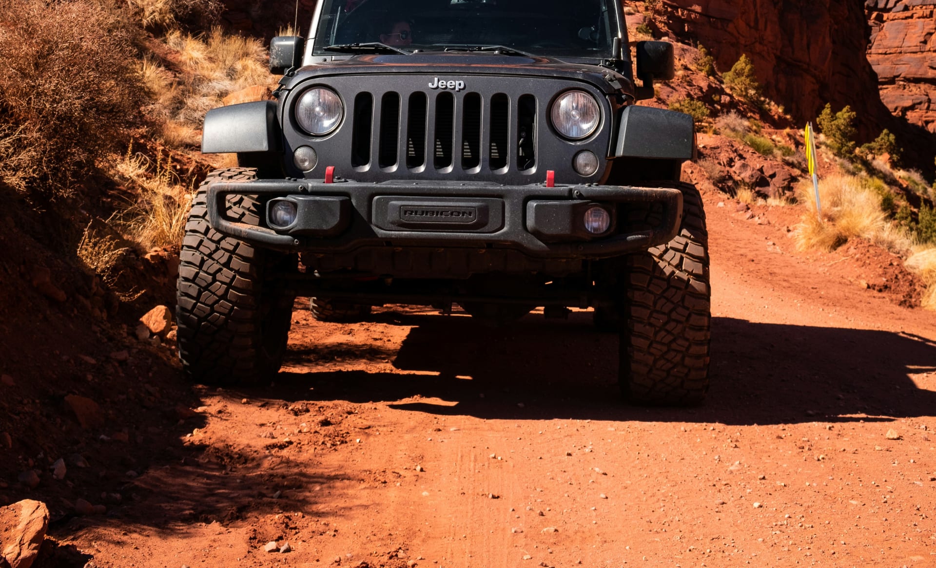
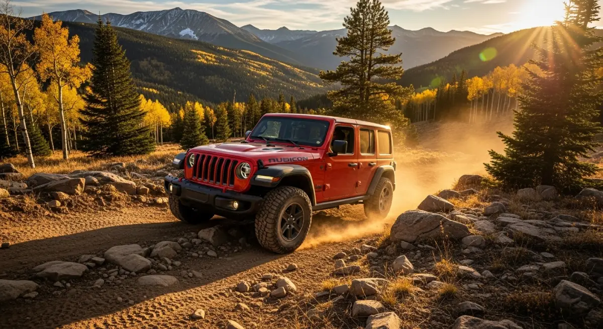
High-clearance 4WD with low-range gearing (4LO) is the practical minimum for Colorado's serious passes. Ground clearance of 10+ inches, aggressive tires with reinforced sidewalls, and underbody protection aren't optional on routes like Black Bear Pass or Imogene Pass.
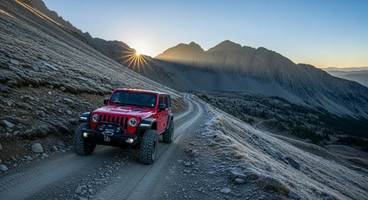
Conditions that change fast
Afternoon thunderstorms develop by 2 PM on most summer days above treeline. Morning starts matter—most experienced Colorado off-roaders aim to clear exposed high passes by noon.
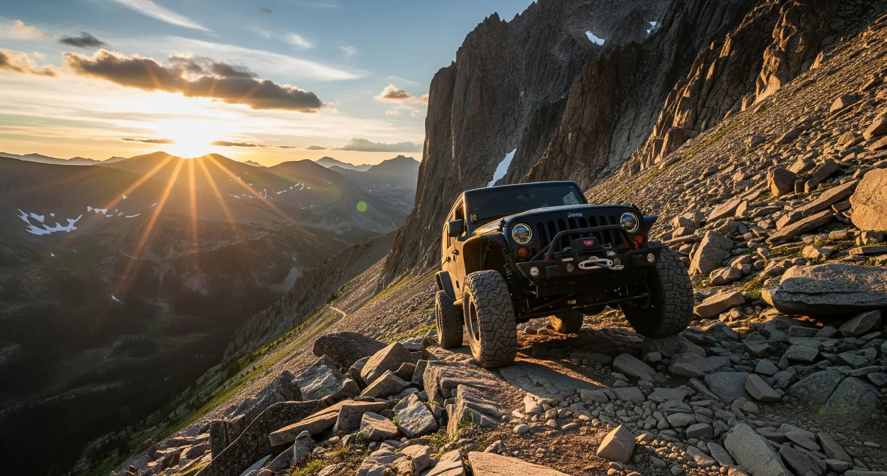
Terrain that earns the views
The reason the San Juan Mountain backcountry looks the way it does in photos is because getting there requires commitment. Shelf roads carved into near-vertical cliff faces, switchbacks that require backing to navigate, loose talus fields above treeline—the scenery correlates directly with the terrain demands.
The Core Routes Worth Building an Itinerary Around
The Alpine Loop — Ouray, Silverton, Lake City
The Alpine Loop is the centerpiece of any serious Colorado 4x4 road trip. This 63-mile backcountry byway connects Ouray, Silverton, and Lake City via Engineer Pass (12,800 feet) and Cinnamon Pass (12,620 feet), passing through some of the most intact 19th-century mining history in the American West.
What to expect:
Engineer Pass via the Ouray side delivers exposed shelf roads with sustained cliff exposure before the summit. The views from the top extend across the entire San Juan range in every direction.
Cinnamon Pass on the Lake City side is slightly less technical but no less dramatic—the descent into the Animas River drainage involves tight switchbacks with significant drop-offs.
Animas Forks ghost town sits at the junction of the two passes at 11,200 feet. Multiple original mining structures remain standing, including the Durant Mill and dozens of collapsed cabin sites. This is one of the most accessible and well-preserved ghost towns in Colorado.
The full loop typically requires 6–8 hours with stops. Budget a full day.
Vehicle requirement: High-clearance 4WD with 4LO capability. This is not a route for crossovers or stock SUVs with highway tires.
Black Bear Pass — Telluride
Black Bear Pass is Colorado's most notorious 4x4 route for one specific reason: the descent into Telluride. After reaching the 12,840-foot summit, the road drops 1,500 vertical feet through a series of switchbacks so tight that forward progress is impossible on several turns—the road requires backing toward the cliff edge to complete them.
What to expect:
The route runs one-way descending into Telluride from the summit. Ascending from Telluride is prohibited, making this a committed one-direction route that requires either a loop or shuttle logistics.
The upper switchbacks above Telluride feature the most technical driving in Colorado's mainstream 4x4 circuit. Single-lane shelf road, sheer drops, and blind corners require constant attention and appropriate vehicle width.
Bridal Veil Falls—Colorado's tallest free-falling waterfall at 365 feet—sits at the base of the pass. Most drivers take 30+ minutes at the falls before continuing into Telluride.
The views of the Telluride box canyon from the upper switchbacks are among the most dramatic in the state.
Vehicle requirement: High-clearance 4WD with 4LO essential. Wheel base matters—longer wheelbase vehicles struggle with the tightest switchbacks. Modified short-wheelbase Jeeps handle this route best. Not recommended for first-time backcountry drivers.
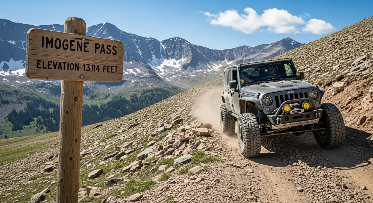
Imogene Pass — Ouray to Telluride
Imogene Pass (13,114 feet) connects Ouray and Telluride through the Uncompahgre National Forest and ranks among the highest driveable passes in Colorado. The route originally served as a supply road for the Camp Bird Mine, one of the most productive gold mines in Colorado history.
What to expect:
The Ouray side climbs through the Camp Bird Mine area with views of Yankee Boy Basin's summer wildflowers. Multiple historic mine structures visible from the road.
Above treeline, the road transitions to loose talus and requires careful tire placement. The summit sits above 13,000 feet with views that extend into Utah on clear days.
The Telluride descent moves through dramatic cliff terrain before dropping into the valley.
Full route from Ouray to Telluride: approximately 4–5 hours with stops.
Vehicle requirement: High-clearance 4WD with 4LO. Aggressive tires required for talus sections. Experienced drivers only above treeline.
Yankee Boy Basin — Ouray
For the Alpine Loop's scenic rewards without the full technical commitment, Yankee Boy Basin delivers Colorado's most accessible above-treeline 4x4 experience. The basin sits below Mount Sneffels (14,150 feet) at approximately 11,500 feet elevation, with wildflower displays from late June through August that attract photographers from across the country.
What to expect:
The road from Ouray into Yankee Boy Basin is accessible to capable high-clearance 4WD vehicles without extreme technical driving. An excellent entry point for drivers new to Colorado's backcountry.
The upper basin near the Sneffels trailhead requires more technical driving and higher clearance.
The wildflower season (typically mid-July through early August) turns the basin into one of the most photographed landscapes in Colorado—columbine, Indian paintbrush, and blue flax covering the slopes below the jagged peaks.
Vehicle requirement: High-clearance 4WD. Less technical than Black Bear or Imogene, but still requires proper equipment for upper basin access.
Building the Itinerary: Cliffhanger's Colorado Locations
The challenge of planning a Colorado 4x4 road trip around rental vehicles is consistency—most rental companies explicitly prohibit unpaved road travel, meaning the standard vacation plan of grabbing a generic SUV at DEN and heading into the San Juans doesn't work.
Cliffhanger Jeep Rentals exists specifically for this problem.
Silverton: The most strategically positioned location for San Juan backcountry access. Silverton sits at the intersection of Alpine Loop access (both Engineer and Cinnamon passes), US-550 connections to Ouray and Durango, and direct trail access to Animas Forks. Starting a San Juan road trip from Silverton puts you within 30 minutes of the most concentrated backcountry route network in Colorado. The town itself is worth a morning—Blair Street's Victorian-era commercial buildings, the San Juan County Historical Museum, and the Durango & Silverton Narrow Gauge Railroad depot give context to the mining history visible on every trail you'll drive.
Telluride: Black Bear Pass descends directly into Telluride, making the Cliffhanger location here the logical endpoint or starting point for any itinerary that includes Colorado's most infamous 4x4 route. Imogene Pass access from the Telluride side is equally straightforward. Telluride itself—a National Historic Landmark District with one of the best-preserved Victorian Main Streets in Colorado—rewards an evening after a day on the passes. The free gondola connecting Telluride and Mountain Village provides views of the box canyon that Black Bear descends, giving the day's drive proper geographic context.
Durango: The southern anchor for San Juan road trips, Durango provides access to the Million Dollar Highway corridor, Alpine Loop connection via Silverton, and the Trail of the Ancients scenic byway into Mesa Verde country. As the largest town in the region, Durango also serves as the best resupply and logistics base—fuel, gear shops, and strong restaurant options before or after multi-day backcountry runs through the San Juans.
Vehicle specifics across all Colorado locations:
Modified Jeep Rubicons: 2.5-inch lift, 35-inch tires, full skid plate protection
Extreme Rubicons: 3.5-inch lift, 39-inch tires for the most demanding terrain
No rental restrictions on unpaved roads—these vehicles exist for exactly this terrain
Local staff with current conditions and honest capability assessments before you head out
Timing and Practical Planning
Season reality:
Colorado's 4x4 passes operate on compressed seasons. Most high passes open between late May and mid-June depending on snowpack, and begin closing again by October. Peak access window runs July through September, with mid-July to mid-August delivering the best combination of open roads, wildflower displays, and stable weather.
The afternoon storm rule:
This applies everywhere in Colorado above treeline, without exception. Thunderstorms develop almost daily from late morning through mid-afternoon from June through August. Plan high-pass crossings for morning, target summits by noon, and descend before 2 PM. This isn't overly cautious—it's how experienced Colorado backcountry drivers operate.
Cell service and navigation:
Download offline maps before leaving any Colorado town. Cell service disappears quickly above treeline and between mountain towns throughout the San Juans. Paper USGS maps or a dedicated GPS unit provide the redundancy that backcountry driving demands.
Fuel planning:
Mountain towns have gas stations, but spacing between them matters. Silverton, Ouray, Lake City, and Telluride all have fuel. Fill up whenever you're below half a tank—routes like the full Alpine Loop put you 60+ miles from the next fuel stop for extended stretches.
The Colorado Road Trip That Justifies the Drive
Colorado road trips come in two versions. The paved version delivers beautiful scenery and comfortable accessibility. The 4x4 version delivers the San Juan Mountains the way they actually are—dramatic, demanding, and entirely worth the preparation.
The Alpine Loop, Black Bear Pass, Imogene Pass, and Yankee Boy Basin represent what Colorado's backcountry offers at its best. None of them are accessible to rental restrictions and stock highway tires. All of them reward proper equipment with terrain and views that don't exist anywhere else.
Cliffhanger Jeep Rentals in Silverton, Telluride, Durango, Moab, and Vernal provides the vehicles that Colorado's actual backcountry requires—modified Rubicons without rental restrictions, with local staff who know current conditions and won't send you up Black Bear Pass unprepared.
The mountain passes are open. The ghost towns are waiting. The only question is whether you're driving something capable of getting there.
Ready to build a Colorado road trip around what the state actually offers? Contact Cliffhanger Jeep Rentals and let's put together an itinerary with vehicles built for every mile of it.